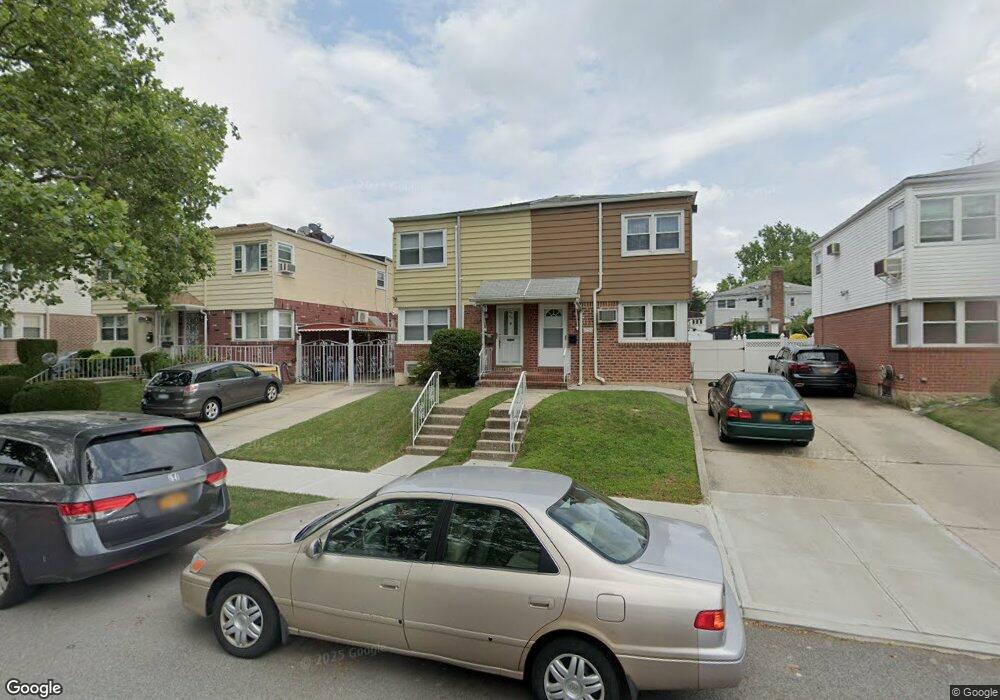
6751 211th St Oakland Gardens, NY 11364
Oakland Gardens NeighborhoodEstimated Value: $839,000 - $927,000
--
Bed
--
Bath
1,136
Sq Ft
$783/Sq Ft
Est. Value
About This Home
This home is located at 6751 211th St, Oakland Gardens, NY 11364 and is currently estimated at $888,957, approximately $782 per square foot. 6751 211th St is a home located in Queens County with nearby schools including P.S. 46 - Alley Pond, Nathaniel Hawthorne Middle School 74, and Benjamin N Cardozo High School.
Ownership History
Date
Name
Owned For
Owner Type
Purchase Details
Closed on
Nov 5, 2009
Sold by
Ifantis George and Ifantis Zoe
Bought by
Han Che-Hin and Tse Kayan
Current Estimated Value
Home Financials for this Owner
Home Financials are based on the most recent Mortgage that was taken out on this home.
Original Mortgage
$275,000
Outstanding Balance
$178,274
Interest Rate
4.86%
Mortgage Type
Purchase Money Mortgage
Estimated Equity
$710,683
Create a Home Valuation Report for This Property
The Home Valuation Report is an in-depth analysis detailing your home's value as well as a comparison with similar homes in the area
Home Values in the Area
Average Home Value in this Area
Purchase History
| Date | Buyer | Sale Price | Title Company |
|---|---|---|---|
| Han Che-Hin | $475,000 | -- |
Source: Public Records
Mortgage History
| Date | Status | Borrower | Loan Amount |
|---|---|---|---|
| Open | Han Che-Hin | $275,000 |
Source: Public Records
Tax History Compared to Growth
Tax History
| Year | Tax Paid | Tax Assessment Tax Assessment Total Assessment is a certain percentage of the fair market value that is determined by local assessors to be the total taxable value of land and additions on the property. | Land | Improvement |
|---|---|---|---|---|
| 2025 | $7,771 | $42,493 | $12,947 | $29,546 |
| 2024 | $7,783 | $40,090 | $12,910 | $27,180 |
| 2023 | $7,315 | $37,822 | $11,191 | $26,631 |
| 2022 | $7,263 | $49,800 | $15,960 | $33,840 |
| 2021 | $7,603 | $48,240 | $15,960 | $32,280 |
| 2020 | $7,199 | $48,480 | $15,960 | $32,520 |
| 2019 | $6,696 | $48,480 | $15,960 | $32,520 |
| 2018 | $6,127 | $31,518 | $11,046 | $20,472 |
| 2017 | $6,125 | $31,518 | $13,414 | $18,104 |
| 2016 | $5,943 | $31,518 | $13,414 | $18,104 |
| 2015 | $3,586 | $29,509 | $15,517 | $13,992 |
| 2014 | $3,586 | $27,840 | $16,968 | $10,872 |
Source: Public Records
Map
Nearby Homes
- 67-52 212th St
- 67-29 211th St
- 211-8 69th Ave Unit 1A
- 210-12 69th Ave Unit Lower
- 69-27 210th St Unit 2
- 69-29 210th St Unit A
- 211-11 73rd Ave Unit B
- 211-19A 73rd Ave Unit Lower
- 212-12 73rd Ave Unit 5C
- 212-12 73rd Ave Unit 2A
- 213-15 73rd Ave
- 213-15 73rd Ave Unit LOWER
- 213-25 73rd Ave Unit B
- 73-23 210th St Unit 2G
- 69-09 215th St Unit 1
- 69-09 215th St Unit Lower 1
- 69-21 215th St Unit A
- 64-58 215th St
- 64-16 211th St
- 67-10 Bell Blvd