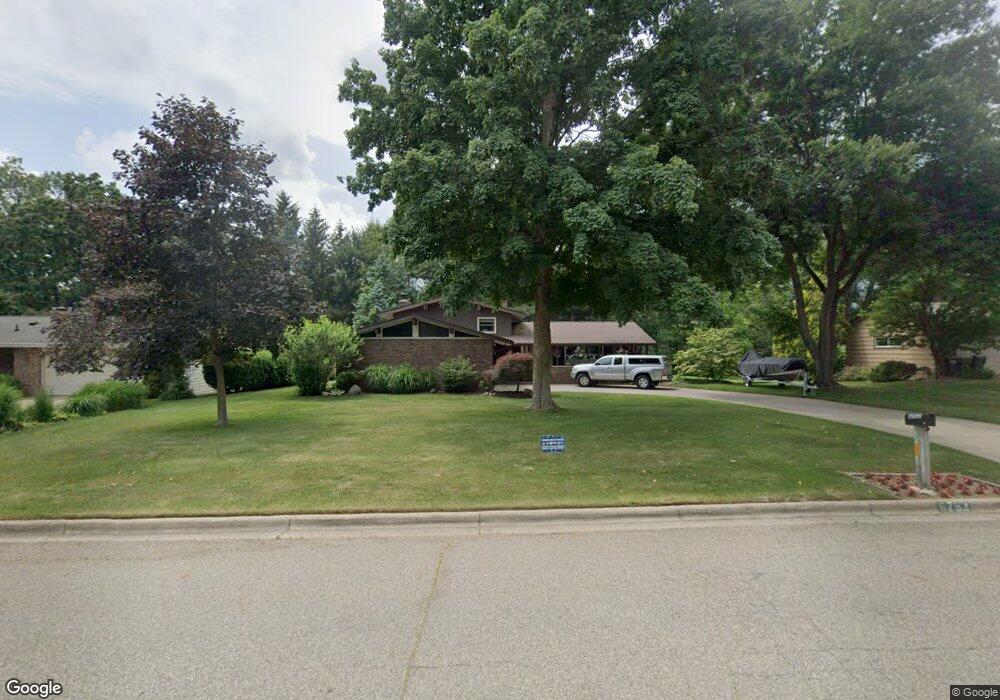
6752 Robinswood St Portage, MI 49024
Estimated Value: $303,508 - $349,000
4
Beds
3
Baths
2,128
Sq Ft
$153/Sq Ft
Est. Value
About This Home
This home is located at 6752 Robinswood St, Portage, MI 49024 and is currently estimated at $325,877, approximately $153 per square foot. 6752 Robinswood St is a home located in Kalamazoo County with nearby schools including Amberly Elementary School, Portage West Middle School, and Portage Northern High School.
Ownership History
Date
Name
Owned For
Owner Type
Purchase Details
Closed on
Sep 24, 2025
Sold by
Bowman Byrl J and Bowman Mary K
Bought by
Bowman Family Trust and Bowman
Current Estimated Value
Create a Home Valuation Report for This Property
The Home Valuation Report is an in-depth analysis detailing your home's value as well as a comparison with similar homes in the area
Home Values in the Area
Average Home Value in this Area
Purchase History
| Date | Buyer | Sale Price | Title Company |
|---|---|---|---|
| Bowman Family Trust | -- | None Listed On Document |
Source: Public Records
Tax History Compared to Growth
Tax History
| Year | Tax Paid | Tax Assessment Tax Assessment Total Assessment is a certain percentage of the fair market value that is determined by local assessors to be the total taxable value of land and additions on the property. | Land | Improvement |
|---|---|---|---|---|
| 2025 | $3,899 | $122,000 | $0 | $0 |
| 2024 | $3,432 | $114,300 | $0 | $0 |
| 2023 | $3,272 | $101,200 | $0 | $0 |
| 2022 | $3,535 | $100,500 | $0 | $0 |
| 2021 | $3,416 | $101,200 | $0 | $0 |
| 2020 | $3,342 | $95,600 | $0 | $0 |
| 2019 | $301 | $86,200 | $0 | $0 |
| 2018 | $0 | $78,700 | $0 | $0 |
| 2017 | $0 | $76,100 | $0 | $0 |
| 2016 | -- | $75,100 | $0 | $0 |
| 2015 | -- | $71,300 | $0 | $0 |
| 2014 | -- | $67,900 | $0 | $0 |
Source: Public Records
Map
Nearby Homes
- 6645 Oleander Ln
- 3318 Davcliff Ave
- 6876 Towhee St
- 6605 Rothbury St
- 6740 Amberly St
- 3034 Tattersall Rd
- 3522 Bellflower Dr
- 2801 Daventry Ave
- 3320 Scots Pine Way Unit 2
- 3638 Bellflower Dr
- 6576 Isabelle St
- 3737 Bellflower Dr
- 6427 Pepperidge Cir
- 6421 Cullys Trail
- 2604 Radcliffe Ave
- 6439 Cypress St
- 6290 Liteolier St
- 6636 Trotwood St
- 6748 Trotwood St
- 7236 Hampstead Ln Unit 18
- 6819 Robinswood Dr
- 6740 Robinswood St
- 6810 Robinswood St
- 6751 Robinswood St
- 6730 Robinswood St
- 6820 Robinswood St
- 6739 Robinswood St
- 6809 Robinswood St
- 6729 Robinswood St
- 6629 Oleander Ln
- 6819 Robinswood St
- 3348 Davcliff Ave
- 6720 Robinswood St
- 6659 Oleander Ln
- 6738 Rothbury St
- 6746 Rothbury St
- 6732 Rothbury St
- 6806 Rothbury St
- 6719 Robinswood St
- 6724 Rothbury St