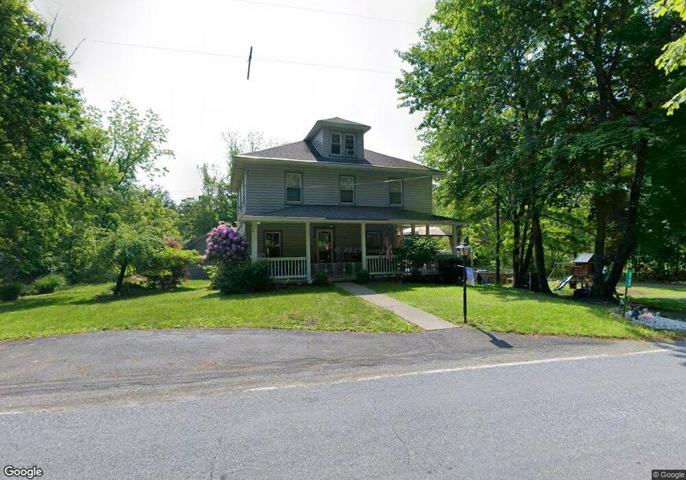
6752 Route 191 Cresco, PA 18326
Estimated Value: $265,000 - $309,000
5
Beds
1
Bath
1,852
Sq Ft
$153/Sq Ft
Est. Value
About This Home
This home is located at 6752 Route 191, Cresco, PA 18326 and is currently estimated at $283,740, approximately $153 per square foot. 6752 Route 191 is a home with nearby schools including Swiftwater Interm School, Swiftwater Elementary Center, and Pocono Mountain East Junior High School.
Ownership History
Date
Name
Owned For
Owner Type
Purchase Details
Closed on
Dec 19, 2023
Sold by
Shaller Virginia A
Bought by
Berrios Angel
Current Estimated Value
Home Financials for this Owner
Home Financials are based on the most recent Mortgage that was taken out on this home.
Original Mortgage
$255,290
Outstanding Balance
$251,053
Interest Rate
7.5%
Mortgage Type
FHA
Estimated Equity
$32,688
Purchase Details
Closed on
Dec 17, 1969
Bought by
Shaller Philip
Create a Home Valuation Report for This Property
The Home Valuation Report is an in-depth analysis detailing your home's value as well as a comparison with similar homes in the area
Home Values in the Area
Average Home Value in this Area
Purchase History
| Date | Buyer | Sale Price | Title Company |
|---|---|---|---|
| Berrios Angel | $260,000 | None Listed On Document | |
| Shaller Philip | $9,500 | -- |
Source: Public Records
Mortgage History
| Date | Status | Borrower | Loan Amount |
|---|---|---|---|
| Open | Berrios Angel | $255,290 |
Source: Public Records
Tax History Compared to Growth
Tax History
| Year | Tax Paid | Tax Assessment Tax Assessment Total Assessment is a certain percentage of the fair market value that is determined by local assessors to be the total taxable value of land and additions on the property. | Land | Improvement |
|---|---|---|---|---|
| 2025 | $835 | $103,440 | $14,300 | $89,140 |
| 2024 | $680 | $103,440 | $14,300 | $89,140 |
| 2023 | $2,707 | $103,440 | $14,300 | $89,140 |
| 2022 | $2,661 | $103,440 | $14,300 | $89,140 |
| 2021 | $2,661 | $103,440 | $14,300 | $89,140 |
| 2020 | $2,208 | $103,440 | $14,300 | $89,140 |
| 2019 | $2,305 | $13,040 | $1,540 | $11,500 |
| 2018 | $2,305 | $13,040 | $1,540 | $11,500 |
| 2017 | $2,331 | $13,040 | $1,540 | $11,500 |
| 2016 | $541 | $13,040 | $1,540 | $11,500 |
| 2015 | -- | $13,040 | $1,540 | $11,500 |
| 2014 | -- | $13,040 | $1,540 | $11,500 |
Source: Public Records
Map
Nearby Homes
- 6733 Route 191
- 6683 Pennsylvania 191
- 6663 Pennsylvania 191
- 6656 Route 191
- 130 Barn Swallow Ln
- 455 Laurel Pine Rd
- 781 White Oak Rd
- 0 Route 191 Unit PWBPW243056
- 612 Prices Dr
- 6509 Route 191
- 4299 High Rd
- 519 Pheasant Ln
- 371 Ridge Cir
- 4130 Mill Creek Dr
- 104 Haverhill Rd
- 136 Oak Ln
- 119 Falls Dr
- 122 Treetop Trail
- 136 Falls Dr
- 664 Griscom Rd
- 6752 Pennsylvania 191
- 6762 Route 191
- 126 Magann Ct
- 6745 Route 191
- 6766 Route 191
- 6743 Route 191
- 6736 Route 191
- 532 Pleasant Ridge Rd
- 6739 Route 191
- 6769 Route 191
- 6741 Route 191
- 6733 Pennsylvania 191
- 6773 Route 191
- 6737 Route 191
- 6774 Route 191
- 116 Magann Ct
- 4 Pleasant Ridge Rd
- 2 Pleasant Ridge Rd
- 594 Pleasant Ridge Rd
- 6775 Route 191