Estimated Value: $743,589 - $796,000
3
Beds
3
Baths
2,298
Sq Ft
$331/Sq Ft
Est. Value
About This Home
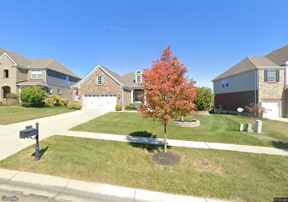
This home is located at 6754 Palmetto Dr Unit 53, Mason, OH 45040 and is currently estimated at $761,147, approximately $331 per square foot. 6754 Palmetto Dr Unit 53 is a home located in Warren County with nearby schools including Mason Intermediate Elementary School, Mason Middle School, and William Mason High School.
Ownership History
Date
Name
Owned For
Owner Type
Purchase Details
Closed on
Jun 20, 2018
Sold by
Fisher Curtis S and Fisher Traci A
Bought by
Newcomb Joseph and Newcomb Victoria
Current Estimated Value
Home Financials for this Owner
Home Financials are based on the most recent Mortgage that was taken out on this home.
Original Mortgage
$432,000
Outstanding Balance
$374,444
Interest Rate
4.6%
Mortgage Type
New Conventional
Estimated Equity
$386,703
Purchase Details
Closed on
Jun 8, 2016
Sold by
M I Homes Of Cincinnati Llc
Bought by
Fisher Curtis S and Fisher Traci A
Create a Home Valuation Report for This Property
The Home Valuation Report is an in-depth analysis detailing your home's value as well as a comparison with similar homes in the area
Home Values in the Area
Average Home Value in this Area
Purchase History
| Date | Buyer | Sale Price | Title Company |
|---|---|---|---|
| Newcomb Joseph | $480,000 | None Available | |
| Fisher Curtis S | $466,667 | First Title |
Source: Public Records
Mortgage History
| Date | Status | Borrower | Loan Amount |
|---|---|---|---|
| Open | Newcomb Joseph | $432,000 |
Source: Public Records
Tax History Compared to Growth
Tax History
| Year | Tax Paid | Tax Assessment Tax Assessment Total Assessment is a certain percentage of the fair market value that is determined by local assessors to be the total taxable value of land and additions on the property. | Land | Improvement |
|---|---|---|---|---|
| 2024 | $9,439 | $220,540 | $49,000 | $171,540 |
| 2023 | $8,933 | $172,081 | $34,965 | $137,116 |
| 2022 | $8,759 | $172,081 | $34,965 | $137,116 |
| 2021 | $8,331 | $172,081 | $34,965 | $137,116 |
| 2020 | $8,836 | $155,029 | $31,500 | $123,529 |
| 2019 | $8,186 | $155,029 | $31,500 | $123,529 |
| 2018 | $8,186 | $155,029 | $31,500 | $123,529 |
| 2017 | $8,366 | $145,597 | $24,500 | $121,097 |
| 2016 | $1,535 | $24,500 | $24,500 | $0 |
| 2015 | -- | $0 | $0 | $0 |
Source: Public Records
Map
Nearby Homes
- 3620 Capitol Ave
- 6943 Roberts Park Dr
- 6962 Roberts Park Dr
- 3288 Bouleware Blvd
- 3793 Wild Cherry Way
- 3806 Heritage Pointe Blvd
- 3871 Heritage Pointe Blvd
- 3253 Nina Ct
- 3852 Legacy Dr
- 5921 Maxfli Ln
- 3394 Pinnacle Ln
- 5922 Maxfli Ln
- 8367 Poppy Ln
- 3923 Marquis Ln
- 8334 Verbena Ln
- 3882 Crooked Tree Dr
- 3845 Pinnacle Ln
- 4029 Ivygrove Ln
- 3262 Ultra Ct
- 8319 Verbena Ln
- 6754 Palmetto Dr
- 6748 Palmetto Dr
- 6760 Palmetto Dr Unit 52
- 6760 Palmetto Dr
- 6742 Palmetto Dr
- 6766 Palmetto Dr Unit 51
- 6755 Palmetto Dr
- 6763 Palmetto Dr Unit 74
- 6751 Palmetto Dr
- 6736 Palmetto Dr
- 6749 Palmetto Dr Unit 71
- 6749 Palmetto Dr
- 6772 Palmetto Dr
- 6743 Palmetto Dr
- 6894 Roberts Park Dr
- 6730 Palmetto Dr
- 6735 Palmetto Dr
- 6906 Roberts Park Dr
- 6757 Sabal Way
- 6731 Palmetto Dr