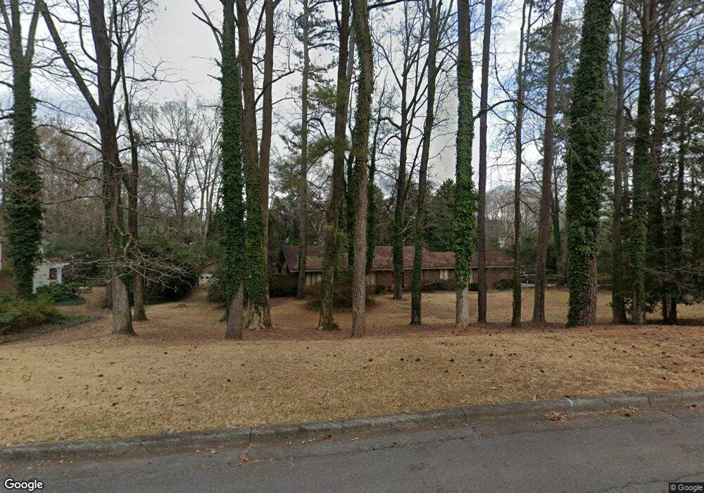
676 Brook Cir Griffin, GA 30224
Spalding County NeighborhoodEstimated Value: $352,154 - $407,000
3
Beds
3
Baths
2,986
Sq Ft
$127/Sq Ft
Est. Value
About This Home
This home is located at 676 Brook Cir, Griffin, GA 30224 and is currently estimated at $378,789, approximately $126 per square foot. 676 Brook Cir is a home located in Spalding County with nearby schools including Futral Road Elementary School, Rehoboth Road Middle School, and Spalding High School.
Ownership History
Date
Name
Owned For
Owner Type
Purchase Details
Closed on
Aug 22, 2003
Sold by
Mullins Richard L
Bought by
Mullins Jean L
Current Estimated Value
Home Financials for this Owner
Home Financials are based on the most recent Mortgage that was taken out on this home.
Original Mortgage
$110,000
Interest Rate
5.94%
Mortgage Type
Stand Alone Second
Purchase Details
Closed on
Jan 2, 1981
Sold by
Mullins Richard L
Bought by
Mullins Jean L
Purchase Details
Closed on
Apr 28, 1975
Sold by
Mullins Richard L and Murray George N
Bought by
Mullins Richard L
Purchase Details
Closed on
Aug 10, 1973
Sold by
Barnes Miss Susan G
Bought by
Mullins Richard L and Murray George N
Purchase Details
Closed on
Dec 1, 1968
Sold by
Banes S Grantland
Bought by
Barnes Miss Usan G
Create a Home Valuation Report for This Property
The Home Valuation Report is an in-depth analysis detailing your home's value as well as a comparison with similar homes in the area
Home Values in the Area
Average Home Value in this Area
Purchase History
| Date | Buyer | Sale Price | Title Company |
|---|---|---|---|
| Mullins Jean L | -- | -- | |
| Mullins Richard L | -- | -- | |
| Mullins Jean L | -- | -- | |
| Mullins Richard L | $1,000 | -- | |
| Mullins Richard L | $25,000 | -- | |
| Barnes Miss Usan G | -- | -- |
Source: Public Records
Mortgage History
| Date | Status | Borrower | Loan Amount |
|---|---|---|---|
| Closed | Mullins Richard L | $110,000 |
Source: Public Records
Tax History
| Year | Tax Paid | Tax Assessment Tax Assessment Total Assessment is a certain percentage of the fair market value that is determined by local assessors to be the total taxable value of land and additions on the property. | Land | Improvement |
|---|---|---|---|---|
| 2025 | $3,594 | $140,726 | $20,000 | $120,726 |
| 2024 | $3,516 | $140,726 | $20,000 | $120,726 |
| 2023 | $3,514 | $126,675 | $20,000 | $106,675 |
| 2022 | $4,408 | $110,294 | $20,000 | $90,294 |
| 2021 | $2,927 | $101,414 | $20,000 | $81,414 |
| 2020 | $2,931 | $101,414 | $20,000 | $81,414 |
| 2019 | $2,322 | $73,440 | $22,800 | $50,640 |
| 2018 | $2,447 | $68,000 | $22,800 | $45,200 |
| 2017 | $2,385 | $68,000 | $22,800 | $45,200 |
| 2016 | $2,422 | $68,000 | $22,800 | $45,200 |
| 2015 | $2,461 | $68,000 | $22,800 | $45,200 |
| 2014 | $2,651 | $81,562 | $22,800 | $58,762 |
Source: Public Records
Map
Nearby Homes
- 644 Brook Cir
- 505 Kincaid Ave
- 315 Powell Ave
- 729 Springer Dr
- 839 Bieze St
- 411 Terrace St
- 502 Searcy Ave
- 372 E College St
- 805 Hale Ave
- 123 Huntsman Dr
- 310 Terrace St
- 606 E Wall St
- 949 E Solomon St
- 963 E Solomon St
- 226 Tilney Ave
- 323 E College St
- 123 N Brawner St
- 319 E College St
- 722 Maple Dr
- 1014 E College St
Your Personal Tour Guide
Ask me questions while you tour the home.