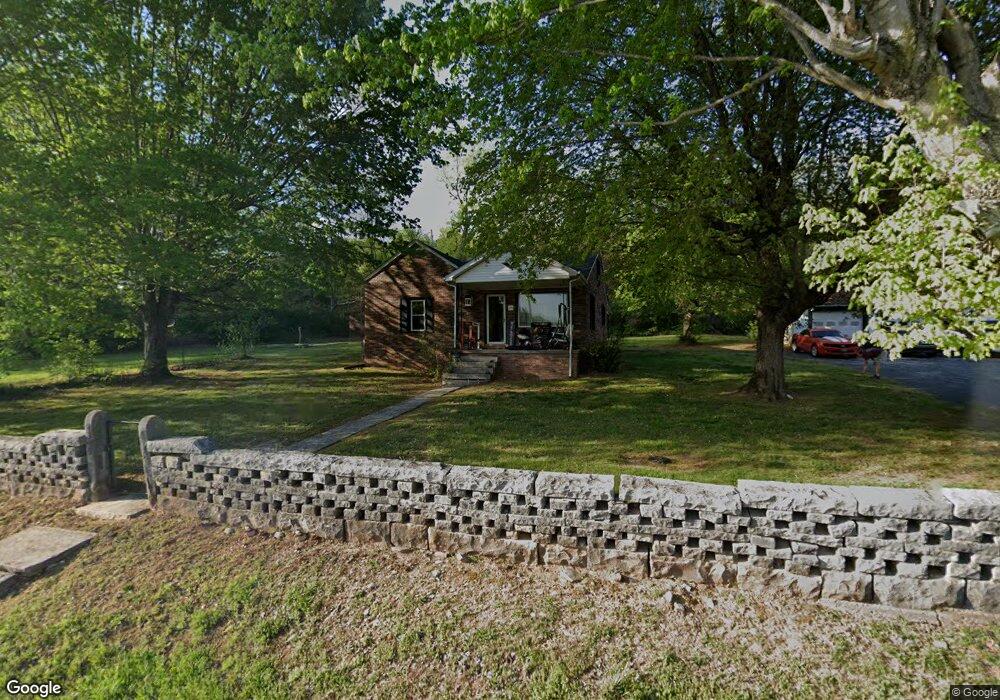
676 Browning Rd Rockfield, KY 42274
Greystone NeighborhoodEstimated Value: $136,000 - $193,000
2
Beds
1
Bath
1,208
Sq Ft
$134/Sq Ft
Est. Value
About This Home
This home is located at 676 Browning Rd, Rockfield, KY 42274 and is currently estimated at $161,884, approximately $134 per square foot. 676 Browning Rd is a home located in Warren County with nearby schools including Rockfield Elementary School, Henry F. Moss Middle School, and Warren Central High School.
Ownership History
Date
Name
Owned For
Owner Type
Purchase Details
Closed on
Sep 26, 2025
Sold by
Graham Michael and Graham Sandra Kaye
Bought by
Payne James and Johnson Tonya
Current Estimated Value
Home Financials for this Owner
Home Financials are based on the most recent Mortgage that was taken out on this home.
Original Mortgage
$139,789
Outstanding Balance
$139,789
Interest Rate
6.58%
Mortgage Type
New Conventional
Estimated Equity
$22,095
Purchase Details
Closed on
Aug 11, 2021
Sold by
Hudnall Katie and Stroube Brenda Hudnall
Bought by
Graham Sandra Kaye
Home Financials for this Owner
Home Financials are based on the most recent Mortgage that was taken out on this home.
Original Mortgage
$2,600,000
Interest Rate
2.9%
Mortgage Type
Purchase Money Mortgage
Create a Home Valuation Report for This Property
The Home Valuation Report is an in-depth analysis detailing your home's value as well as a comparison with similar homes in the area
Home Values in the Area
Average Home Value in this Area
Purchase History
| Date | Buyer | Sale Price | Title Company |
|---|---|---|---|
| Payne James | $133,000 | None Listed On Document | |
| Graham Sandra Kaye | $141,240 | None Available |
Source: Public Records
Mortgage History
| Date | Status | Borrower | Loan Amount |
|---|---|---|---|
| Open | Payne James | $139,789 | |
| Previous Owner | Graham Sandra Kaye | $2,600,000 |
Source: Public Records
Tax History Compared to Growth
Tax History
| Year | Tax Paid | Tax Assessment Tax Assessment Total Assessment is a certain percentage of the fair market value that is determined by local assessors to be the total taxable value of land and additions on the property. | Land | Improvement |
|---|---|---|---|---|
| 2024 | $815 | $90,000 | $0 | $0 |
| 2023 | $822 | $90,000 | $0 | $0 |
| 2022 | $770 | $90,000 | $0 | $0 |
| 2021 | $768 | $90,000 | $0 | $0 |
| 2020 | $690 | $80,000 | $0 | $0 |
| 2019 | $689 | $80,000 | $0 | $0 |
| 2018 | $686 | $80,000 | $0 | $0 |
| 2017 | $681 | $80,000 | $0 | $0 |
| 2015 | $588 | $69,550 | $0 | $0 |
| 2014 | $579 | $69,550 | $0 | $0 |
Source: Public Records
Map
Nearby Homes
- 301 Murphy Rd
- 7060 Stone Meade Ct
- 0 Weatherstone Blvd
- 7046 Stone Meade Ct
- 7230 Eagle Stone Ln
- 546 Morehead Rd
- 350 Hillwood Dr
- 290 Hillwood Dr
- 8691 Russellville Rd
- 137 W Windsor Cir
- 190 W Windsor Cir
- 400 W Windsor Cir
- 171 W Windsor Cir Unit Lot 317
- LOT 321 W Windsor Cir
- 239 W Mclellan Rd
- 300 Thompson Heights Ct
- 708 Timothy Ln
- 702 Timothy Ln
- 212 Pinewood Ct
- 298 Rockfield Browning Rd
- 573 Browning Rd
- 556 Browning Rd
- 769 Browning Rd
- 534 Browning Rd
- 808 Browning Rd
- 793 Browning Rd
- 545 Browning Rd
- 815 Browning Rd
- 677 Browning Rd
- 887 Browning Rd
- 830 Browning Rd
- 414 Browning Rd
- 415 Browning Rd
- 412 Browning Rd
- 943 Browning Rd
- 936 Browning Rd
- 959 Browning Rd
- 120 Browning Rd
- 946 Browning Rd
- 370 Browning Rd