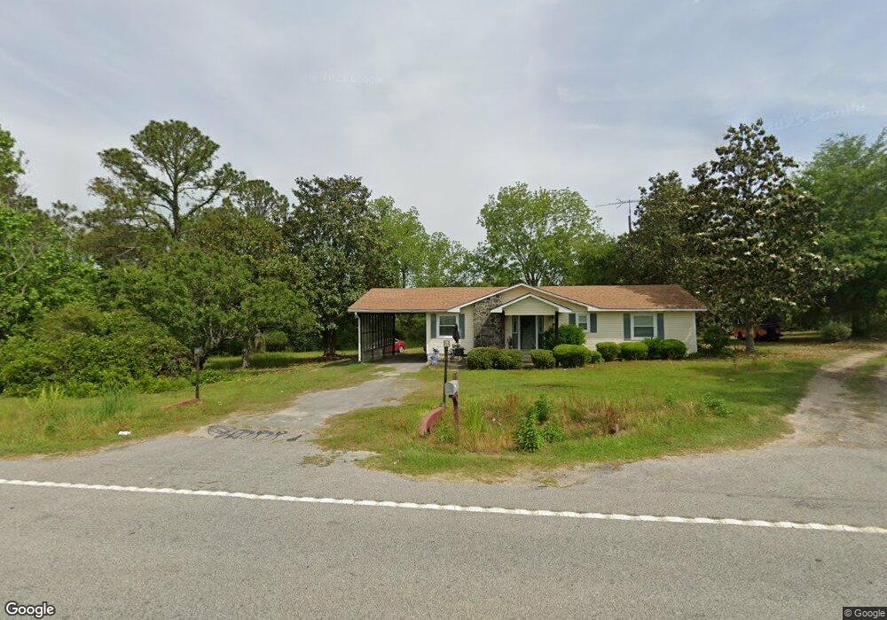
676 Broxton Hwy Fitzgerald, GA 31750
Estimated Value: $127,000 - $308,000
3
Beds
1
Bath
1,213
Sq Ft
$148/Sq Ft
Est. Value
About This Home
This home is located at 676 Broxton Hwy, Fitzgerald, GA 31750 and is currently estimated at $179,656, approximately $148 per square foot. 676 Broxton Hwy is a home located in Ben Hill County with nearby schools including Ben Hill County Primary School, Ben Hill Elementary School, and Ben Hill County Middle School.
Ownership History
Date
Name
Owned For
Owner Type
Purchase Details
Closed on
Feb 23, 2005
Sold by
Fisher James H
Bought by
Spooney Deborah C and Spooney Robinson Minnie
Current Estimated Value
Home Financials for this Owner
Home Financials are based on the most recent Mortgage that was taken out on this home.
Original Mortgage
$57,566
Outstanding Balance
$16,242
Interest Rate
5.6%
Mortgage Type
New Conventional
Estimated Equity
$163,414
Purchase Details
Closed on
Aug 7, 1980
Bought by
Blevins Blevins L and Blevins C
Create a Home Valuation Report for This Property
The Home Valuation Report is an in-depth analysis detailing your home's value as well as a comparison with similar homes in the area
Home Values in the Area
Average Home Value in this Area
Purchase History
| Date | Buyer | Sale Price | Title Company |
|---|---|---|---|
| Spooney Deborah C | $70,000 | -- | |
| Blevins Blevins L | -- | -- |
Source: Public Records
Mortgage History
| Date | Status | Borrower | Loan Amount |
|---|---|---|---|
| Open | Spooney Deborah C | $57,566 |
Source: Public Records
Tax History Compared to Growth
Tax History
| Year | Tax Paid | Tax Assessment Tax Assessment Total Assessment is a certain percentage of the fair market value that is determined by local assessors to be the total taxable value of land and additions on the property. | Land | Improvement |
|---|---|---|---|---|
| 2024 | $1,112 | $36,249 | $5,680 | $30,569 |
| 2023 | $1,078 | $35,148 | $5,680 | $29,468 |
| 2022 | $1,028 | $31,089 | $5,680 | $25,409 |
| 2021 | $1,000 | $29,093 | $5,680 | $23,413 |
| 2020 | $1,004 | $28,887 | $5,680 | $23,207 |
| 2019 | $1,000 | $28,887 | $5,680 | $23,207 |
| 2018 | $951 | $28,750 | $5,680 | $23,070 |
| 2017 | $1,002 | $28,801 | $5,680 | $23,121 |
| 2016 | $955 | $28,737 | $5,680 | $23,057 |
| 2015 | -- | $28,956 | $5,680 | $23,276 |
| 2014 | -- | $29,395 | $5,680 | $23,715 |
Source: Public Records
Map
Nearby Homes
- 691 Broxton Hwy
- 0 Sturgeon Creek Rd Unit LOT 3 10366749
- 1095 Jacksonville Hwy
- 1182 Jacksonville Hwy
- 00 Camp Brooklyn Rd
- 0 Sturgeon Creek Rd Lt 3
- 358 Camp Brooklyn Rd
- 0 Camp Brooklyn Rd Unit 10610288
- 00 East Rd
- 0 Sinclair Rd
- 000 Evergreen Rd
- 140 Jack Rd
- TBD Amber St
- 114 Taylor Cir
- 130 Arnold Dr
- 573 Frank Rd
- 117 Royal Cir
- 229 Hudson Rd
- 155 Grove Ave
- 0 Sparrow Rd
- 684 Broxton Hwy
- 673 Broxton Hwy
- 640 Broxton Hwy
- 649 Broxton Hwy
- 709 Broxton Hwy
- 00 Sturgeon Creek Church Rd Lt48
- 00 Sturgeon Creek Church Rd Lt22
- 00 Sturgeon Creek Church Rd Lt23
- 00 Sturgeon Creek Church Rd Lt21
- 186 Prospect Church Rd
- 784 Broxton Hwy
- 789 Broxton Hwy
- 180 Dicksons Mill Pond Rd
- 158 Dicksons Mill Pond Rd
- 143 Prospect Church Rd
- 212 Prospect Church Rd
- 2142 Jacksonville Hwy
- 213 Prospect Church Rd
- 509 Broxton Hwy
- 509 Broxton Hwy