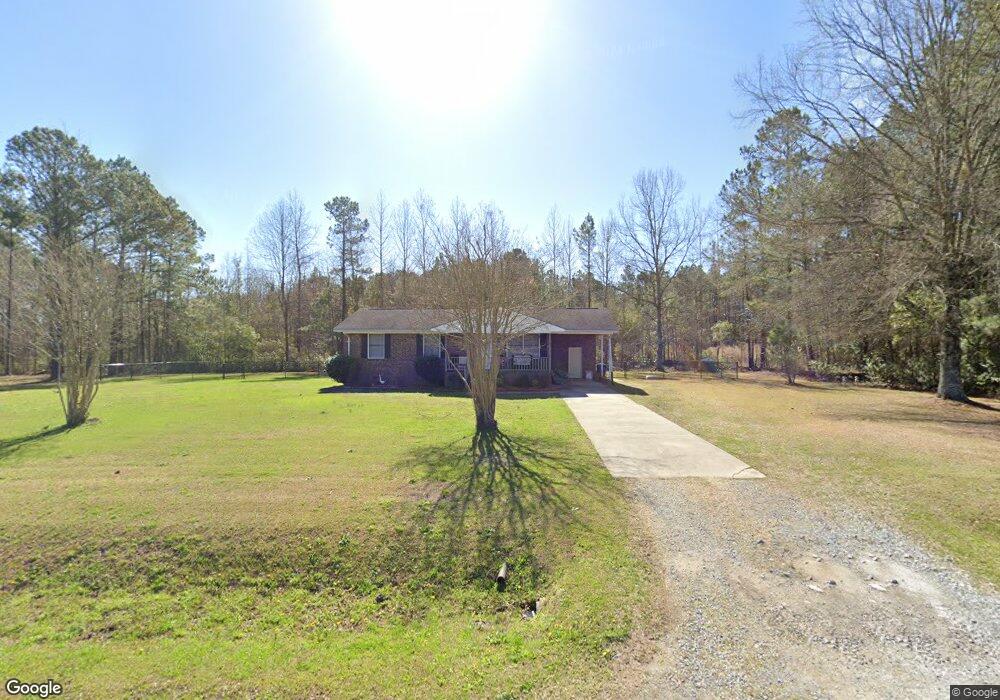
676 Langley Rd Chocowinity, NC 27817
Estimated Value: $118,000 - $203,000
3
Beds
2
Baths
1,120
Sq Ft
$141/Sq Ft
Est. Value
About This Home
This home is located at 676 Langley Rd, Chocowinity, NC 27817 and is currently estimated at $158,151, approximately $141 per square foot. 676 Langley Rd is a home with nearby schools including Chocowinity Primary School, Chocowinity Middle School, and Southside High School.
Ownership History
Date
Name
Owned For
Owner Type
Purchase Details
Closed on
May 19, 2023
Sold by
Smith Charles A and Smith Jo A
Bought by
Armstrong Victoria
Current Estimated Value
Home Financials for this Owner
Home Financials are based on the most recent Mortgage that was taken out on this home.
Original Mortgage
$109,250
Outstanding Balance
$106,234
Interest Rate
6.43%
Mortgage Type
New Conventional
Estimated Equity
$51,917
Purchase Details
Closed on
Aug 31, 2020
Bought by
Smith Charles Allan and Smith Jo Ann
Purchase Details
Closed on
Jul 18, 2001
Bought by
Ashby Preston T and Ashby Diana L
Create a Home Valuation Report for This Property
The Home Valuation Report is an in-depth analysis detailing your home's value as well as a comparison with similar homes in the area
Home Values in the Area
Average Home Value in this Area
Purchase History
| Date | Buyer | Sale Price | Title Company |
|---|---|---|---|
| Armstrong Victoria | $115,000 | Attorney Only | |
| Smith Charles Allan | $75,000 | -- | |
| Ashby Preston T | $58,000 | -- |
Source: Public Records
Mortgage History
| Date | Status | Borrower | Loan Amount |
|---|---|---|---|
| Open | Armstrong Victoria | $109,250 |
Source: Public Records
Tax History
| Year | Tax Paid | Tax Assessment Tax Assessment Total Assessment is a certain percentage of the fair market value that is determined by local assessors to be the total taxable value of land and additions on the property. | Land | Improvement |
|---|---|---|---|---|
| 2025 | $936 | $138,638 | $30,280 | $108,358 |
| 2024 | $690 | $69,945 | $18,060 | $51,885 |
| 2023 | $682 | $69,945 | $18,060 | $51,885 |
| 2022 | $677 | $69,945 | $18,060 | $51,885 |
| 2021 | $672 | $69,945 | $18,060 | $51,885 |
| 2020 | $674 | $69,945 | $18,060 | $51,885 |
| 2019 | $664 | $69,945 | $18,060 | $51,885 |
| 2018 | $640 | $69,945 | $18,060 | $51,885 |
| 2017 | $624 | $74,898 | $18,060 | $56,838 |
| 2016 | $603 | $74,898 | $18,060 | $56,838 |
| 2015 | $533 | $0 | $0 | $0 |
| 2014 | $533 | $0 | $0 | $0 |
| 2013 | -- | $74,898 | $18,060 | $56,838 |
Source: Public Records
Map
Nearby Homes
- 227 Langley Rd
- 216 Langley Rd
- 1603 E Barr Rd
- 0 US 17 S Unit 100548235
- 215 Harding Rd
- Lot 27 Peed Rd
- Lot 27 Peed Rd
- 0 Us 17 Unit 100451811
- 883 Dixon Rd
- 4073 Possum Track Rd
- 100 Thames Ln
- 0 Dean Unit 100341209
- 00 Poore Farm Rd
- 00000 N Carolina 33
- 0000 N Carolina 33
- 375 Victoria Dr
- 36 1st St
- 20 Santee Dr
- 119 Cape Fear Dr
- 421 Cypress Landing Trail
Your Personal Tour Guide
Ask me questions while you tour the home.