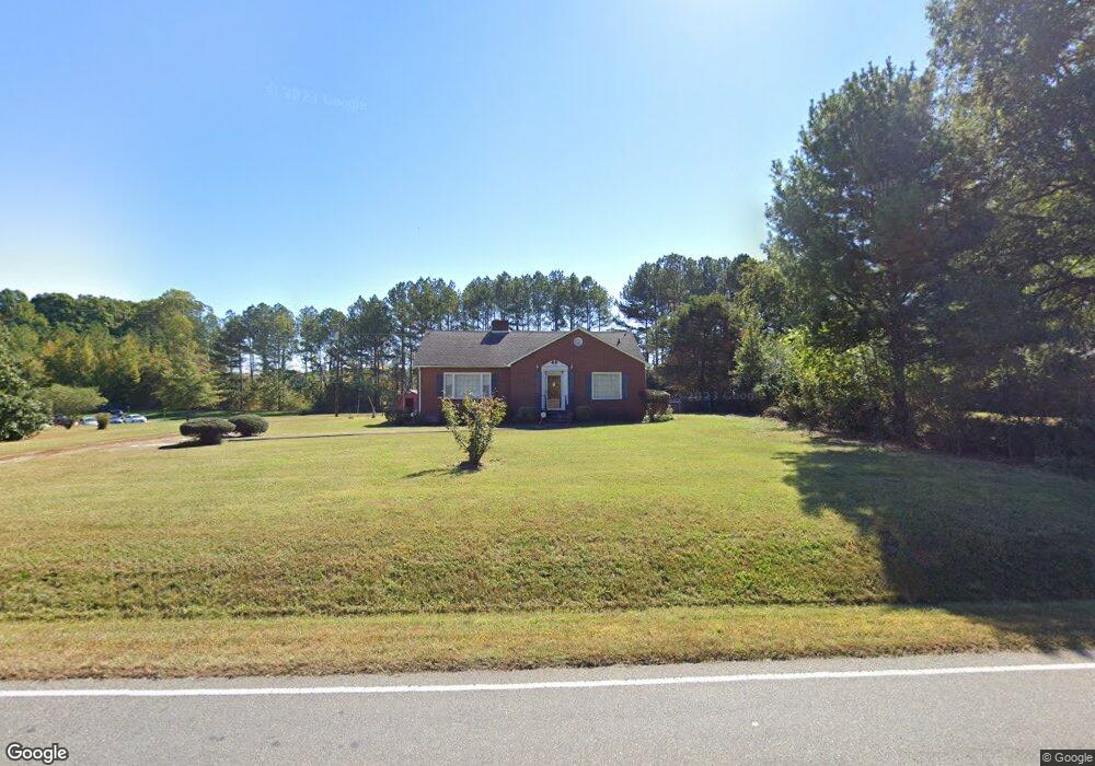
676 Murdock Rd Troutman, NC 28166
Estimated Value: $303,000 - $328,000
3
Beds
1
Bath
1,406
Sq Ft
$226/Sq Ft
Est. Value
About This Home
This home is located at 676 Murdock Rd, Troutman, NC 28166 and is currently estimated at $317,460, approximately $225 per square foot. 676 Murdock Rd is a home located in Iredell County with nearby schools including Troutman Elementary School, Troutman Middle School, and South Iredell High School.
Ownership History
Date
Name
Owned For
Owner Type
Purchase Details
Closed on
Oct 17, 2024
Sold by
Piedmont Landco Llc
Bought by
Kb Godley Vii Llc
Current Estimated Value
Purchase Details
Closed on
Sep 11, 2023
Sold by
Murdock Frances L
Bought by
Piedmont Landco Llc
Purchase Details
Closed on
Nov 3, 2005
Sold by
Murdock John C and Murdock Margaret Louise
Bought by
Murdock Frances L
Purchase Details
Closed on
Jun 1, 1966
Create a Home Valuation Report for This Property
The Home Valuation Report is an in-depth analysis detailing your home's value as well as a comparison with similar homes in the area
Home Values in the Area
Average Home Value in this Area
Purchase History
| Date | Buyer | Sale Price | Title Company |
|---|---|---|---|
| Kb Godley Vii Llc | $330,000 | None Listed On Document | |
| Piedmont Landco Llc | $241,000 | None Listed On Document | |
| Piedmont Landco Llc | $241,000 | None Listed On Document | |
| Murdock Frances L | -- | None Available | |
| -- | -- | -- |
Source: Public Records
Tax History
| Year | Tax Paid | Tax Assessment Tax Assessment Total Assessment is a certain percentage of the fair market value that is determined by local assessors to be the total taxable value of land and additions on the property. | Land | Improvement |
|---|---|---|---|---|
| 2025 | $1,483 | $237,230 | $169,950 | $67,280 |
| 2024 | $1,511 | $231,940 | $133,700 | $98,240 |
| 2023 | $1,452 | $231,940 | $133,700 | $98,240 |
| 2022 | $1,164 | $173,150 | $111,260 | $61,890 |
| 2021 | $1,143 | $173,150 | $111,260 | $61,890 |
| 2020 | $1,143 | $173,150 | $111,260 | $61,890 |
| 2019 | $1,099 | $173,150 | $111,260 | $61,890 |
| 2018 | $1,078 | $171,690 | $111,260 | $60,430 |
| 2017 | $1,078 | $171,690 | $111,260 | $60,430 |
| 2016 | $1,078 | $171,690 | $111,260 | $60,430 |
| 2015 | $1,078 | $171,690 | $111,260 | $60,430 |
| 2014 | $1,011 | $174,430 | $108,900 | $65,530 |
Source: Public Records
Map
Nearby Homes
- 00 Hamilton Rd
- 112 E Heart Pine Ln
- 131 History Ln
- 105 Wedge View Way
- 107 Megby Trail
- 111 Megby Trail
- 0 Hoover Rd
- 115 Davenport Dr Unit B
- 111 Allenton Way
- 127 Players Park Cir
- 108 Megby Trail
- 112 Megby Trail
- 435 Moose Club Rd
- 130 Jana Dr
- 134 Iredell Ave
- 118 Margo Ln
- 121 Jana Dr
- 116 Jana Dr
- 112 Canada Dr
- 194 Canada Dr
- 0 Hamilton Rd
- 670 Murdock Rd
- 266 Hamilton Rd
- 712 Murdock Rd
- 2844 Amity Hill Rd
- 703 Murdock Rd
- 246 Hamilton Rd
- 000 Amity Hill Rd
- 272 Hamilton Rd
- 113 Gille Ln
- 641 Murdock Rd
- 2820 Amity Hill Rd
- 247 Hamilton Rd
- 122 Gille Ln
- 0 Amity Hill Rd Unit CAR3868099
- 0 Amity Hill Rd Unit CAR3868092
- 230 Hamilton Rd
- 2813 Amity Hill Rd
- 2840 Amity Hill Rd
- 2844 Amity Hill Rd
Your Personal Tour Guide
Ask me questions while you tour the home.