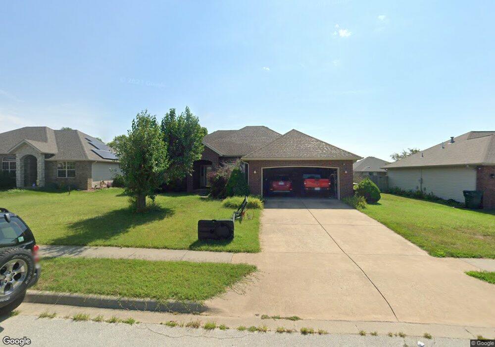
676 N White Rock Ave Republic, MO 65738
Estimated Value: $268,713 - $280,000
3
Beds
2
Baths
1,571
Sq Ft
$175/Sq Ft
Est. Value
About This Home
This home is located at 676 N White Rock Ave, Republic, MO 65738 and is currently estimated at $274,678, approximately $174 per square foot. 676 N White Rock Ave is a home located in Greene County with nearby schools including Price Elementary School, Republic Middle School, and Republic High School.
Ownership History
Date
Name
Owned For
Owner Type
Purchase Details
Closed on
Jul 29, 2005
Sold by
R And R Custom Homes Inc
Bought by
Stevens Kimberly D and Stevens Anthony C
Current Estimated Value
Home Financials for this Owner
Home Financials are based on the most recent Mortgage that was taken out on this home.
Original Mortgage
$111,120
Outstanding Balance
$57,809
Interest Rate
5.51%
Mortgage Type
New Conventional
Estimated Equity
$216,869
Create a Home Valuation Report for This Property
The Home Valuation Report is an in-depth analysis detailing your home's value as well as a comparison with similar homes in the area
Home Values in the Area
Average Home Value in this Area
Purchase History
| Date | Buyer | Sale Price | Title Company |
|---|---|---|---|
| Stevens Kimberly D | -- | None Available |
Source: Public Records
Mortgage History
| Date | Status | Borrower | Loan Amount |
|---|---|---|---|
| Open | Stevens Kimberly D | $111,120 |
Source: Public Records
Tax History Compared to Growth
Tax History
| Year | Tax Paid | Tax Assessment Tax Assessment Total Assessment is a certain percentage of the fair market value that is determined by local assessors to be the total taxable value of land and additions on the property. | Land | Improvement |
|---|---|---|---|---|
| 2025 | $1,891 | $38,150 | $6,650 | $31,500 |
| 2024 | $1,891 | $33,860 | $5,700 | $28,160 |
| 2023 | $1,855 | $33,860 | $5,700 | $28,160 |
| 2022 | $1,542 | $28,010 | $5,700 | $22,310 |
| 2021 | $1,533 | $28,010 | $5,700 | $22,310 |
| 2020 | $1,385 | $24,910 | $5,700 | $19,210 |
| 2019 | $1,380 | $24,910 | $5,700 | $19,210 |
| 2018 | $1,329 | $23,180 | $5,700 | $17,480 |
| 2017 | $1,318 | $23,240 | $5,700 | $17,540 |
| 2016 | $1,336 | $23,240 | $5,700 | $17,540 |
| 2015 | $1,331 | $23,240 | $5,700 | $17,540 |
| 2014 | $1,301 | $22,520 | $5,700 | $16,820 |
Source: Public Records
Map
Nearby Homes
- 761 N Lexington Ave
- 508 Glenwood Ave
- 515 N Glenwood Ave
- 747 N Glenwood Ave
- 715 N Franklin Ave
- 733 N Franklin Ave
- 7217 W Farm Road 182
- 435 N Claremont Place
- 0 W Farm Road 174 Unit 60286557
- 4889 S Douglas Dr
- 436 N Murphy Dr
- 2465 E Timber Oak St
- 1550KP-4 Plan at Greenfield Estates
- 1350 Plan at Greenfield Estates
- 1400 Plan at Greenfield Estates
- 1505KP-4 Cottage Plan at Greenfield Estates
- 1226 N London Place
- 2327 E Lee St
- Lot 24 The Woods
- 2429 E Timber Oak St
- 682 N White Rock Ave
- 646 N White Rock Ave
- 673 N White Rock Ave
- 696 N White Rock Ave
- 687 N Washington Ct
- 661 N Washington Ct
- 683 N White Rock Ave
- 647 N White Rock Ave
- 695 N White Rock Ave
- 647 N Washington Ct
- 699 N Washington Ct
- 3024 E Jamestown Ct Unit L42
- 3024 E Jamestown Ct
- 3000 E Jamestown Ct
- 3000 E Jamestown Ct Unit Lot 43
- 701 N White Rock Ave
- 688 N Lexington Ave
- 3066 E Jamestown Ct
- 2992 E Jamestown Ct
- 648 N Lexington Ave