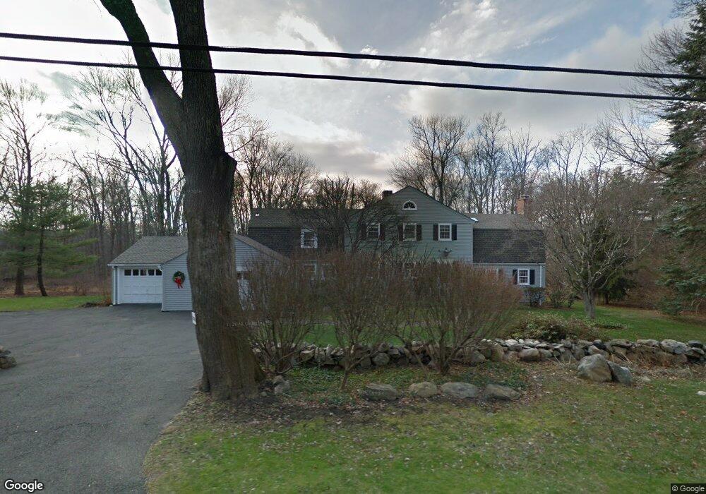
676 Ponus Ridge New Canaan, CT 06840
Estimated Value: $2,404,938 - $3,009,000
5
Beds
5
Baths
3,446
Sq Ft
$789/Sq Ft
Est. Value
About This Home
This home is located at 676 Ponus Ridge, New Canaan, CT 06840 and is currently estimated at $2,720,235, approximately $789 per square foot. 676 Ponus Ridge is a home located in Fairfield County with nearby schools including West Elementary School, Saxe Middle School, and New Canaan High School.
Ownership History
Date
Name
Owned For
Owner Type
Purchase Details
Closed on
Apr 9, 2012
Sold by
Brown Stephen G
Bought by
Stephen G Brown Ret and Brown Stephen G
Current Estimated Value
Home Financials for this Owner
Home Financials are based on the most recent Mortgage that was taken out on this home.
Original Mortgage
$385,000
Outstanding Balance
$257,499
Interest Rate
3.25%
Mortgage Type
Adjustable Rate Mortgage/ARM
Estimated Equity
$2,462,736
Purchase Details
Closed on
Oct 1, 2010
Sold by
Sisson Elliott H and Sisson Marguerite
Bought by
Brown Stephen G
Create a Home Valuation Report for This Property
The Home Valuation Report is an in-depth analysis detailing your home's value as well as a comparison with similar homes in the area
Home Values in the Area
Average Home Value in this Area
Purchase History
| Date | Buyer | Sale Price | Title Company |
|---|---|---|---|
| Stephen G Brown Ret | -- | -- | |
| Brown Stephen G | $575,000 | -- |
Source: Public Records
Mortgage History
| Date | Status | Borrower | Loan Amount |
|---|---|---|---|
| Open | Brown Stephen G | $385,000 | |
| Previous Owner | Brown Stephen G | $340,000 | |
| Previous Owner | Brown Stephen G | $168,000 |
Source: Public Records
Tax History Compared to Growth
Tax History
| Year | Tax Paid | Tax Assessment Tax Assessment Total Assessment is a certain percentage of the fair market value that is determined by local assessors to be the total taxable value of land and additions on the property. | Land | Improvement |
|---|---|---|---|---|
| 2025 | $21,045 | $1,260,910 | $877,800 | $383,110 |
| 2024 | $20,351 | $1,260,910 | $877,800 | $383,110 |
| 2023 | $18,348 | $968,730 | $760,480 | $208,250 |
| 2022 | $17,796 | $968,730 | $760,480 | $208,250 |
| 2021 | $17,592 | $968,730 | $760,480 | $208,250 |
| 2020 | $17,592 | $968,730 | $760,480 | $208,250 |
| 2019 | $17,670 | $968,730 | $760,480 | $208,250 |
| 2018 | $19,501 | $1,149,820 | $782,460 | $367,360 |
| 2017 | $19,167 | $1,149,820 | $782,460 | $367,360 |
| 2016 | $18,754 | $1,149,820 | $782,460 | $367,360 |
| 2015 | $19,041 | $1,149,820 | $782,460 | $367,360 |
| 2014 | $17,868 | $1,149,820 | $782,460 | $367,360 |
Source: Public Records
Map
Nearby Homes
- 474 Ponus Ridge
- 470 Frogtown Rd Unit Lot 1
- 105 N Stamford Rd
- 113 Skyview Ln
- 185 Interlaken Rd
- 357 Jelliff Mill Rd
- 19 Skymeadow Dr
- 49 Pinner Ln
- 276 Greenley Rd
- 298 Greenley Rd
- 39 Running Brook Ln
- 202 Weed St
- 30 Thornwood Rd
- 40 Hoyclo Rd
- 42 Hannahs Rd
- 100 Spring Water Ln
- 119 Wedgemere Rd
- 139 Jelliff Mill Rd
- 317 Park St
- 60 Redmont Rd
- 12 Wing Rd
- 43 Bartling Dr
- 714 Ponus Ridge
- 683 Ponus Ridge
- 663 Ponus Ridge
- 630 Ponus Ridge
- 649 Ponus Ridge
- 705 Ponus Ridge
- 49 Bartling Dr
- 716 Ponus Ridge
- 40 Bartling Dr
- 718 Ponus Ridge
- 633 Ponus Ridge
- 37 Bennington Place
- 734 Ponus Ridge
- 612 Ponus Ridge
- 719 Ponus Ridge
- 719 Ponus Ridge Rd
- 38 Lumanor Dr
- 47 Lumanor Dr