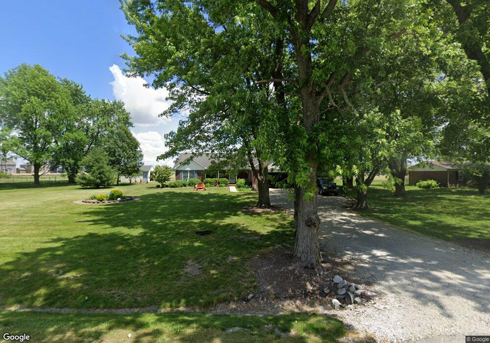
6761 E 230 S Whitestown, IN 46075
Estimated Value: $335,000 - $347,070
3
Beds
3
Baths
1,641
Sq Ft
$208/Sq Ft
Est. Value
About This Home
This home is located at 6761 E 230 S, Whitestown, IN 46075 and is currently estimated at $341,518, approximately $208 per square foot. 6761 E 230 S is a home located in Boone County with nearby schools including Perry Worth Elementary School, Lebanon Middle School, and Lebanon Senior High School.
Ownership History
Date
Name
Owned For
Owner Type
Purchase Details
Closed on
Feb 16, 2009
Sold by
Melvin Brenda C
Bought by
Melvin Dale A
Current Estimated Value
Create a Home Valuation Report for This Property
The Home Valuation Report is an in-depth analysis detailing your home's value as well as a comparison with similar homes in the area
Home Values in the Area
Average Home Value in this Area
Purchase History
| Date | Buyer | Sale Price | Title Company |
|---|---|---|---|
| Melvin Dale A | -- | -- |
Source: Public Records
Tax History Compared to Growth
Tax History
| Year | Tax Paid | Tax Assessment Tax Assessment Total Assessment is a certain percentage of the fair market value that is determined by local assessors to be the total taxable value of land and additions on the property. | Land | Improvement |
|---|---|---|---|---|
| 2025 | $2,688 | $323,100 | $22,200 | $300,900 |
| 2024 | $2,688 | $314,500 | $22,200 | $292,300 |
| 2023 | $2,540 | $302,400 | $22,200 | $280,200 |
| 2022 | $2,523 | $279,300 | $22,200 | $257,100 |
| 2021 | $2,244 | $243,600 | $22,200 | $221,400 |
| 2020 | $1,984 | $222,500 | $22,200 | $200,300 |
| 2019 | $1,725 | $215,100 | $22,200 | $192,900 |
| 2018 | $1,853 | $207,300 | $22,200 | $185,100 |
| 2017 | $1,796 | $206,500 | $22,200 | $184,300 |
| 2016 | $1,735 | $192,800 | $22,200 | $170,600 |
| 2014 | $1,372 | $167,900 | $22,200 | $145,700 |
| 2013 | $1,343 | $167,900 | $22,200 | $145,700 |
Source: Public Records
Map
Nearby Homes
- Convington Plan at Jackson Run - The District
- Quincy Plan at Jackson Run - The District
- Woodburn Plan at Jackson Run - The District
- Monroe Plan at Jackson Run - The District
- Osgood Plan at Jackson Run - The District
- Hanover Plan at Jackson Run - The District
- New Haven Plan at Jackson Run - The District
- 2646 Grassy Branch Dr
- 2234 Walnut Fork Dr
- Grand Bahama Plan at Jackson Run
- Cedar Plan at Jackson Run
- Hazel Plan at Jackson Run
- Eden Cay Plan at Jackson Run
- Elder Plan at Jackson Run
- 2549 Plano Dr
- 2252 Stony Creek Dr
- 6400 Flag Stop Dr
- 6390 Flag Stop Dr
- 2270 Holiday Creek Dr
- 2413 Stony Creek Dr
- 6760 E 225 S
- 6769 E 230 S
- 6854 Orchard Run Cir
- 6752 E 225 S
- 6720 E 225 S
- 6680 E 230 S
- 6859 Orchard Run Cir
- 6694 E 225 S
- 6862 Orchard Run Cir
- 6685 E 230 S
- 6834 Orchard Run Cir
- 6658 E 230 S
- 6866 Orchard Run Cir
- 6671 E 225 S
- 6832 Orchard Run Cir
- 6823 Orchard Run Cir
- 2230 Bauer Creek Dr
- 2208 Bauer Creek Dr
- 6819 Orchard Run Cir
- 2350 S 700 E