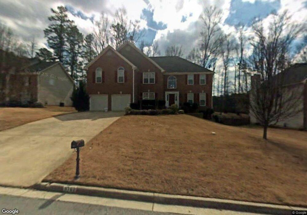
6767 Devon Trace Unit 2 Stone Mountain, GA 30087
Estimated Value: $379,151 - $439,000
4
Beds
3
Baths
3,165
Sq Ft
$125/Sq Ft
Est. Value
About This Home
This home is located at 6767 Devon Trace Unit 2, Stone Mountain, GA 30087 and is currently estimated at $395,788, approximately $125 per square foot. 6767 Devon Trace Unit 2 is a home located in DeKalb County with nearby schools including Pine Ridge Elementary School, Stephenson Middle School, and Stephenson High School.
Ownership History
Date
Name
Owned For
Owner Type
Purchase Details
Closed on
Apr 15, 2003
Sold by
Conseco Finance Svcing Corp
Bought by
Fryson Paul and Surillo Carmen
Current Estimated Value
Home Financials for this Owner
Home Financials are based on the most recent Mortgage that was taken out on this home.
Original Mortgage
$152,000
Outstanding Balance
$62,372
Interest Rate
5.62%
Mortgage Type
New Conventional
Estimated Equity
$333,416
Purchase Details
Closed on
Sep 3, 2002
Sold by
Jones Brian R
Bought by
Conseco Fin Svc Corp
Purchase Details
Closed on
Apr 28, 2000
Sold by
Summer Homes Inc
Bought by
Jones Brian R
Home Financials for this Owner
Home Financials are based on the most recent Mortgage that was taken out on this home.
Original Mortgage
$187,150
Interest Rate
10.75%
Mortgage Type
New Conventional
Create a Home Valuation Report for This Property
The Home Valuation Report is an in-depth analysis detailing your home's value as well as a comparison with similar homes in the area
Home Values in the Area
Average Home Value in this Area
Purchase History
| Date | Buyer | Sale Price | Title Company |
|---|---|---|---|
| Fryson Paul | $190,000 | -- | |
| Conseco Fin Svc Corp | $196,140 | -- | |
| Jones Brian R | $208,000 | -- |
Source: Public Records
Mortgage History
| Date | Status | Borrower | Loan Amount |
|---|---|---|---|
| Open | Fryson Paul | $152,000 | |
| Previous Owner | Jones Brian R | $187,150 |
Source: Public Records
Tax History
| Year | Tax Paid | Tax Assessment Tax Assessment Total Assessment is a certain percentage of the fair market value that is determined by local assessors to be the total taxable value of land and additions on the property. | Land | Improvement |
|---|---|---|---|---|
| 2025 | $1,303 | $153,800 | $16,000 | $137,800 |
| 2024 | $1,436 | $142,880 | $16,000 | $126,880 |
| 2023 | $1,436 | $146,600 | $10,520 | $136,080 |
Source: Public Records
Map
Nearby Homes
- 587 Wynmeadow Ct
- 507 Wynbrooke Pkwy
- 467 Pineburr Ln
- 559 Wynbrooke Pkwy Unit II
- 423 Orchards Walk
- 416 Pineburr Ln
- 7039 Rockbridge Rd
- 698 Deer Lake Trail
- 6703 Blantyre Blvd
- 415 N Deshong Rd
- 401 N Deshong Rd
- 6960 Dockbridge Way
- 586 Stonehedge Dr
- 6914 Waters Edge Dr Unit 6
- 6646 Poplar Grove Way
- 7030 Biltmore Trace
- 7049 Crestwood Place Unit 1
- 7019 Biltmore Trace
- 523 N Shore Rd Unit 1
- 7129 Biltmore Way
- 6775 Devon Trace Unit II
- 6761 Devon Trace Unit 2
- 6781 Devon Trace Unit 2
- 6770 Devon Trace
- 6755 Devon Trace
- 6762 Devon Trace
- 6780 Devon Trace
- 6785 Devon Trace
- 6756 Devon Trace
- 6752 Devon Trace
- 6786 Devon Trace Unit 11
- 791 Wynbrooke Pkwy
- 781 Wynbrooke Pkwy Unit 1
- 6793 Devon Trace
- 797 Wynbrooke Pkwy
- 6792 Devon Trace
- 773 Wynbrooke Pkwy
- 6818 Wynbrooke Cove Unit 1
- 803 Wynbrooke Pkwy Unit 2
- 763 Wynbrooke Pkwy Unit 2
Your Personal Tour Guide
Ask me questions while you tour the home.