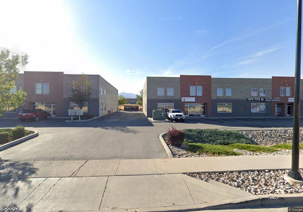
6768 Airport Rd West Jordan, UT 84084
Jordan Oaks NeighborhoodEstimated Value: $920,832
--
Bed
--
Bath
3,444
Sq Ft
$267/Sq Ft
Est. Value
About This Home
This home is located at 6768 Airport Rd, West Jordan, UT 84084 and is currently estimated at $920,832, approximately $267 per square foot. 6768 Airport Rd is a home located in Salt Lake County with nearby schools including Oquirrh Elementary School, Joel P. Jensen Middle School, and Copper Hills High School.
Ownership History
Date
Name
Owned For
Owner Type
Purchase Details
Closed on
Aug 24, 2023
Sold by
Seven90 Llc and Monday Allstar Llc
Bought by
Pucon Capital Llc
Current Estimated Value
Purchase Details
Closed on
May 20, 2016
Sold by
6768 South Airport Road Llc
Bought by
Seven90 Llc
Home Financials for this Owner
Home Financials are based on the most recent Mortgage that was taken out on this home.
Original Mortgage
$312,000
Interest Rate
3.59%
Mortgage Type
Commercial
Purchase Details
Closed on
Aug 1, 2011
Sold by
Golder David and Golder Stephanie
Bought by
6768 South Airport Road Llc
Purchase Details
Closed on
Oct 12, 2009
Sold by
Avigation Lc
Bought by
Golder David and Golder Stephanie
Create a Home Valuation Report for This Property
The Home Valuation Report is an in-depth analysis detailing your home's value as well as a comparison with similar homes in the area
Home Values in the Area
Average Home Value in this Area
Purchase History
| Date | Buyer | Sale Price | Title Company |
|---|---|---|---|
| Pucon Capital Llc | -- | Old Republic Title | |
| Seven90 Llc | -- | Old Republic Title | |
| Seven90 Llc | -- | Surety Title | |
| 6768 South Airport Road Llc | -- | None Available | |
| Golder David | -- | Title One |
Source: Public Records
Mortgage History
| Date | Status | Borrower | Loan Amount |
|---|---|---|---|
| Previous Owner | Seven90 Llc | $312,000 |
Source: Public Records
Tax History Compared to Growth
Tax History
| Year | Tax Paid | Tax Assessment Tax Assessment Total Assessment is a certain percentage of the fair market value that is determined by local assessors to be the total taxable value of land and additions on the property. | Land | Improvement |
|---|---|---|---|---|
| 2025 | $6,610 | $871,200 | $261,400 | $609,800 |
| 2024 | $6,610 | $699,500 | $209,900 | $489,600 |
| 2023 | $6,034 | $601,800 | $180,500 | $421,300 |
| 2022 | $5,754 | $564,600 | $169,400 | $395,200 |
| 2021 | $5,187 | $463,300 | $139,000 | $324,300 |
| 2020 | $5,131 | $430,100 | $129,000 | $301,100 |
| 2019 | $5,327 | $437,900 | $131,400 | $306,500 |
| 2018 | $5,039 | $410,800 | $123,200 | $287,600 |
| 2017 | $4,449 | $361,100 | $32,200 | $328,900 |
| 2016 | $4,047 | $308,600 | $48,700 | $259,900 |
| 2015 | $4,067 | $302,400 | $48,700 | $253,700 |
| 2014 | $3,752 | $274,700 | $39,900 | $234,800 |
Source: Public Records
Map
Nearby Homes
- 6900 S Florentine Way
- 4793 Barletta Ct
- 4785 Foggio Ct
- 6983 Florentine Way
- 4891 Calyx Cir
- 7071 S Kristilyn Ln
- 7093 S Greensand Dr
- 4909 Sakura Ct
- 7138 S Brittany Town Dr
- 4983 Shooting Star Ave
- 7173 S Kristilyn Ln
- 4164 W Millsden Ln
- 5043 Ticklegrass Rd
- 6706 Marshrock Rd
- 6437 S Lobelia Dr
- 6928 Beargrass Rd
- 6398 S Lobelia Dr
- 5183 W Cadenza Dr
- 4692 W Talavera Way
- 5198 Crus Corvi Rd
- 6768 Airport Rd Unit 7
- 6764 S Airport Rd
- 6782 S Airport Rd
- 6756 S Airport Rd
- 6784 S Airport Rd
- 6752 S Airport Rd
- 6788 S Airport Rd
- 6748 S Airport Rd
- 6792 S Airport Rd
- 6796 S Airport Rd
- 6732 S Airport Rd
- 6722 S Airport Rd
- 6708 S Airport Rd
- 6869 S Navigator Dr
- 6882 S Airport Rd Unit LOT 18
- 6882 S Airport Rd Unit B, C
- 6882 S Airport Rd
- 6726 S Navigator Dr
- 6833 S Florentine Way
- 6833 Florentine Way