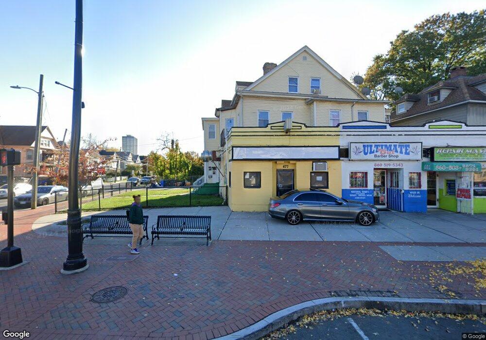
677 Albany Ave Unit 681 Hartford, CT 06112
Upper Albany NeighborhoodEstimated Value: $253,456
6
Beds
--
Bath
7,052
Sq Ft
$36/Sq Ft
Est. Value
About This Home
This home is located at 677 Albany Ave Unit 681, Hartford, CT 06112 and is currently estimated at $253,456, approximately $35 per square foot. 677 Albany Ave Unit 681 is a home located in Hartford County with nearby schools including Capital Preparatory Magnet School, Wish Museum School, and Ib Global Communications Academy.
Ownership History
Date
Name
Owned For
Owner Type
Purchase Details
Closed on
Mar 13, 2000
Sold by
1St Union Nb
Bought by
Tacey Joan
Current Estimated Value
Home Financials for this Owner
Home Financials are based on the most recent Mortgage that was taken out on this home.
Original Mortgage
$64,800
Interest Rate
8.18%
Mortgage Type
Commercial
Create a Home Valuation Report for This Property
The Home Valuation Report is an in-depth analysis detailing your home's value as well as a comparison with similar homes in the area
Home Values in the Area
Average Home Value in this Area
Purchase History
| Date | Buyer | Sale Price | Title Company |
|---|---|---|---|
| Tacey Joan | $90,000 | -- | |
| Tacey Joan | $90,000 | -- |
Source: Public Records
Mortgage History
| Date | Status | Borrower | Loan Amount |
|---|---|---|---|
| Closed | Tacey Joan | $160,100 | |
| Closed | Tacey Joan | $129,810 | |
| Closed | Tacey Joan | $64,450 | |
| Closed | Tacey Joan | $64,800 |
Source: Public Records
Tax History Compared to Growth
Tax History
| Year | Tax Paid | Tax Assessment Tax Assessment Total Assessment is a certain percentage of the fair market value that is determined by local assessors to be the total taxable value of land and additions on the property. | Land | Improvement |
|---|---|---|---|---|
| 2025 | $20,155 | $292,320 | $28,560 | $263,760 |
| 2024 | $20,155 | $292,320 | $28,560 | $263,760 |
| 2023 | $20,155 | $292,320 | $28,560 | $263,760 |
| 2022 | $18,357 | $292,320 | $28,560 | $263,760 |
| 2021 | $18,357 | $247,100 | $49,770 | $197,330 |
| 2020 | $18,357 | $247,100 | $49,770 | $197,330 |
| 2019 | $18,357 | $247,100 | $49,770 | $197,330 |
| 2018 | $18,362 | $247,170 | $49,770 | $197,400 |
| 2016 | $17,286 | $232,680 | $14,420 | $218,260 |
| 2015 | $16,051 | $216,060 | $13,390 | $202,670 |
| 2014 | $14,816 | $199,440 | $12,360 | $187,080 |
Source: Public Records
Map
Nearby Homes
- 62 Burton St
- 59 Magnolia St
- 10 Burton St Unit 12
- 54 Edgewood St Unit A
- 6 Magnolia St
- 78-80 Cabot St
- 410 Garden St
- 96 Sargeant St Unit 98
- 68 Sterling St Unit 70
- 48 Brook St Unit 50
- 116 Fairmount St
- 33 Sargeant St
- 67 Enfield St Unit 37
- 152 Brook St
- 68 Enfield St Unit 70
- 183 Brook St Unit 185
- 178 Brook St Unit 180
- 186 Brook St Unit 188
- 240 Sargeant St
- 33 Guilford St Unit B
- 701 Albany Ave
- 57 Magnolia St
- 690 Albany Ave
- 53 Magnolia St Unit 55
- 68 Burton St
- 68 Burton St
- 635 Albany Ave
- 60 Magnolia St Unit 62
- 58 Burton St
- 629 Albany Ave
- 51 Magnolia St
- 56 Magnolia St
- 88 Magnolia St Unit 90
- 89 Magnolia St Unit 91
- 54 Burton St
- 45 Magnolia St Unit 47
- 91 Magnolia St Unit 3
- 52 Magnolia St
- 93 Magnolia St Unit 95
- 50 Burton St