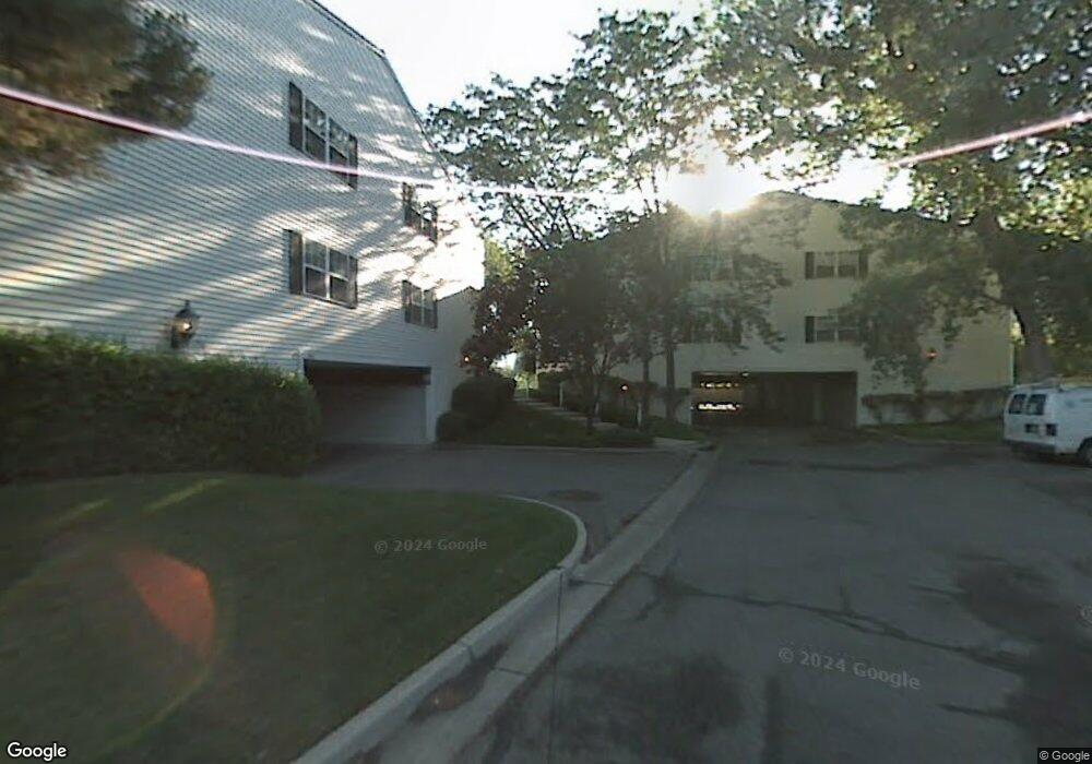
677 E 4025 S Unit F Salt Lake City, UT 84107
Estimated Value: $378,000 - $397,000
2
Beds
2
Baths
1,320
Sq Ft
$295/Sq Ft
Est. Value
About This Home
This home is located at 677 E 4025 S Unit F, Salt Lake City, UT 84107 and is currently estimated at $389,719, approximately $295 per square foot. 677 E 4025 S Unit F is a home located in Salt Lake County with nearby schools including James E Moss Elementary School, Bonneville Junior High School, and Cottonwood High School.
Ownership History
Date
Name
Owned For
Owner Type
Purchase Details
Closed on
Sep 13, 1995
Sold by
Anderson Steven V and Anderson Ann H
Bought by
Forbush Lawrence B and Forbush Elaine B
Current Estimated Value
Home Financials for this Owner
Home Financials are based on the most recent Mortgage that was taken out on this home.
Original Mortgage
$98,000
Interest Rate
7.88%
Mortgage Type
Purchase Money Mortgage
Create a Home Valuation Report for This Property
The Home Valuation Report is an in-depth analysis detailing your home's value as well as a comparison with similar homes in the area
Home Values in the Area
Average Home Value in this Area
Purchase History
| Date | Buyer | Sale Price | Title Company |
|---|---|---|---|
| Forbush Lawrence B | -- | -- |
Source: Public Records
Mortgage History
| Date | Status | Borrower | Loan Amount |
|---|---|---|---|
| Closed | Forbush Lawrence B | $98,000 |
Source: Public Records
Tax History Compared to Growth
Tax History
| Year | Tax Paid | Tax Assessment Tax Assessment Total Assessment is a certain percentage of the fair market value that is determined by local assessors to be the total taxable value of land and additions on the property. | Land | Improvement |
|---|---|---|---|---|
| 2025 | $2,162 | $338,700 | $101,600 | $237,100 |
| 2024 | $2,162 | $336,700 | $101,000 | $235,700 |
| 2023 | $2,144 | $322,000 | $96,600 | $225,400 |
| 2022 | $2,080 | $314,500 | $94,300 | $220,200 |
| 2021 | $1,936 | $253,800 | $76,100 | $177,700 |
| 2020 | $1,832 | $227,100 | $68,100 | $159,000 |
| 2019 | $1,695 | $205,100 | $61,500 | $143,600 |
| 2018 | $1,697 | $197,700 | $59,300 | $138,400 |
| 2017 | $1,466 | $178,800 | $53,600 | $125,200 |
| 2016 | $1,364 | $168,200 | $50,400 | $117,800 |
| 2015 | $1,387 | $160,100 | $48,000 | $112,100 |
| 2014 | $1,403 | $158,500 | $47,500 | $111,000 |
Source: Public Records
Map
Nearby Homes
- 4040 S 685 E Unit F
- 4040 S 685 E Unit F
- 651 E 4025 S Unit G
- 657 E 4065 S Unit C
- 779 E 4070 S
- 830 E 3990 S Unit D
- 3965 S 805 E Unit B
- 602 E Betsey Cove Unit 20
- 3938 S 805 E Unit A
- 3924 S 805 E Unit B
- 825 E 3990 S Unit C
- 599 E Betsey Cove Unit 23
- 3970 S 840 E Unit A
- 568 E Dolores Cove Unit 4
- 689 E 4149 S
- Type B3 Plan at The Monroe - theMONROE
- 4178 S 650 E
- 4175 S 590 E
- 3944 S 900 E Unit 204
- 3944 S 900 E Unit 203
- 677 E 4025 S Unit E
- 677 E 4025 S Unit H
- 677 E 4025 S Unit G
- 665 E 4025 S Unit G
- 665 E 4025 S Unit E
- 665 E 4025 S Unit F
- 665 E 4025 S
- 679 E 4025 S Unit B
- 679 E 4025 S Unit A
- 679 E 4025 S Unit C
- 679 E 4025 S Unit D
- 667 E 4025 S Unit D
- 667 E 4025 S Unit A
- 667 E 4025 S Unit C
- 667 E 4025 S Unit B
- 653 E 4025 S Unit C
- 653 E 4025 S Unit D
- 653 E 4025 S Unit B
- 653 E 4025 S Unit A
- 653 E 4025 S Unit 171 C