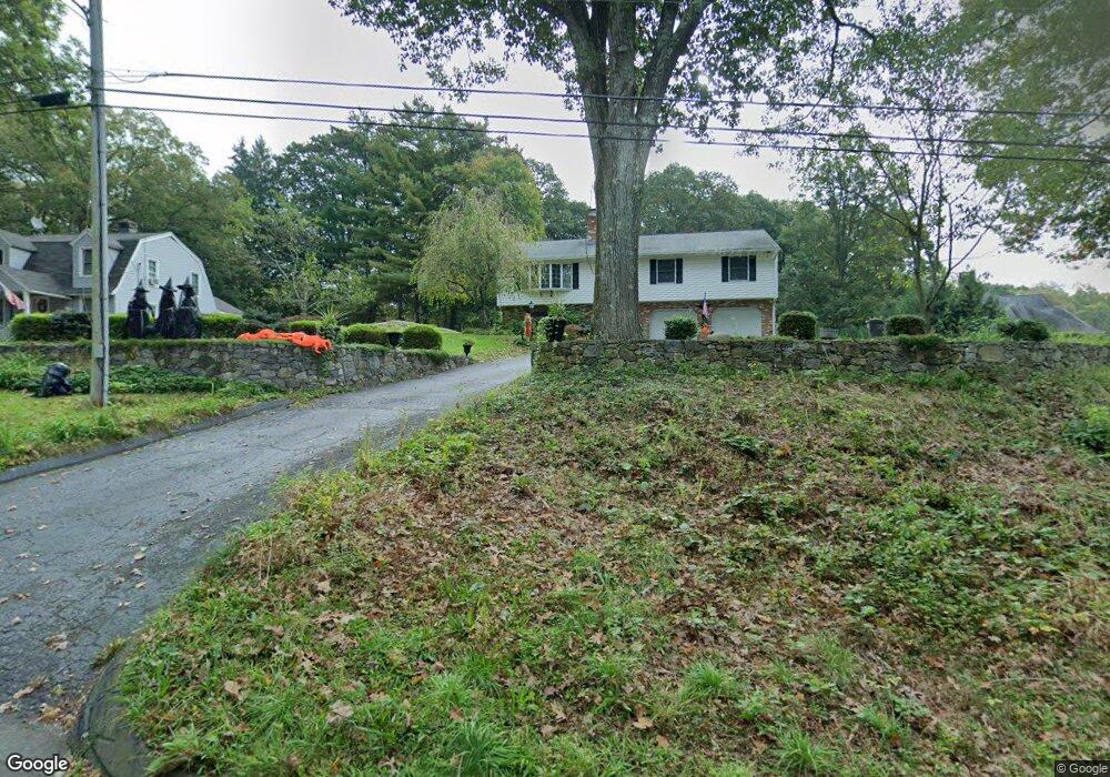
677 King St Naugatuck, CT 06770
Estimated Value: $414,181 - $467,000
3
Beds
3
Baths
1,612
Sq Ft
$274/Sq Ft
Est. Value
About This Home
This home is located at 677 King St, Naugatuck, CT 06770 and is currently estimated at $442,295, approximately $274 per square foot. 677 King St is a home located in New Haven County with nearby schools including City Hill Middle School, Naugatuck High School, and Westover School.
Ownership History
Date
Name
Owned For
Owner Type
Purchase Details
Closed on
Apr 18, 1986
Bought by
Demers Joseph Wilfred and Demers Kathleen Ann
Current Estimated Value
Create a Home Valuation Report for This Property
The Home Valuation Report is an in-depth analysis detailing your home's value as well as a comparison with similar homes in the area
Home Values in the Area
Average Home Value in this Area
Purchase History
We collect this data history from publicly available records. To have your information removed, we recommend requesting removal directly through your county’s website.
| Date | Buyer | Sale Price | Title Company |
|---|---|---|---|
| Demers Joseph Wilfred | -- | -- |
Source: Public Records
Mortgage History
We collect this data history from publicly available records. To have your information removed, we recommend requesting removal directly through your county’s website.
| Date | Status | Borrower | Loan Amount |
|---|---|---|---|
| Closed | Demers Joseph Wilfred | $17,500 | |
| Closed | Demers Joseph Wilfred | $81,000 |
Source: Public Records
Tax History
| Year | Tax Paid | Tax Assessment Tax Assessment Total Assessment is a certain percentage of the fair market value that is determined by local assessors to be the total taxable value of land and additions on the property. | Land | Improvement |
|---|---|---|---|---|
| 2025 | $8,370 | $210,350 | $30,450 | $179,900 |
| 2024 | $8,791 | $210,350 | $30,450 | $179,900 |
| 2023 | $9,413 | $210,350 | $30,450 | $179,900 |
| 2022 | $7,362 | $154,170 | $32,680 | $121,490 |
| 2021 | $7,362 | $154,170 | $32,680 | $121,490 |
| 2020 | $7,362 | $154,170 | $32,680 | $121,490 |
| 2019 | $7,285 | $154,170 | $32,680 | $121,490 |
| 2018 | $7,351 | $152,040 | $52,860 | $99,180 |
| 2017 | $7,382 | $152,040 | $52,860 | $99,180 |
| 2016 | $7,248 | $152,040 | $52,860 | $99,180 |
| 2015 | $6,928 | $152,040 | $52,860 | $99,180 |
| 2014 | $6,851 | $152,040 | $52,860 | $99,180 |
| 2012 | $6,796 | $202,560 | $62,800 | $139,760 |
Source: Public Records
Map
Nearby Homes
- 45 Michael Ln
- 57 Mistywood Ln
- 26 Vidich Ln
- 279 Wedgewood Dr
- 36 Stoneybrook Rd
- 422 Jones Rd
- 123 Evelyn Dr
- 101 Ridge Rd Unit 5
- 30 Round Tree Dr Unit 6
- 166 Round Hill Rd
- 271 Shadduck Rd
- 350 Bristol St Unit C12
- 350 Bristol St Unit C1
- 350 Bristol St Unit A-6
- 233 Conrad St
- 293 N Hoadley St
- 0 Westover Dr
- 0 Silver Ridge Ln Unit 24173272
- 518 Spring St
- 47 Jones Rd
- 685 King St
- 681 King St
- 455 Allerton Rd
- 500 Allerton Rd
- 689 King St
- 466 Allerton Rd
- 466 Allerton Rd
- 455 Allerton Farms Rd
- 460 Allerton Farms Rd
- 450 Allerton Rd
- 671 King St
- 433 Allerton Rd
- 28 Mistywood Ln
- 517 Allerton Rd
- 517 Allerton Rd
- 438 Allerton Rd
- 438 Allerton Rd
- 63 Michael Ln
- 33 Michael Ln
- 59 Michael Ln
Your Personal Tour Guide
Ask me questions while you tour the home.