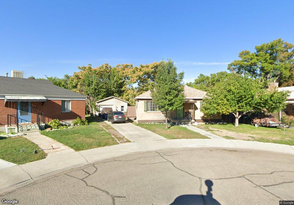
677 Pioneer Cir Provo, UT 84601
Rivergrove NeighborhoodEstimated Value: $430,000 - $486,000
2
Beds
2
Baths
850
Sq Ft
$534/Sq Ft
Est. Value
About This Home
This home is located at 677 Pioneer Cir, Provo, UT 84601 and is currently estimated at $453,814, approximately $533 per square foot. 677 Pioneer Cir is a home located in Utah County with nearby schools including Timpanogos Elementary School, Dixon Middle School, and Provo High School.
Ownership History
Date
Name
Owned For
Owner Type
Purchase Details
Closed on
Aug 19, 2024
Sold by
Hill Ashley J
Bought by
Jones Ashley
Current Estimated Value
Purchase Details
Closed on
Mar 3, 2009
Sold by
Jones Jerald W and The Florence M Bly Family Trus
Bought by
Jones Jerald W and The Karen P Jones Revocable Tr
Purchase Details
Closed on
Dec 21, 2006
Sold by
Jones Jerald W and The Karen P Jones Family Trust
Bought by
Hill Ashley J
Create a Home Valuation Report for This Property
The Home Valuation Report is an in-depth analysis detailing your home's value as well as a comparison with similar homes in the area
Home Values in the Area
Average Home Value in this Area
Purchase History
| Date | Buyer | Sale Price | Title Company |
|---|---|---|---|
| Jones Ashley | -- | None Listed On Document | |
| Jones Jerald W | -- | None Available | |
| Hill Ashley J | -- | None Available | |
| Jones Jerald W | -- | None Available |
Source: Public Records
Tax History
| Year | Tax Paid | Tax Assessment Tax Assessment Total Assessment is a certain percentage of the fair market value that is determined by local assessors to be the total taxable value of land and additions on the property. | Land | Improvement |
|---|---|---|---|---|
| 2025 | $2,391 | $254,595 | -- | -- |
| 2024 | $2,391 | $235,345 | $0 | $0 |
| 2023 | $2,413 | $234,135 | $0 | $0 |
| 2022 | $2,259 | $221,045 | $0 | $0 |
| 2021 | $1,636 | $279,200 | $117,600 | $161,600 |
| 2020 | $1,586 | $253,800 | $106,900 | $146,900 |
| 2019 | $1,445 | $240,400 | $93,500 | $146,900 |
| 2018 | $1,291 | $217,900 | $90,200 | $127,700 |
| 2017 | $1,154 | $106,975 | $0 | $0 |
| 2016 | $1,013 | $87,505 | $0 | $0 |
| 2015 | $907 | $79,200 | $0 | $0 |
| 2014 | $830 | $75,570 | $0 | $0 |
Source: Public Records
Map
Nearby Homes