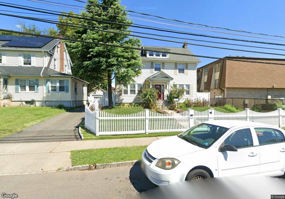
677 Salem Ave Unit 679 Elizabeth, NJ 07208
Westminster NeighborhoodEstimated Value: $405,000 - $623,028
--
Bed
--
Bath
2,324
Sq Ft
$232/Sq Ft
Est. Value
About This Home
This home is located at 677 Salem Ave Unit 679, Elizabeth, NJ 07208 and is currently estimated at $540,007, approximately $232 per square foot. 677 Salem Ave Unit 679 is a home located in Union County with nearby schools including Number 23, N.M. Butler Elementary School, Elizabeth High School, and Bruriah High School For Girls.
Ownership History
Date
Name
Owned For
Owner Type
Purchase Details
Closed on
Nov 10, 2023
Sold by
Panlilio Balbino and Panlilio Maria Antonette
Bought by
Giron Noe D and Cordon-Giron Floridalma
Current Estimated Value
Purchase Details
Closed on
Feb 12, 2003
Sold by
Panlilio Remieliza
Bought by
Panlilio Balbino
Purchase Details
Closed on
May 31, 2002
Sold by
Hoover Jean and Hoover Richard P
Bought by
Panlilio Balbino
Home Financials for this Owner
Home Financials are based on the most recent Mortgage that was taken out on this home.
Original Mortgage
$184,200
Interest Rate
6.8%
Create a Home Valuation Report for This Property
The Home Valuation Report is an in-depth analysis detailing your home's value as well as a comparison with similar homes in the area
Home Values in the Area
Average Home Value in this Area
Purchase History
| Date | Buyer | Sale Price | Title Company |
|---|---|---|---|
| Giron Noe D | $429,000 | Ats Title | |
| Giron Noe D | $429,000 | Ats Title | |
| Panlilio Balbino | -- | -- | |
| Panlilio Balbino | $160,000 | -- |
Source: Public Records
Mortgage History
| Date | Status | Borrower | Loan Amount |
|---|---|---|---|
| Previous Owner | Panlilio Balbino | $184,200 |
Source: Public Records
Tax History Compared to Growth
Tax History
| Year | Tax Paid | Tax Assessment Tax Assessment Total Assessment is a certain percentage of the fair market value that is determined by local assessors to be the total taxable value of land and additions on the property. | Land | Improvement |
|---|---|---|---|---|
| 2025 | $9,772 | $507,900 | $226,100 | $281,800 |
| 2024 | $12,101 | $507,900 | $226,100 | $281,800 |
| 2023 | $12,101 | $38,500 | $14,000 | $24,500 |
| 2022 | $11,773 | $38,500 | $14,000 | $24,500 |
| 2021 | $11,530 | $38,500 | $14,000 | $24,500 |
| 2020 | $11,269 | $38,500 | $14,000 | $24,500 |
| 2019 | $11,097 | $38,500 | $14,000 | $24,500 |
| 2018 | $10,989 | $38,500 | $14,000 | $24,500 |
| 2017 | $10,683 | $38,500 | $14,000 | $24,500 |
| 2016 | $10,683 | $38,500 | $14,000 | $24,500 |
| 2015 | $10,596 | $40,600 | $14,000 | $26,600 |
| 2014 | -- | $40,600 | $14,000 | $26,600 |
Source: Public Records
Map
Nearby Homes
- 660-672 N Broad St Unit 20 A
- 660-672 N Broad St Unit b19
- 660 N Broad St Unit 20 A
- 704-712 N Broad St Unit 3D
- 712 N Broad St Unit 2E
- 712 N Broad St Unit 2A
- 730 Salem Ave
- 747 757 N Broad St Unit 301
- 8 Malden Terrace Unit 10
- 8 Malden Terrace Unit 8 10
- 704 712 N Broad St Unit 8B
- 808 Salem Ave Unit 1
- 11 Denman Place Unit 5
- 17 Barnard Place Unit 21
- 159 Hartley Terrace
- 71 Georgian Ct
- 153 North Ave
- 843 Winchester Ave
- 600 Pennsylvania Ave Unit 602
- 136 Parker Rd
- 681 Salem Ave Unit 3
- 701 Salem Ave Unit 705
- 703 Salem Ave
- 668 N Broad St Unit A16
- 668 N Broad St Unit 672
- 668 N Broad St Unit A-12
- 668 N Broad St Unit 7
- 668 N Broad St Unit A01
- 668 N Broad St Unit 10A
- 668 N Broad St Unit A-21
- 668 N Broad St
- 42 Dewitt Rd
- 34 Dewitt Rd Unit 38
- 660-672 N Broad St Unit B3
- 660-672 N Broad St Unit A17
- 660-672 N Broad St Unit B-9
- 660-672 N Broad St Unit B-21
- 660 N Broad St Unit A-12
- 660-672 N Broad St Unit B-13
- 660-672 N Broad St Unit A8