Estimated Value: $322,000 - $382,451
--
Bed
2
Baths
1,890
Sq Ft
$182/Sq Ft
Est. Value
About This Home
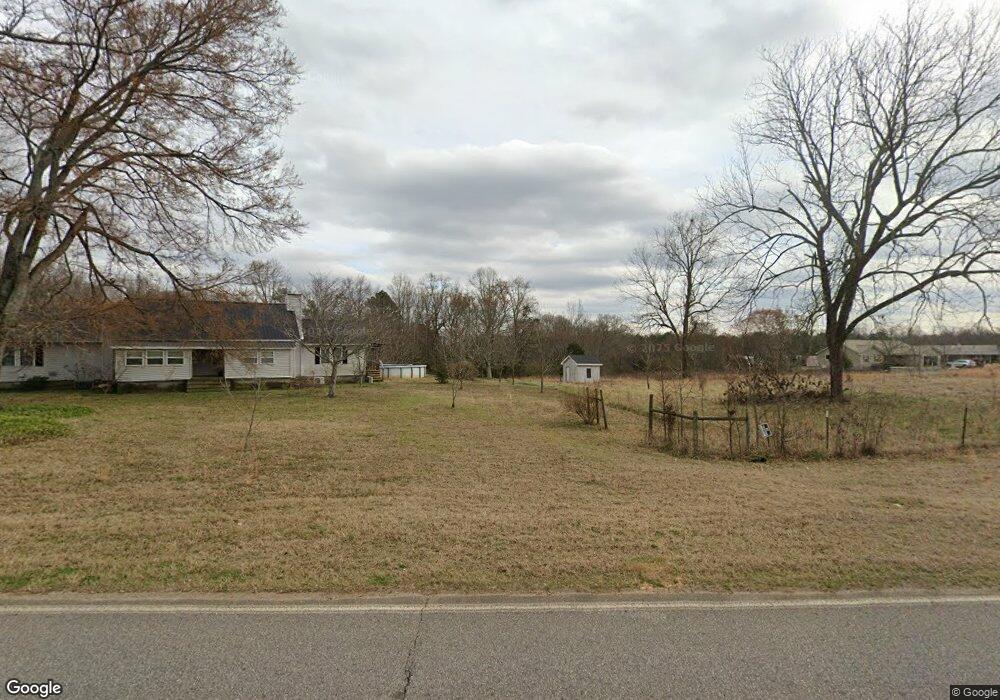
This home is located at 6770 Nowhere Rd, Hull, GA 30646 and is currently estimated at $344,113, approximately $182 per square foot. 6770 Nowhere Rd is a home located in Madison County with nearby schools including Madison County High School.
Ownership History
Date
Name
Owned For
Owner Type
Purchase Details
Closed on
Nov 13, 2024
Sold by
Sartain Kristie Dawn
Bought by
Cutshall Jacob and Cutshall Rebecca
Current Estimated Value
Home Financials for this Owner
Home Financials are based on the most recent Mortgage that was taken out on this home.
Original Mortgage
$293,040
Outstanding Balance
$289,727
Interest Rate
6.44%
Mortgage Type
FHA
Estimated Equity
$54,386
Purchase Details
Closed on
Jul 16, 2003
Sold by
Sartain Jason and Sartain Kristie D
Bought by
Sartain Jason and Sartain Kristie D
Purchase Details
Closed on
Jan 12, 1999
Sold by
Rutherford Lillian F
Bought by
Sartain Jason and Sartain Kris
Create a Home Valuation Report for This Property
The Home Valuation Report is an in-depth analysis detailing your home's value as well as a comparison with similar homes in the area
Purchase History
| Date | Buyer | Sale Price | Title Company |
|---|---|---|---|
| Cutshall Jacob | $370,000 | -- | |
| Sartain Jason | -- | -- | |
| Sartain Jason | -- | -- |
Source: Public Records
Mortgage History
| Date | Status | Borrower | Loan Amount |
|---|---|---|---|
| Open | Cutshall Jacob | $293,040 |
Source: Public Records
Tax History
| Year | Tax Paid | Tax Assessment Tax Assessment Total Assessment is a certain percentage of the fair market value that is determined by local assessors to be the total taxable value of land and additions on the property. | Land | Improvement |
|---|---|---|---|---|
| 2025 | $3,493 | $139,464 | $54,580 | $84,884 |
| 2024 | $3,038 | $118,722 | $54,580 | $64,142 |
| 2023 | $3,223 | $105,578 | $45,483 | $60,095 |
| 2022 | $1,712 | $85,281 | $31,270 | $54,011 |
| 2021 | $1,559 | $74,295 | $31,270 | $43,025 |
| 2020 | $1,532 | $69,747 | $26,722 | $43,025 |
| 2018 | $1,484 | $65,929 | $24,448 | $41,481 |
| 2017 | $1,755 | $60,966 | $22,742 | $38,224 |
| 2016 | $1,108 | $55,742 | $22,742 | $33,000 |
| 2015 | $1,107 | $55,742 | $22,742 | $33,000 |
| 2014 | $1,135 | $55,965 | $21,986 | $33,979 |
| 2013 | -- | $55,965 | $21,986 | $33,979 |
Source: Public Records
Map
Nearby Homes
- 310 Sawdust Rd
- 0 Crabapple Hollow Rd Unit TRACT 2
- 357 Carither Rd
- 284 Snow Farm Rd
- 1246 Stone Stewart Rd
- 25 Rose Hill Ln
- 832 Stone Stewart Rd
- 0 Stone Stewart Rd Unit 7519457
- 0 Stone Stewart Rd Unit 10452697
- 0 Stone Stewart Rd Unit 1023553
- 1067 Garnett Ward Rd Unit 2
- 0 Nowhere Ln Unit 10544151
- 450 Candlestick Dr
- 140 Kimberly Way
- 9 Cooper Farm Rd
- 7 Cooper Farm Rd
- 151 Sandy Springs Dr
- 103 Three Rivers Ct
- 9980 Nowhere Rd
- 65 Kimberly Way
- 6658 Nowhere Rd
- 6656 Nowhere Rd
- 6902 Nowhere Rd
- 6930 Nowhere Rd
- 3553 Seagraves Mill Rd
- 190 Sawdust Rd
- 2831 Sanford Rd
- 6655 Nowhere Rd
- 0 Lloyd Nelms Rd
- 6584 Nowhere Rd
- 7015 Nowhere Rd
- 7016 Nowhere Rd
- 216 Sawdust Rd
- 299 Sawdust Rd
- 7041 Nowhere Rd
- 6537 Nowhere Rd
- 3433 Seagraves Mill Rd
- 6508 Nowhere Rd
- 7078 Nowhere Rd
- 2567 Sanford Rd
Your Personal Tour Guide
Ask me questions while you tour the home.