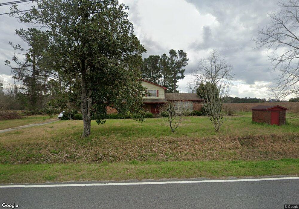
6772 Clyattstone Rd Hahira, GA 31632
Estimated Value: $190,000 - $360,000
--
Bed
2
Baths
1,909
Sq Ft
$127/Sq Ft
Est. Value
About This Home
This home is located at 6772 Clyattstone Rd, Hahira, GA 31632 and is currently estimated at $242,642, approximately $127 per square foot. 6772 Clyattstone Rd is a home located in Lowndes County with nearby schools including Westside Elementary School, Hahira Middle School, and Lowndes High School.
Ownership History
Date
Name
Owned For
Owner Type
Purchase Details
Closed on
Jul 1, 2010
Sold by
Price John E
Bought by
Wells Fargo Bank Na
Current Estimated Value
Home Financials for this Owner
Home Financials are based on the most recent Mortgage that was taken out on this home.
Original Mortgage
$187,500
Interest Rate
4.79%
Mortgage Type
Reverse Mortgage Home Equity Conversion Mortgage
Purchase Details
Closed on
Apr 14, 1975
Bought by
Price John E and Price Margarie
Create a Home Valuation Report for This Property
The Home Valuation Report is an in-depth analysis detailing your home's value as well as a comparison with similar homes in the area
Home Values in the Area
Average Home Value in this Area
Purchase History
| Date | Buyer | Sale Price | Title Company |
|---|---|---|---|
| Wells Fargo Bank Na | $183,786 | -- | |
| Price John E | -- | -- | |
| Price John E | $37,500 | -- |
Source: Public Records
Mortgage History
| Date | Status | Borrower | Loan Amount |
|---|---|---|---|
| Previous Owner | Price John E | $187,500 |
Source: Public Records
Tax History Compared to Growth
Tax History
| Year | Tax Paid | Tax Assessment Tax Assessment Total Assessment is a certain percentage of the fair market value that is determined by local assessors to be the total taxable value of land and additions on the property. | Land | Improvement |
|---|---|---|---|---|
| 2024 | $1,177 | $49,320 | $4,135 | $45,185 |
| 2023 | $1,177 | $49,050 | $3,865 | $45,185 |
| 2022 | $735 | $36,377 | $3,865 | $32,512 |
| 2021 | $777 | $36,672 | $3,865 | $32,807 |
| 2020 | $725 | $36,820 | $4,013 | $32,807 |
| 2019 | $733 | $36,820 | $4,013 | $32,807 |
| 2018 | $740 | $36,820 | $4,013 | $32,807 |
| 2017 | $742 | $36,455 | $3,648 | $32,807 |
| 2016 | $744 | $36,455 | $3,648 | $32,807 |
| 2015 | $712 | $36,455 | $3,648 | $32,807 |
| 2014 | $790 | $38,807 | $6,000 | $32,807 |
Source: Public Records
Map
Nearby Homes
- 4268 Nelson Hill Place
- 2048 Tottenham Dr
- 4190 Parker Trail
- The Ryleigh Plan at Ballantyne
- The Embry Plan at Ballantyne
- The Carol Plan at Ballantyne
- The Belfort Plan at Ballantyne
- 1000 Ballantyne Ln
- 4005 Ashbourne Dr
- 4970 Hatfield Cir
- 4029 Ashbourne Dr
- 4040 Ashbourne Dr
- 5051 Hatfield Cir
- 5055 Hatfield Cir
- 4609 Amelia Cir
- 3061 Houser Way
- 4868 Brown Cat Cir
- 4860 Brown Cat Cir
- 5039 Hatfield Cir
- 5020 Hatfield Cir
- 2020 Tottenham Dr
- 6770 Clyattstone Rd
- 6776 Clyattstone Rd
- 6712 Clyattstone Rd
- 6720 Clyattstone Rd
- 6711 Clyattstone Rd
- 6700 Clyattstone Rd
- 4486 Simpson Ln
- 4460 Simpson Ln
- 4255 Shadow Garden Dr
- 4218 Cider Trail
- 4251 Shadow Garden Dr
- 4231 Nelson Hill Place
- 4235 Nelson Hill Place
- 4221 Nelson Hill Place
- 4214 Cider Trail
- 4243 Shadow Garden Dr
- 4239 Shadow Garden Dr
- 4217 Nelson Hill Place
- 4243 Nelson Hill Place