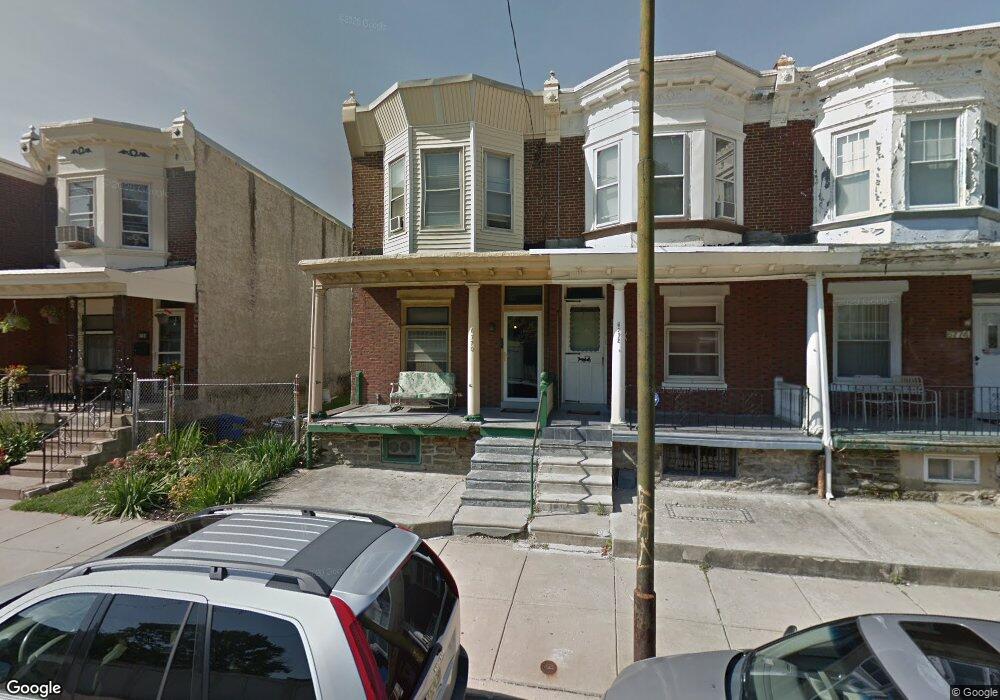
6772 Musgrave St Philadelphia, PA 19119
East Mount Airy NeighborhoodEstimated Value: $265,000 - $304,000
3
Beds
1
Bath
1,552
Sq Ft
$179/Sq Ft
Est. Value
About This Home
This home is located at 6772 Musgrave St, Philadelphia, PA 19119 and is currently estimated at $277,951, approximately $179 per square foot. 6772 Musgrave St is a home located in Philadelphia County with nearby schools including Eleanor C. Emlen School, Roosevelt Theodore Middle School, and Martin Luther King High School.
Ownership History
Date
Name
Owned For
Owner Type
Purchase Details
Closed on
Sep 22, 2008
Sold by
Bender Paula and Estate Of Sybil Bernice Bender
Bought by
Bender Paula
Current Estimated Value
Purchase Details
Closed on
Aug 3, 2006
Sold by
Bender Sybil Bernice and Obot Nse Nsima
Bought by
Bender Sybil Bernice
Purchase Details
Closed on
May 28, 2004
Sold by
Bender Sybil Bernice
Bought by
Bender Sybil Bernice and Obot Nse Nsima
Purchase Details
Closed on
Nov 30, 2000
Sold by
Bender Robert O and Bender Leslyn I
Bought by
Bender Sybil Bernice
Create a Home Valuation Report for This Property
The Home Valuation Report is an in-depth analysis detailing your home's value as well as a comparison with similar homes in the area
Home Values in the Area
Average Home Value in this Area
Purchase History
| Date | Buyer | Sale Price | Title Company |
|---|---|---|---|
| Bender Paula | -- | None Available | |
| Bender Sybil Bernice | $19,486 | None Available | |
| Bender Sybil Bernice | $18,900 | -- | |
| Bender Sybil Bernice | -- | -- |
Source: Public Records
Tax History Compared to Growth
Tax History
| Year | Tax Paid | Tax Assessment Tax Assessment Total Assessment is a certain percentage of the fair market value that is determined by local assessors to be the total taxable value of land and additions on the property. | Land | Improvement |
|---|---|---|---|---|
| 2025 | $2,199 | $203,900 | $40,780 | $163,120 |
| 2024 | $2,199 | $203,900 | $40,780 | $163,120 |
| 2023 | $2,199 | $157,100 | $31,420 | $125,680 |
| 2022 | $1,638 | $157,100 | $31,420 | $125,680 |
| 2021 | $1,638 | $0 | $0 | $0 |
| 2020 | $1,638 | $0 | $0 | $0 |
| 2019 | $1,711 | $0 | $0 | $0 |
| 2018 | $1,550 | $0 | $0 | $0 |
| 2017 | $1,550 | $0 | $0 | $0 |
| 2016 | $1,550 | $0 | $0 | $0 |
| 2015 | -- | $0 | $0 | $0 |
| 2014 | -- | $110,700 | $9,344 | $101,356 |
| 2012 | -- | $11,968 | $1,941 | $10,027 |
Source: Public Records
Map
Nearby Homes
- 203 E Slocum St Unit A
- 221 E Slocum St
- 122 E Meehan Ave
- 135 E Pleasant St
- 6833 Musgrave St
- 224 E Dorset St
- 6714 Bass St
- 213 E E Phil Ellena St
- 101 E Phil Ellena St
- 231 E Phil Ellena St
- 135 E Springer St
- 6807 Chew Ave
- 244 E Springer St
- 305 E Vernon Rd
- 20 Pelham Rd
- 70 E Springer St
- 6641 Crowson St
- 6631 Musgrave St
- 6627 Musgrave St
- 6638 Ross St
- 6774 Musgrave St
- 6770 Musgrave St
- 6768 Musgrave St
- 6766 Musgrave St
- 79 E Slocum St
- 54 E Pleasant St
- 6764 Musgrave St
- 52 E Pleasant St
- 60 E Pleasant St
- 56 E Pleasant St
- 50 E Pleasant St
- 77 E Slocum St
- 48 E Pleasant St
- 75 E Slocum St
- 46 E Pleasant St
- 44 E Pleasant St
- 73 E Slocum St
- 42 E Pleasant St
- 6762 Musgrave St
- 203 E Slocum St