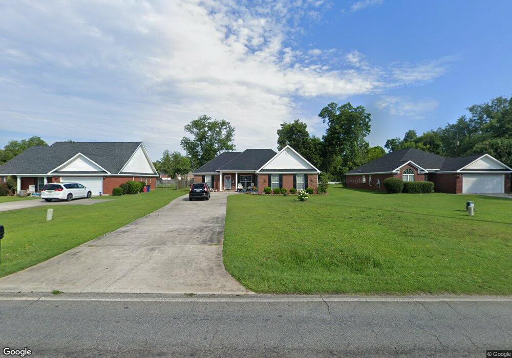
6773 Houston Rd Unit 2 Macon, GA 31216
Estimated Value: $234,000 - $278,000
3
Beds
2
Baths
1,630
Sq Ft
$156/Sq Ft
Est. Value
About This Home
This home is located at 6773 Houston Rd Unit 2, Macon, GA 31216 and is currently estimated at $253,943, approximately $155 per square foot. 6773 Houston Rd Unit 2 is a home located in Bibb County with nearby schools including Heard Elementary School, Rutland Middle School, and Rutland High School.
Ownership History
Date
Name
Owned For
Owner Type
Purchase Details
Closed on
Aug 11, 2017
Sold by
Fleming Leo
Bought by
Stallwood Christine T
Current Estimated Value
Home Financials for this Owner
Home Financials are based on the most recent Mortgage that was taken out on this home.
Original Mortgage
$120,772
Outstanding Balance
$101,749
Interest Rate
4.5%
Mortgage Type
FHA
Estimated Equity
$152,194
Purchase Details
Closed on
Oct 26, 2004
Bought by
Fleming Leo
Purchase Details
Closed on
Oct 6, 2003
Create a Home Valuation Report for This Property
The Home Valuation Report is an in-depth analysis detailing your home's value as well as a comparison with similar homes in the area
Home Values in the Area
Average Home Value in this Area
Purchase History
| Date | Buyer | Sale Price | Title Company |
|---|---|---|---|
| Stallwood Christine T | $123,000 | None Available | |
| Fleming Leo | $139,900 | -- | |
| -- | $133,000 | -- |
Source: Public Records
Mortgage History
| Date | Status | Borrower | Loan Amount |
|---|---|---|---|
| Open | Stallwood Christine T | $120,772 |
Source: Public Records
Tax History Compared to Growth
Tax History
| Year | Tax Paid | Tax Assessment Tax Assessment Total Assessment is a certain percentage of the fair market value that is determined by local assessors to be the total taxable value of land and additions on the property. | Land | Improvement |
|---|---|---|---|---|
| 2025 | $1,902 | $91,965 | $16,000 | $75,965 |
| 2024 | $1,968 | $91,965 | $16,000 | $75,965 |
| 2023 | $1,511 | $91,965 | $16,000 | $75,965 |
| 2022 | $1,481 | $56,688 | $9,600 | $47,088 |
| 2021 | $1,628 | $56,688 | $9,600 | $47,088 |
| 2020 | $1,663 | $56,688 | $9,600 | $47,088 |
| 2019 | $1,757 | $56,688 | $9,600 | $47,088 |
| 2018 | $2,710 | $56,688 | $9,600 | $47,088 |
| 2017 | $1,844 | $56,227 | $9,600 | $46,627 |
| 2016 | $1,703 | $56,227 | $9,600 | $46,627 |
| 2015 | $2,411 | $56,227 | $9,600 | $46,627 |
| 2014 | $2,001 | $56,227 | $9,600 | $46,627 |
Source: Public Records
Map
Nearby Homes
- 411 Bob White Rd
- 428 Bob White Rd
- 465 Bob White Rd
- 436 Joseph Chandler Dr
- 708 Coopers Lnd
- 408 Resting Fawn Place
- DUPONT Plan at Quail Ridge
- GARDNER Plan at Quail Ridge
- KINGSTON Plan at Quail Ridge
- ESSEX Plan at Quail Ridge
- 813 Ocala National Trail
- 405 Stonecrest Ct
- 214 Golden Ocala Blvd
- 102 Haylie Ct
- 330 Cody Dr
- 104 Alayna Ct
- 328 Cody Dr
- 326 Thoroughbred Ln
- 6773 Houston Rd
- 6771 Houston Rd
- 6775 Houston Rd
- 6779 Houston Rd
- 6783 Houston Rd
- 6789 Houston Rd
- 6767 Houston Rd
- 639 Manning Mill
- 639 Manning Mill Unit 103-9
- 639 Manning Mill Unit 94
- 641 Manning Mill
- 637 Manning Mill
- 325 Whittington Dr
- 320 Whittington Dr
- 643 Manning Mill
- 635 Manning Mill
- 645 Manning Mill
- 633 Manning Mill
- 6793 Houston Rd
- 321 Whittington Dr