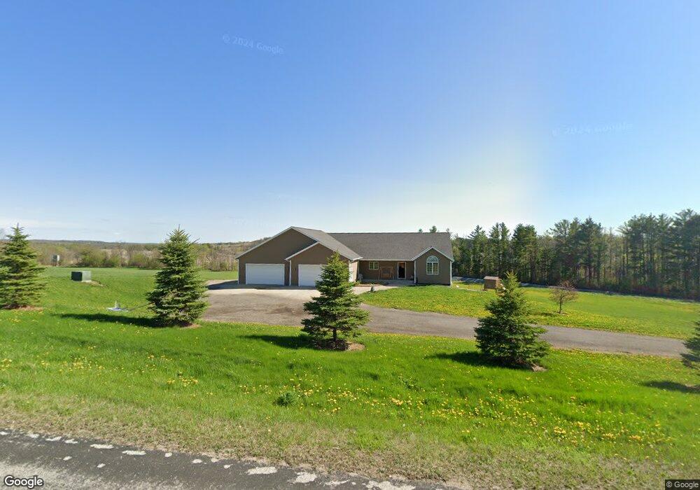
6775 Commercial Ln Allenton, WI 53002
Estimated Value: $424,000 - $600,000
--
Bed
--
Bath
--
Sq Ft
4.17
Acres
About This Home
This home is located at 6775 Commercial Ln, Allenton, WI 53002 and is currently estimated at $521,047. 6775 Commercial Ln is a home with nearby schools including Kewaskum High School.
Ownership History
Date
Name
Owned For
Owner Type
Purchase Details
Closed on
Sep 19, 2008
Sold by
White Bonnie and White Bonnie L
Bought by
Mckee Melissa A
Current Estimated Value
Home Financials for this Owner
Home Financials are based on the most recent Mortgage that was taken out on this home.
Original Mortgage
$39,920
Interest Rate
5.96%
Mortgage Type
New Conventional
Create a Home Valuation Report for This Property
The Home Valuation Report is an in-depth analysis detailing your home's value as well as a comparison with similar homes in the area
Home Values in the Area
Average Home Value in this Area
Purchase History
| Date | Buyer | Sale Price | Title Company |
|---|---|---|---|
| Mckee Melissa A | $49,900 | Abstract & Title Company |
Source: Public Records
Mortgage History
| Date | Status | Borrower | Loan Amount |
|---|---|---|---|
| Closed | Mckee Melissa A | $39,920 |
Source: Public Records
Tax History Compared to Growth
Tax History
| Year | Tax Paid | Tax Assessment Tax Assessment Total Assessment is a certain percentage of the fair market value that is determined by local assessors to be the total taxable value of land and additions on the property. | Land | Improvement |
|---|---|---|---|---|
| 2024 | $3,653 | $326,200 | $58,100 | $268,100 |
| 2023 | $3,297 | $326,200 | $58,100 | $268,100 |
| 2022 | $3,004 | $326,200 | $58,100 | $268,100 |
| 2021 | $3,091 | $326,200 | $58,100 | $268,100 |
| 2020 | $3,165 | $326,200 | $58,100 | $268,100 |
| 2019 | $3,507 | $288,600 | $54,600 | $234,000 |
| 2018 | $3,483 | $288,600 | $54,600 | $234,000 |
| 2017 | $3,557 | $288,600 | $54,600 | $234,000 |
| 2016 | $3,495 | $288,600 | $54,600 | $234,000 |
| 2015 | $3,404 | $288,600 | $54,600 | $234,000 |
| 2014 | $40 | $3,200 | $3,200 | $0 |
| 2013 | $44 | $3,200 | $3,200 | $0 |
Source: Public Records
Map
Nearby Homes
- Lt13 Eagle View Dr
- Lt1 Eagle View Dr
- Lt4 Eagle View Dr
- 7087 Nenno Rd
- N7575 Doyle Rd
- 6372 Yellowstone Trail N
- 8480 Fairview Dr
- Lt3 Wilson Dr
- Lt2 Wilson Dr
- Lt1 Wilson Dr
- Montrose Manor Plan at Grandview Heights
- Isabelle II Plan at Grandview Heights
- Simen Plan at Grandview Heights
- Sarah III Plan at Grandview Heights
- Balmore II Plan at Grandview Heights
- Edinburgh Plan at Grandview Heights
- 7721 Aurora Rd
- 6372 Wildlife Rd
- 5954 Mohawk Rd
- Lt0 County Hwy W
- 6749 Commercial Ln
- 6875 Commercial Ln
- 6740 Commercial Ln
- 6701 Commercial Ln
- 6706 Commercial Ln
- 6538 Bridge Ct
- 6900 Hocheim Rd
- Lt2 Commercial Ln
- 6527 Bridge Ct
- 7499 Nenno Rd
- 6528 Bridge Ct
- 6518 Bridge Ct
- 7555 Midland Dr
- 0 Pamperin Way
- 7505 Midland Dr
- 7502 Nenno Rd
- 7493 Midland Dr
- 7515 Midland Dr
- 7510 Midland Dr
- 7449 Midland Dr