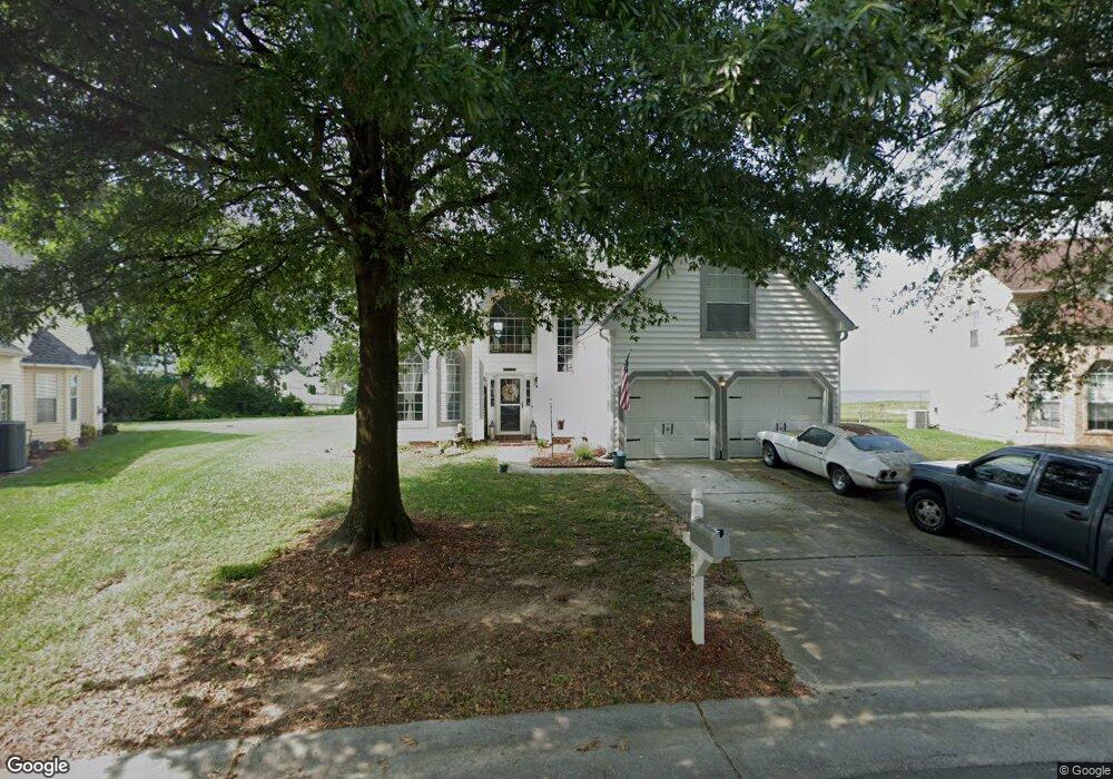
6776 Burbage Landing Cir Suffolk, VA 23435
Nansemond NeighborhoodEstimated Value: $533,781 - $587,000
4
Beds
3
Baths
2,678
Sq Ft
$208/Sq Ft
Est. Value
About This Home
This home is located at 6776 Burbage Landing Cir, Suffolk, VA 23435 and is currently estimated at $557,195, approximately $208 per square foot. 6776 Burbage Landing Cir is a home located in Suffolk City with nearby schools including Northern Shores Elementary School, John Yeates Middle School, and Nansemond River High School.
Ownership History
Date
Name
Owned For
Owner Type
Purchase Details
Closed on
May 3, 2016
Sold by
The Rudolph Vincent Bland Revocable Livi
Bought by
Torres Angel R and Torres Estella M
Current Estimated Value
Home Financials for this Owner
Home Financials are based on the most recent Mortgage that was taken out on this home.
Original Mortgage
$365,000
Outstanding Balance
$291,038
Interest Rate
3.71%
Mortgage Type
VA
Estimated Equity
$266,157
Create a Home Valuation Report for This Property
The Home Valuation Report is an in-depth analysis detailing your home's value as well as a comparison with similar homes in the area
Home Values in the Area
Average Home Value in this Area
Purchase History
| Date | Buyer | Sale Price | Title Company |
|---|---|---|---|
| Torres Angel R | $365,000 | Alpha1 Title & Escrow Llc |
Source: Public Records
Mortgage History
| Date | Status | Borrower | Loan Amount |
|---|---|---|---|
| Open | Torres Angel R | $365,000 |
Source: Public Records
Tax History Compared to Growth
Tax History
| Year | Tax Paid | Tax Assessment Tax Assessment Total Assessment is a certain percentage of the fair market value that is determined by local assessors to be the total taxable value of land and additions on the property. | Land | Improvement |
|---|---|---|---|---|
| 2024 | $450 | $528,500 | $170,000 | $358,500 |
| 2023 | $393 | $497,400 | $170,000 | $327,400 |
| 2022 | $5,123 | $470,000 | $170,000 | $300,000 |
| 2021 | $4,532 | $408,300 | $147,100 | $261,200 |
| 2020 | $4,421 | $398,300 | $147,100 | $251,200 |
| 2019 | $4,255 | $383,300 | $147,100 | $236,200 |
| 2018 | $3,860 | $367,200 | $147,100 | $220,100 |
| 2017 | $3,849 | $359,700 | $147,100 | $212,600 |
| 2016 | $3,764 | $351,800 | $147,100 | $204,700 |
| 2015 | $1,634 | $315,400 | $110,700 | $204,700 |
| 2014 | $1,634 | $316,100 | $110,700 | $205,400 |
Source: Public Records
Map
Nearby Homes
- 6602 James Point Ct
- 5028 Bay Cir
- 6750 Burbage Landing Cir
- 6832 Ivanhoe Ct
- 5109 Hoffler St
- 4913 Marina Dr
- 4726 River Shore Rd
- 6446 Olde Bullocks Cir
- 4071 Long Point Blvd
- 6417 Pelican Crescent N
- 21 Windy Pines Crescent
- 8 Compass Ct
- 4619 River Shore Rd
- 17 Shoal Ct
- 6205 Glenrose Dr
- 4444 Southampton Arch
- 6215 Cambridge Dr
- 1132 Samuel Greene Way
- 1130 Samuel Greene Way
- 1129 Marston St
- 6778 Burbage Landing Cir
- 6774 Burbage Landing Cir
- 6753 Burbage Landing CI
- 6753 Burbage Landing Cir
- 6780 Burbage Landing Cir
- 6772 Burbage Landing Cir
- 6755 Burbage Landing Cir
- 6770 Burbage Landing Cir
- 6757 Burbage Landing Cir
- 6600 James Point Ct
- 6768 Burbage Landing Cir
- 6759 Burbage Landing Cir
- 6604 James Point Ct
- 6606 James Point Ct
- 6766 Burbage Landing Cir
- 6761 Burbage Landing Cir
- 6601 James Point Ct
- 6603 James Point Ct
- 6605 James Point Ct
- 6763 Burbage Landing Cir