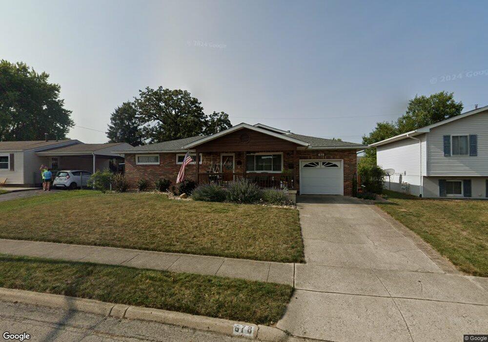
678 Brookdale Dr West Jefferson, OH 43162
Estimated Value: $240,000 - $280,000
3
Beds
2
Baths
1,559
Sq Ft
$166/Sq Ft
Est. Value
About This Home
This home is located at 678 Brookdale Dr, West Jefferson, OH 43162 and is currently estimated at $258,450, approximately $165 per square foot. 678 Brookdale Dr is a home located in Madison County with nearby schools including Norwood Elementary School, West Jefferson Middle School, and West Jefferson High School.
Ownership History
Date
Name
Owned For
Owner Type
Purchase Details
Closed on
Oct 22, 2021
Sold by
Jones Brenda L and The Houk Keystone Inheritance
Bought by
Swingle Brenda L and The Brenda L Swingle Family Tr
Current Estimated Value
Purchase Details
Closed on
Apr 23, 2009
Sold by
Houk Richard E and Houk Betty J
Bought by
Jones Brenda L and The Houk Keystone Inheritance Trust
Purchase Details
Closed on
Jun 4, 2003
Sold by
Houk Betty J and Houk Richard E
Bought by
Houk Richard E and Houk Betty J
Create a Home Valuation Report for This Property
The Home Valuation Report is an in-depth analysis detailing your home's value as well as a comparison with similar homes in the area
Home Values in the Area
Average Home Value in this Area
Purchase History
| Date | Buyer | Sale Price | Title Company |
|---|---|---|---|
| Swingle Brenda L | $115,900 | Allodial Title Llc | |
| Jones Brenda L | -- | None Available | |
| Houk Richard E | -- | None Available | |
| Houk Richard E | -- | -- |
Source: Public Records
Tax History Compared to Growth
Tax History
| Year | Tax Paid | Tax Assessment Tax Assessment Total Assessment is a certain percentage of the fair market value that is determined by local assessors to be the total taxable value of land and additions on the property. | Land | Improvement |
|---|---|---|---|---|
| 2024 | $3,419 | $77,320 | $16,120 | $61,200 |
| 2023 | $3,419 | $77,320 | $16,120 | $61,200 |
| 2022 | $2,689 | $56,610 | $11,880 | $44,730 |
| 2021 | $2,700 | $56,610 | $11,880 | $44,730 |
| 2020 | $2,324 | $56,610 | $11,880 | $44,730 |
| 2019 | $2,010 | $49,530 | $10,630 | $38,900 |
| 2018 | $1,869 | $49,530 | $10,630 | $38,900 |
| 2017 | $1,872 | $49,530 | $10,630 | $38,900 |
| 2016 | $1,419 | $39,050 | $10,630 | $28,420 |
| 2015 | $1,554 | $39,050 | $10,630 | $28,420 |
| 2014 | $1,554 | $39,050 | $10,630 | $28,420 |
| 2013 | -- | $40,760 | $10,590 | $30,170 |
Source: Public Records
Map
Nearby Homes
- 555 Kirkwood Dr
- 908 Kingsdale Ct
- 304 Middle Dr
- 0 W Jeff Kiousville Rd Unit 225000725
- 283 Madison Dr N
- 1000 W Main St Unit Lot 13
- 248 London Rd
- 106 Kings Way Unit 4
- 277 Hathaway Rd
- 22 N Franklin St
- 200 Smith St
- 74 S Chester St
- 545 Trillium Dr
- 125 Dogwood Ct
- 312 Larkspur Dr
- 1615 Olmstead Rd
- 430 Trillium Dr
- 270 State Route 142 NE
- 360 State Route 142 NE
- 1890 Wilson Rd SE
- 688 Brookdale Dr
- 668 Brookdale Dr
- 671 Hillsdale Dr
- 683 Hillsdale Dr
- 696 Brookdale Dr
- 660 Brookdale Dr
- 665 Hillsdale Dr
- 695 Hillsdale Dr
- 679 Brookdale Dr
- 667 Brookdale Dr
- 687 Brookdale Dr
- 659 Hillsdale Dr
- 703 Hillsdale Dr
- 661 Brookdale Dr
- 699 Brookdale Dr
- 710 Brookdale Dr
- 136 Inwood Rd
- 649 Brookdale Dr
- 640 Brookdale Dr
- 651 Hillsdale Dr