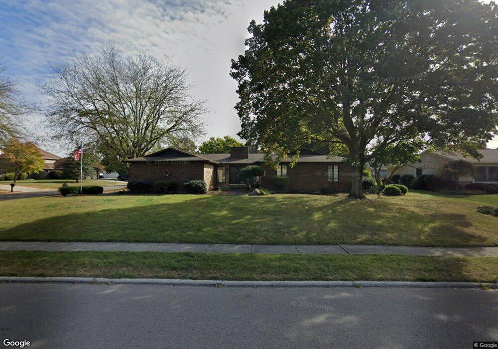
678 Brookpark Rd Marion, OH 43302
Estimated Value: $269,000 - $326,000
3
Beds
2
Baths
1,936
Sq Ft
$149/Sq Ft
Est. Value
About This Home
This home is located at 678 Brookpark Rd, Marion, OH 43302 and is currently estimated at $289,301, approximately $149 per square foot. 678 Brookpark Rd is a home located in Marion County with nearby schools including River Valley High School, Marion Preparatory Academy, and Rushmore Academy.
Ownership History
Date
Name
Owned For
Owner Type
Purchase Details
Closed on
Feb 10, 2025
Sold by
Conroy Ronald E and Conroy Craig A
Bought by
Manns Rhonda L
Current Estimated Value
Home Financials for this Owner
Home Financials are based on the most recent Mortgage that was taken out on this home.
Original Mortgage
$166,667
Outstanding Balance
$165,108
Interest Rate
6.96%
Mortgage Type
New Conventional
Estimated Equity
$124,193
Purchase Details
Closed on
May 22, 1997
Bought by
Conroy Ronald E
Purchase Details
Closed on
Jun 2, 1994
Bought by
Conroy Ronald E
Create a Home Valuation Report for This Property
The Home Valuation Report is an in-depth analysis detailing your home's value as well as a comparison with similar homes in the area
Home Values in the Area
Average Home Value in this Area
Purchase History
| Date | Buyer | Sale Price | Title Company |
|---|---|---|---|
| Manns Rhonda L | $250,000 | None Listed On Document | |
| Manns Rhonda L | $250,000 | None Listed On Document | |
| Conroy Ronald E | $150,000 | -- | |
| Conroy Ronald E | $105,000 | -- |
Source: Public Records
Mortgage History
| Date | Status | Borrower | Loan Amount |
|---|---|---|---|
| Open | Manns Rhonda L | $166,667 | |
| Closed | Manns Rhonda L | $166,667 |
Source: Public Records
Tax History
| Year | Tax Paid | Tax Assessment Tax Assessment Total Assessment is a certain percentage of the fair market value that is determined by local assessors to be the total taxable value of land and additions on the property. | Land | Improvement |
|---|---|---|---|---|
| 2025 | $2,827 | $88,420 | $12,370 | $76,050 |
| 2024 | $2,827 | $79,340 | $15,130 | $64,210 |
| 2023 | $2,827 | $79,340 | $15,130 | $64,210 |
| 2022 | $2,936 | $79,340 | $15,130 | $64,210 |
| 2021 | $2,368 | $59,940 | $9,380 | $50,560 |
| 2020 | $2,294 | $59,940 | $9,380 | $50,560 |
| 2019 | $2,290 | $59,940 | $9,380 | $50,560 |
| 2018 | $1,846 | $55,150 | $9,850 | $45,300 |
| 2017 | $1,867 | $55,150 | $9,850 | $45,300 |
| 2016 | $1,865 | $55,150 | $9,850 | $45,300 |
| 2015 | $1,843 | $53,820 | $9,380 | $44,440 |
| 2014 | $1,844 | $53,820 | $9,380 | $44,440 |
| 2012 | $2,057 | $57,430 | $8,210 | $49,220 |
Source: Public Records
Map
Nearby Homes
- 534 Meadow Ln
- 534 Edgefield Dr
- 680 Eton St
- 736 Eton St
- 653 Exeter Way
- 655 Exeter Way
- 0 Richland Rd
- 1317 Adare Rd
- 1378 Chaucer Ct
- 1364 Woodridge Rd
- 0 University Dr
- 1309 Lusch Rd
- 523 Normandy Dr
- 1200 Inwood Dr
- 819 Laura Dr
- 500 Linda Mel Dr
- 278 Spencer St
- 0 Barks Rd E
- 283 Clover Ave
- 400 Forest Lawn Blvd
- 696 Brookpark Rd
- 1755 Westminster Rd
- 693 Mayfield Dr
- 1730 Westminster Rd
- 1718 Westminster Rd
- 1703 Westminster Rd
- 712 Brookpark Rd
- 709 Mayfield Dr
- 647 Mayfield Dr
- 695 Brookpark Rd
- 1704 Westminster Rd
- 711 Brookpark Rd
- 725 Mayfield Dr
- 725 Mayfield Drive(p)
- 728 Brookpark Rd
- 1692 Westminster Rd
- 1775 Westminster Rd
- 694 Mayfield Dr
- 648 Mayfield Dr
- 659 Edgefield Dr
Your Personal Tour Guide
Ask me questions while you tour the home.