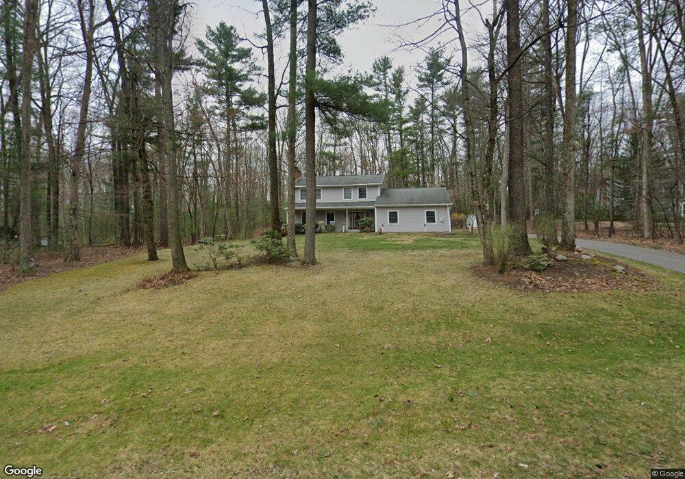
678 Crandall Dr State College, PA 16803
Estimated Value: $502,772 - $581,000
4
Beds
3
Baths
2,411
Sq Ft
$225/Sq Ft
Est. Value
About This Home
This home is located at 678 Crandall Dr, State College, PA 16803 and is currently estimated at $541,443, approximately $224 per square foot. 678 Crandall Dr is a home located in Centre County with nearby schools including Park Forest Elementary School, Park Forest Middle School, and State College Area High School.
Ownership History
Date
Name
Owned For
Owner Type
Purchase Details
Closed on
Jun 7, 2010
Sold by
Cartus Financial Corporation
Bought by
Black Brian A and Black Jennifer L
Current Estimated Value
Home Financials for this Owner
Home Financials are based on the most recent Mortgage that was taken out on this home.
Original Mortgage
$284,000
Outstanding Balance
$190,431
Interest Rate
4.98%
Mortgage Type
New Conventional
Estimated Equity
$351,012
Purchase Details
Closed on
Jun 13, 2007
Sold by
Herrle Joseph C and Wedler Vicki L
Bought by
Killam Jason R and Killam Emily L
Home Financials for this Owner
Home Financials are based on the most recent Mortgage that was taken out on this home.
Original Mortgage
$243,750
Interest Rate
6.14%
Mortgage Type
Purchase Money Mortgage
Purchase Details
Closed on
Nov 28, 2006
Sold by
Herrle Joseph C
Bought by
Herrle Joseph C
Create a Home Valuation Report for This Property
The Home Valuation Report is an in-depth analysis detailing your home's value as well as a comparison with similar homes in the area
Home Values in the Area
Average Home Value in this Area
Purchase History
| Date | Buyer | Sale Price | Title Company |
|---|---|---|---|
| Black Brian A | $355,000 | None Available | |
| Cartus Financial Corporation | $355,000 | None Available | |
| Killam Jason R | $325,000 | None Available | |
| Herrle Joseph C | -- | None Available |
Source: Public Records
Mortgage History
| Date | Status | Borrower | Loan Amount |
|---|---|---|---|
| Open | Cartus Financial Corporation | $284,000 | |
| Previous Owner | Killam Jason R | $243,750 |
Source: Public Records
Tax History Compared to Growth
Tax History
| Year | Tax Paid | Tax Assessment Tax Assessment Total Assessment is a certain percentage of the fair market value that is determined by local assessors to be the total taxable value of land and additions on the property. | Land | Improvement |
|---|---|---|---|---|
| 2025 | $6,239 | $100,740 | $26,460 | $74,280 |
| 2024 | $5,834 | $100,740 | $26,460 | $74,280 |
| 2023 | $5,834 | $100,740 | $26,460 | $74,280 |
| 2022 | $5,677 | $100,740 | $26,460 | $74,280 |
| 2021 | $5,677 | $100,740 | $26,460 | $74,280 |
| 2020 | $5,677 | $100,740 | $26,460 | $74,280 |
| 2019 | $4,801 | $100,740 | $26,460 | $74,280 |
| 2018 | $5,481 | $100,740 | $26,460 | $74,280 |
| 2017 | $5,413 | $100,740 | $26,460 | $74,280 |
| 2016 | -- | $100,740 | $26,460 | $74,280 |
| 2015 | -- | $100,740 | $26,460 | $74,280 |
| 2014 | -- | $92,910 | $26,460 | $66,450 |
Source: Public Records
Map
Nearby Homes
- 2251 Red Oak Ln
- 2292 Oak Leaf Dr
- 169 Sandy Ridge Rd
- 291 Oakley Dr
- 1765 Cambridge Dr
- 479 Westgate Dr
- 1635 Princeton Dr
- 1111-C W Aaron Dr
- 833 Galen Dr
- 835 Galen Dr Unit 835
- 3182 Carnegie Dr
- 1832 Waddle Rd
- 1836 Waddle Rd
- 253 Bolton Ave
- 1383 N Allen St
- 505 Hillcrest Ave
- 465 Hillcrest Ave
- 936 Taylor St
- 1457 Curtin St
- 715 W Park Ave
- 668 Crandall Dr
- 684 Crandall Dr
- 2611 Acacia Dr
- 2615 Acacia Dr
- 673 Crandall Dr
- 656 Crandall Dr
- 661 Crandall Dr
- 2602 Acacia Dr
- 2649 Circleville Rd
- 2619 Acacia Dr
- 685 Crandall Dr
- 649 Crandall Dr
- 2608 Acacia Dr
- 628 Crandall Dr
- 697 Crandall Dr
- 2604 Tall Cedar Cir
- 637 Crandall Dr
- 2625 Acacia Dr
- 610 Old Farm Ln
- 139 Cardinal Ln