Estimated Value: $1,006,000 - $1,237,529
4
Beds
3
Baths
4,500
Sq Ft
$241/Sq Ft
Est. Value
About This Home
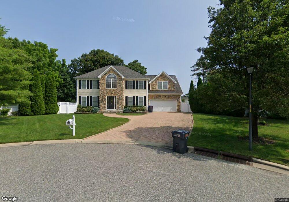
This home is located at 678 Hawks Nest Rd, Brick, NJ 08724 and is currently estimated at $1,085,132, approximately $241 per square foot. 678 Hawks Nest Rd is a home located in Ocean County with nearby schools including Midstreams Elementary School, Veterans Memorial Middle School, and Brick Township Memorial High School.
Ownership History
Date
Name
Owned For
Owner Type
Purchase Details
Closed on
Jan 16, 2003
Sold by
Project Associates
Bought by
Santora Albert
Current Estimated Value
Home Financials for this Owner
Home Financials are based on the most recent Mortgage that was taken out on this home.
Original Mortgage
$275,000
Interest Rate
5.98%
Create a Home Valuation Report for This Property
The Home Valuation Report is an in-depth analysis detailing your home's value as well as a comparison with similar homes in the area
Home Values in the Area
Average Home Value in this Area
Purchase History
| Date | Buyer | Sale Price | Title Company |
|---|---|---|---|
| Santora Albert | $475,000 | -- |
Source: Public Records
Mortgage History
| Date | Status | Borrower | Loan Amount |
|---|---|---|---|
| Previous Owner | Santora Albert | $275,000 |
Source: Public Records
Tax History
| Year | Tax Paid | Tax Assessment Tax Assessment Total Assessment is a certain percentage of the fair market value that is determined by local assessors to be the total taxable value of land and additions on the property. | Land | Improvement |
|---|---|---|---|---|
| 2025 | $14,812 | $567,500 | $171,900 | $395,600 |
| 2024 | $14,057 | $567,500 | $171,900 | $395,600 |
Source: Public Records
Map
Nearby Homes
- 665 Bancroft Rd
- 1608 Osprey Ct
- 599 Parker Ave
- 648 Point Ave
- 660 Point Ave
- 15 Hidden Harbor Dr
- 603 Point Ave
- 8 Hidden Harbor Dr Unit 8H
- 556 Parker Ave
- 599 Point Ave
- 701 Princeton Ave
- 546 Princeton Ave
- 1616 Beaver Dam Rd
- 1621 Northstream Pkwy
- 1612 Beaver Dam Rd
- 173 Cliff Rd
- 511 Robinhood Rd
- 1553 Littlehill Rd
- 1622 Center St
- 515 Carroll Fox Rd
- 617 Shadow Way
- 674 Hawks Nest Rd
- 682 Hawks Nest Rd
- 631 Harbor Rd
- 621 Shadow Way
- 613 Shadow Way
- 635 Harbor Rd
- 679 Hawks Nest Rd
- 683 Hawks Nest Rd
- 622 Hartford Place
- 675 Hawks Nest Rd
- 670 Hawks Nest Rd
- 618 Hartford Place
- 616 Shadow Way
- 609 Shadow Way
- 630 Harbor Rd
- 614 Hartford Place
- 624 Cedarstream Place
- 620 Cedarstream Place
- 671 Hawks Nest Rd
Your Personal Tour Guide
Ask me questions while you tour the home.