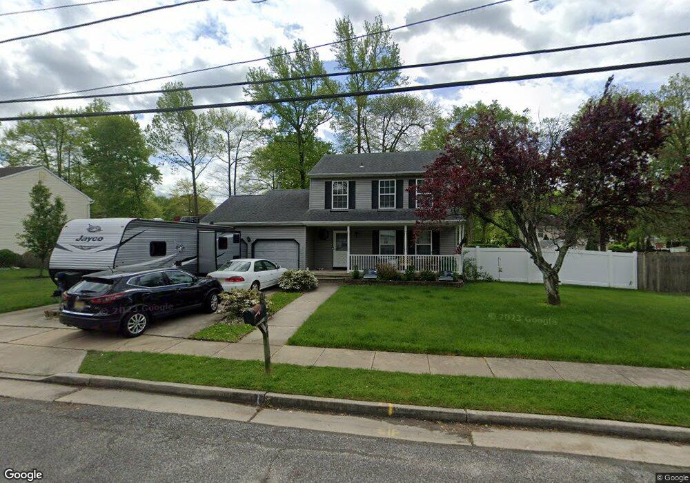
678 Iszard Rd Woodbury, NJ 08096
Deptford Township NeighborhoodEstimated Value: $309,642 - $382,000
--
Bed
--
Bath
1,552
Sq Ft
$223/Sq Ft
Est. Value
About This Home
This home is located at 678 Iszard Rd, Woodbury, NJ 08096 and is currently estimated at $346,411, approximately $223 per square foot. 678 Iszard Rd is a home located in Gloucester County with nearby schools including Deptford Township High School and Holy Angels Catholic School.
Ownership History
Date
Name
Owned For
Owner Type
Purchase Details
Closed on
Apr 16, 2016
Sold by
Broadwater David and Broadwater Heather
Bought by
Broadwater David
Current Estimated Value
Purchase Details
Closed on
Apr 30, 2001
Sold by
Hubmaster William and Hubmaster Sandra
Bought by
Broadwater David and Broadwater Heather
Home Financials for this Owner
Home Financials are based on the most recent Mortgage that was taken out on this home.
Original Mortgage
$124,971
Outstanding Balance
$46,042
Interest Rate
6.85%
Mortgage Type
FHA
Estimated Equity
$300,369
Create a Home Valuation Report for This Property
The Home Valuation Report is an in-depth analysis detailing your home's value as well as a comparison with similar homes in the area
Home Values in the Area
Average Home Value in this Area
Purchase History
| Date | Buyer | Sale Price | Title Company |
|---|---|---|---|
| Broadwater David | -- | None Available | |
| Broadwater David | $143,500 | -- |
Source: Public Records
Mortgage History
| Date | Status | Borrower | Loan Amount |
|---|---|---|---|
| Open | Broadwater David | $124,971 |
Source: Public Records
Tax History Compared to Growth
Tax History
| Year | Tax Paid | Tax Assessment Tax Assessment Total Assessment is a certain percentage of the fair market value that is determined by local assessors to be the total taxable value of land and additions on the property. | Land | Improvement |
|---|---|---|---|---|
| 2025 | $6,772 | $188,900 | $48,200 | $140,700 |
| 2024 | $6,555 | $188,900 | $48,200 | $140,700 |
| 2023 | $6,555 | $188,900 | $48,200 | $140,700 |
| 2022 | $6,508 | $188,900 | $48,200 | $140,700 |
| 2021 | $6,415 | $188,900 | $48,200 | $140,700 |
| 2020 | $6,341 | $188,900 | $48,200 | $140,700 |
| 2019 | $6,220 | $188,900 | $48,200 | $140,700 |
| 2018 | $6,081 | $188,900 | $48,200 | $140,700 |
| 2017 | $5,918 | $188,900 | $48,200 | $140,700 |
| 2016 | $5,797 | $188,900 | $48,200 | $140,700 |
| 2015 | $5,618 | $188,900 | $48,200 | $140,700 |
| 2014 | $5,472 | $188,900 | $48,200 | $140,700 |
Source: Public Records
Map
Nearby Homes
- 504 Glassboro Rd
- 471 Glassboro Rd
- 470 E Barber Ave
- 437 E Barber Ave
- 118 Caribou Ct
- 400 Poplar Ave
- BL 129 LT 8 10-20 Buffalo Ct
- 226 S Maple St
- 345 Ivy Dr
- 31 S Bayard Ave
- 311 Holly Ave
- 416 Oak Ave
- 616 Fairview Ave
- 89 E Barber Ave
- 843 New Jersey Ave
- 38 Bellevue Ave
- 25 N Evergreen Ave
- 10 Lake Dr
- 10 Carter Dr
- 360 Haverford Ave