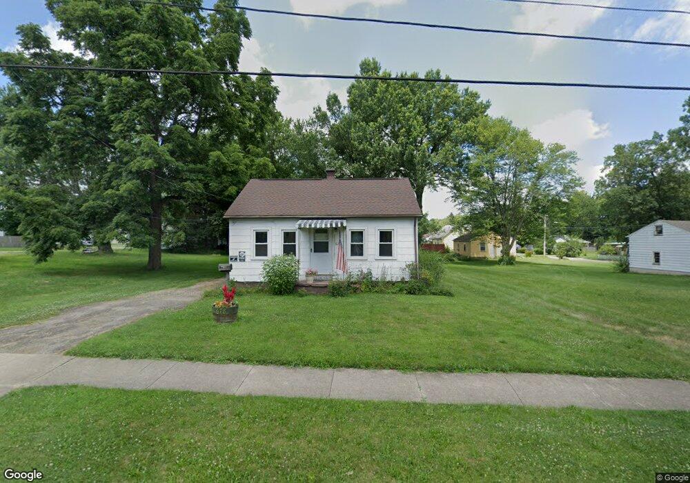
678 Mcpherson St Mansfield, OH 44903
Estimated Value: $57,000 - $74,000
2
Beds
1
Bath
624
Sq Ft
$106/Sq Ft
Est. Value
About This Home
This home is located at 678 Mcpherson St, Mansfield, OH 44903 and is currently estimated at $66,050, approximately $105 per square foot. 678 Mcpherson St is a home located in Richland County with nearby schools including Foundation Academy, Mansfield Elective Academy, and Goal Digital Academy.
Ownership History
Date
Name
Owned For
Owner Type
Purchase Details
Closed on
May 27, 2005
Sold by
Martin Lyle and Martin Barbara A
Bought by
Wade Sherry L and Mast Jody P
Current Estimated Value
Home Financials for this Owner
Home Financials are based on the most recent Mortgage that was taken out on this home.
Original Mortgage
$40,500
Outstanding Balance
$21,442
Interest Rate
5.98%
Mortgage Type
Fannie Mae Freddie Mac
Estimated Equity
$44,608
Purchase Details
Closed on
Nov 9, 1998
Sold by
Sparkman Estralita
Bought by
Martin Barbara and Martin Lyle
Home Financials for this Owner
Home Financials are based on the most recent Mortgage that was taken out on this home.
Original Mortgage
$18,400
Interest Rate
6.41%
Mortgage Type
Balloon
Create a Home Valuation Report for This Property
The Home Valuation Report is an in-depth analysis detailing your home's value as well as a comparison with similar homes in the area
Home Values in the Area
Average Home Value in this Area
Purchase History
| Date | Buyer | Sale Price | Title Company |
|---|---|---|---|
| Wade Sherry L | $40,500 | None Available | |
| Martin Barbara | $23,000 | -- |
Source: Public Records
Mortgage History
| Date | Status | Borrower | Loan Amount |
|---|---|---|---|
| Open | Wade Sherry L | $40,500 | |
| Closed | Martin Barbara | $18,400 |
Source: Public Records
Tax History Compared to Growth
Tax History
| Year | Tax Paid | Tax Assessment Tax Assessment Total Assessment is a certain percentage of the fair market value that is determined by local assessors to be the total taxable value of land and additions on the property. | Land | Improvement |
|---|---|---|---|---|
| 2024 | $499 | $10,660 | $1,580 | $9,080 |
| 2023 | $499 | $10,660 | $1,580 | $9,080 |
| 2022 | $450 | $8,060 | $1,430 | $6,630 |
| 2021 | $453 | $8,060 | $1,430 | $6,630 |
| 2020 | $464 | $8,060 | $1,430 | $6,630 |
| 2019 | $514 | $8,060 | $1,430 | $6,630 |
| 2018 | $507 | $8,060 | $1,430 | $6,630 |
| 2017 | $513 | $8,060 | $1,430 | $6,630 |
| 2016 | $532 | $8,430 | $2,270 | $6,160 |
| 2015 | $508 | $8,430 | $2,270 | $6,160 |
| 2014 | $502 | $8,430 | $2,270 | $6,160 |
| 2012 | $201 | $8,870 | $2,390 | $6,480 |
Source: Public Records
Map
Nearby Homes
- 0 State Route 314 Unit 9069650
- 0 State Route 314 Unit 9067316
- 0 State Route 314 Unit 225021979
- 512 Burns St
- 269 Parkway Dr
- 480 Mcpherson St
- 450 Tracy St
- 641 Averill Ave
- 237 Helen Ave
- 426 Mcpherson St
- 0 Highway 30
- 170 Western Ave
- 185 Rowland Ave
- 212 Penn Ave
- 0 Voegele Ave Unit Lot 6048, 6049, 6
- 741 Burger Ave
- 362-364 W 6th St
- 96 Helen Ave
- 120 Gettings Place
- 371 Bell St
- 688 Mcpherson St
- 469 Stark St
- 666 Mcpherson St
- 468 Collins Dr
- 0 State Route 314 Unit 9066294
- 0 Sturges Ave Unit 403041
- 0 State Route 314 Unit 9057767
- 0 State Route 314 Unit 9032037
- 0 State Route 314 Unit 9032261
- 0 State Route 314 Unit 9033932
- 0 State Route 314 Unit 9034466
- 0 State Route 314 Unit 9037901
- 0 State Route 314 Unit 9041096
- 0 State Route 314 Unit 9044733
- 0 State Route 314 Unit 9053096
- 3201 W Park Ave
- 0 Sturges Ave Unit 9054525
- 0 State Route 314 Unit 9053862
- 473 Stark St
- 679 Mcpherson St