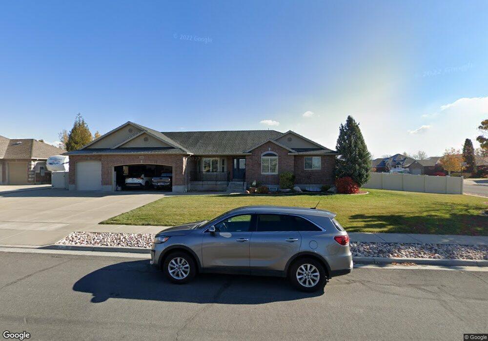
678 N 2475 W Layton, UT 84041
Estimated Value: $695,000 - $757,000
5
Beds
4
Baths
3,802
Sq Ft
$191/Sq Ft
Est. Value
About This Home
This home is located at 678 N 2475 W, Layton, UT 84041 and is currently estimated at $726,828, approximately $191 per square foot. 678 N 2475 W is a home located in Davis County with nearby schools including Ellison Park School, Shoreline Junior High School, and Layton High School.
Ownership History
Date
Name
Owned For
Owner Type
Purchase Details
Closed on
Dec 15, 2020
Sold by
Bankhead Randall S and Bankhead Jeri T
Bought by
Bankhead Jeri T and Bankhead Randall S
Current Estimated Value
Home Financials for this Owner
Home Financials are based on the most recent Mortgage that was taken out on this home.
Original Mortgage
$310,000
Outstanding Balance
$274,718
Interest Rate
2.7%
Mortgage Type
New Conventional
Estimated Equity
$452,110
Purchase Details
Closed on
Apr 10, 2019
Sold by
Bankhead Jeri T and Bankhead Randall S
Bought by
The Bankhead Family Trust
Home Financials for this Owner
Home Financials are based on the most recent Mortgage that was taken out on this home.
Original Mortgage
$305,000
Interest Rate
4.3%
Mortgage Type
New Conventional
Purchase Details
Closed on
Apr 9, 2019
Sold by
Cole Jack C and Cole Pamela T
Bought by
Bankhead Jeri T and Bankhead Randall S
Home Financials for this Owner
Home Financials are based on the most recent Mortgage that was taken out on this home.
Original Mortgage
$305,000
Interest Rate
4.3%
Mortgage Type
New Conventional
Purchase Details
Closed on
Sep 23, 2005
Sold by
Ed Green Construction Inc
Bought by
Cole Jack C and Cole Pamela T
Home Financials for this Owner
Home Financials are based on the most recent Mortgage that was taken out on this home.
Original Mortgage
$59,600
Interest Rate
5.7%
Mortgage Type
Stand Alone Second
Purchase Details
Closed on
Mar 18, 2005
Sold by
Swan Meadows Lc
Bought by
Ed Green Construction Inc
Create a Home Valuation Report for This Property
The Home Valuation Report is an in-depth analysis detailing your home's value as well as a comparison with similar homes in the area
Home Values in the Area
Average Home Value in this Area
Purchase History
| Date | Buyer | Sale Price | Title Company |
|---|---|---|---|
| Bankhead Jeri T | -- | Gateway Title Ins Agcy Llc | |
| The Bankhead Family Trust | -- | Meridian Title Co | |
| Bankhead Jeri T | -- | First American Title | |
| Cole Jack C | -- | Security Title | |
| Ed Green Construction Inc | -- | Secrity Title Of Davis Coun |
Source: Public Records
Mortgage History
| Date | Status | Borrower | Loan Amount |
|---|---|---|---|
| Open | Bankhead Jeri T | $310,000 | |
| Closed | Bankhead Jeri T | $305,000 | |
| Previous Owner | Cole Jack C | $59,600 | |
| Previous Owner | Cole Jack C | $238,000 |
Source: Public Records
Tax History
| Year | Tax Paid | Tax Assessment Tax Assessment Total Assessment is a certain percentage of the fair market value that is determined by local assessors to be the total taxable value of land and additions on the property. | Land | Improvement |
|---|---|---|---|---|
| 2025 | $3,652 | $383,350 | $134,076 | $249,274 |
| 2024 | $3,667 | $387,750 | $141,756 | $245,994 |
| 2023 | $3,557 | $663,000 | $153,702 | $509,298 |
| 2022 | $3,788 | $383,350 | $87,092 | $296,258 |
| 2021 | $3,504 | $529,000 | $130,600 | $398,400 |
| 2020 | $3,204 | $464,000 | $112,243 | $351,757 |
| 2019 | $3,060 | $434,000 | $109,352 | $324,648 |
| 2018 | $2,830 | $403,000 | $96,542 | $306,458 |
| 2016 | $2,653 | $194,865 | $40,938 | $153,927 |
| 2015 | $2,591 | $180,675 | $40,938 | $139,737 |
| 2014 | $2,204 | $157,116 | $40,938 | $116,178 |
| 2013 | -- | $153,796 | $37,105 | $116,691 |
Source: Public Records
Map
Nearby Homes
- 816 N 2700 W
- 841 N 2175 W
- 867 N 2125 W
- 1999 W 850 N
- 1141 N 2275 W
- 1976 W 850 N
- 1186 N 2425 W
- 1950 W 900 N
- 979 Cold Creek Way
- 2144 W 1275 N
- 273 N 2975 W
- 1250 N 2925 W
- 1211 N 1875 W Unit 211
- 1211 N 1875 W
- 1227 N 1875 W
- 1227 N 1875 W Unit 213
- 1235 N 1875 W Unit 214
- 1235 N 1875 W
- 2794 W Gentile St
- 1452 N 1875 W Unit 146
Your Personal Tour Guide
Ask me questions while you tour the home.