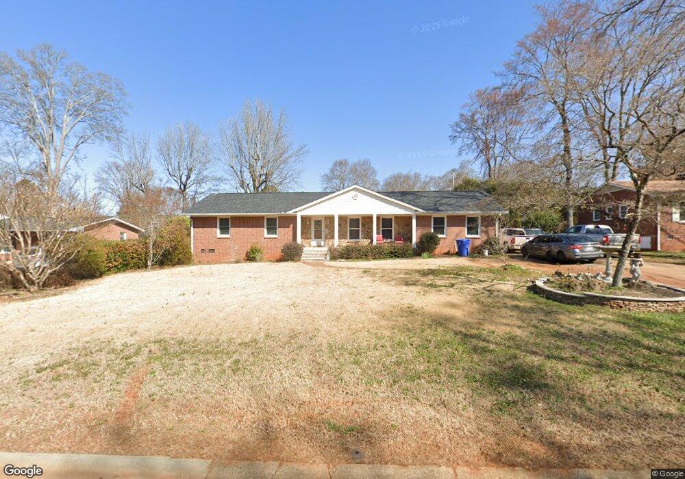
678 University Dr Rock Hill, SC 29730
Estimated Value: $278,598 - $326,000
--
Bed
--
Bath
1,512
Sq Ft
$202/Sq Ft
Est. Value
About This Home
This home is located at 678 University Dr, Rock Hill, SC 29730 and is currently estimated at $305,900, approximately $202 per square foot. 678 University Dr is a home located in York County with nearby schools including Northside Elementary School of The Arts, W.C. Sullivan Middle School, and Rock Hill High School.
Ownership History
Date
Name
Owned For
Owner Type
Purchase Details
Closed on
Aug 25, 2010
Sold by
Estate Of John R Welsh
Bought by
Roman German
Current Estimated Value
Home Financials for this Owner
Home Financials are based on the most recent Mortgage that was taken out on this home.
Original Mortgage
$120,000
Outstanding Balance
$79,280
Interest Rate
4.45%
Mortgage Type
New Conventional
Estimated Equity
$226,620
Purchase Details
Closed on
Apr 18, 2005
Sold by
Welsh John R
Bought by
Welsh John R
Create a Home Valuation Report for This Property
The Home Valuation Report is an in-depth analysis detailing your home's value as well as a comparison with similar homes in the area
Home Values in the Area
Average Home Value in this Area
Purchase History
| Date | Buyer | Sale Price | Title Company |
|---|---|---|---|
| Roman German | $120,000 | -- | |
| Welsh John R | -- | -- |
Source: Public Records
Mortgage History
| Date | Status | Borrower | Loan Amount |
|---|---|---|---|
| Open | Roman German | $120,000 |
Source: Public Records
Tax History Compared to Growth
Tax History
| Year | Tax Paid | Tax Assessment Tax Assessment Total Assessment is a certain percentage of the fair market value that is determined by local assessors to be the total taxable value of land and additions on the property. | Land | Improvement |
|---|---|---|---|---|
| 2024 | $1,203 | $5,485 | $1,400 | $4,085 |
| 2023 | $1,207 | $5,485 | $1,400 | $4,085 |
| 2022 | $3,480 | $8,238 | $2,100 | $6,138 |
| 2021 | -- | $8,238 | $2,100 | $6,138 |
| 2020 | $3,410 | $8,238 | $0 | $0 |
| 2019 | $3,170 | $7,470 | $0 | $0 |
| 2018 | $3,123 | $7,470 | $0 | $0 |
| 2017 | $3,016 | $7,470 | $0 | $0 |
| 2016 | $2,956 | $7,470 | $0 | $0 |
| 2014 | $2,584 | $7,470 | $2,100 | $5,370 |
| 2013 | $2,584 | $6,810 | $2,100 | $4,710 |
Source: Public Records
Map
Nearby Homes
- 637 University Dr
- 709 University Dr
- 622 University Dr
- 744 University Dr
- 1508 Eden Terrace
- 733 Norwood Ave
- 742 Norwood Ave
- 1638 Pineburr Ln
- 591 Rabun Cir
- 1755 Bird St
- 1321 Eisenhower Rd
- 1021 Chandler Dr
- 611 Greenbriar Ave
- 1062 Cherry Meadow Ln
- 772 Nations Ct
- 1098 Farm Pond Ln Unit 5A
- 2135 Eden Terrace
- 1110 Mckinnon Dr
- 873 Kentwood Dr
- 309 Frayser St
- 686 University Dr
- 670 University Dr
- 685 Bancroft Dr
- 677 Bancroft Dr
- 691 Bancroft Dr
- 694 University Dr
- 675 University Dr
- 669 University Dr
- 685 University Dr
- 669 Bancroft Dr
- 695 Bancroft Dr
- 663 Bancroft Dr
- 661 University Dr
- 693 University Dr
- 654 University Dr
- 696 University Dr
- 672 Bancroft Dr
- 661 Bancroft Dr
- 699 Bancroft Dr
- 690 Bancroft Dr