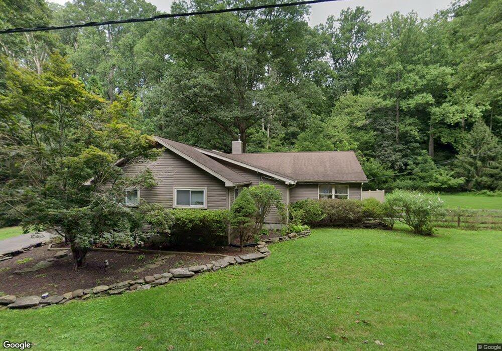
679 Grubbs Mill Rd West Chester, PA 19380
Estimated Value: $535,000 - $684,000
5
Beds
2
Baths
2,493
Sq Ft
$249/Sq Ft
Est. Value
About This Home
This home is located at 679 Grubbs Mill Rd, West Chester, PA 19380 and is currently estimated at $621,583, approximately $249 per square foot. 679 Grubbs Mill Rd is a home located in Chester County with nearby schools including East Bradford Elementary School, E.N. Peirce Middle School, and Henderson High School.
Ownership History
Date
Name
Owned For
Owner Type
Purchase Details
Closed on
Dec 31, 2002
Sold by
Gladfelter Matthew B and Gladfelter Julie A
Bought by
Samuelson Christian A and Samuelson Christine A
Current Estimated Value
Home Financials for this Owner
Home Financials are based on the most recent Mortgage that was taken out on this home.
Original Mortgage
$151,900
Outstanding Balance
$65,604
Interest Rate
6.19%
Estimated Equity
$555,979
Purchase Details
Closed on
Jun 28, 1996
Sold by
Chappelle Walton S
Bought by
Gladfelter Matthew B and Bisher Julie A
Home Financials for this Owner
Home Financials are based on the most recent Mortgage that was taken out on this home.
Original Mortgage
$118,750
Interest Rate
7.98%
Create a Home Valuation Report for This Property
The Home Valuation Report is an in-depth analysis detailing your home's value as well as a comparison with similar homes in the area
Home Values in the Area
Average Home Value in this Area
Purchase History
| Date | Buyer | Sale Price | Title Company |
|---|---|---|---|
| Samuelson Christian A | $189,900 | -- | |
| Gladfelter Matthew B | $125,000 | -- |
Source: Public Records
Mortgage History
| Date | Status | Borrower | Loan Amount |
|---|---|---|---|
| Open | Samuelson Christian A | $151,900 | |
| Previous Owner | Gladfelter Matthew B | $118,750 | |
| Closed | Samuelson Christian A | $18,990 |
Source: Public Records
Tax History Compared to Growth
Tax History
| Year | Tax Paid | Tax Assessment Tax Assessment Total Assessment is a certain percentage of the fair market value that is determined by local assessors to be the total taxable value of land and additions on the property. | Land | Improvement |
|---|---|---|---|---|
| 2025 | $4,137 | $142,710 | $68,270 | $74,440 |
| 2024 | $4,137 | $142,710 | $68,270 | $74,440 |
| 2023 | $3,953 | $142,710 | $68,270 | $74,440 |
| 2022 | $3,900 | $142,710 | $68,270 | $74,440 |
| 2021 | $3,843 | $142,710 | $68,270 | $74,440 |
| 2020 | $3,817 | $142,710 | $68,270 | $74,440 |
| 2019 | $3,762 | $142,710 | $68,270 | $74,440 |
| 2018 | $3,678 | $142,710 | $68,270 | $74,440 |
| 2017 | $3,594 | $142,710 | $68,270 | $74,440 |
| 2016 | $3,047 | $142,710 | $68,270 | $74,440 |
| 2015 | $3,047 | $142,710 | $68,270 | $74,440 |
| 2014 | $3,047 | $142,710 | $68,270 | $74,440 |
Source: Public Records
Map
Nearby Homes
- 1280 Cardinal Ave
- 1252 Memory Ln
- 4 Amanda Ln
- 479 Douglas Dr
- Lot 1 Susan Dr
- 1430 Grove Ave
- 1432 Grove Ave
- 530 Legion Dr
- 510 Pine Needle Dr
- 48 Sheffield Ln
- 1500 Cardiff Terrace
- 81 Four Leaf Dr
- 1354 Old Pottstown Pike
- 456 Cardigan Terrace Unit 456
- 141 Four Leaf Dr
- 1402 Redwood Ct Unit 57
- 415 Anglesey Terrace
- 214 Silverbell Ct
- 306 Greenhill Rd
- 1492 Conifer Dr
- 664 Grubbs Mill Rd
- 1243 Palomino Dr
- 660 Grubbs Mill Rd
- 659 Grubbs Mill Rd
- 1241 Palomino Dr
- 1239 Palomino Dr
- 1245 Palomino Dr
- 1237 Palomino Dr
- 1186 Macpherson Dr
- 1184 Macpherson Dr
- 1235 Palomino Dr
- 1182 Macpherson Dr
- 1247 Palomino Dr
- 1188 Macpherson Dr
- 1244 Palomino Dr
- 714 Morgan Cir
- 640 Grubbs Mill Rd
- 708 Southern Dr
- 710 Southern Dr
- 706 Southern Dr