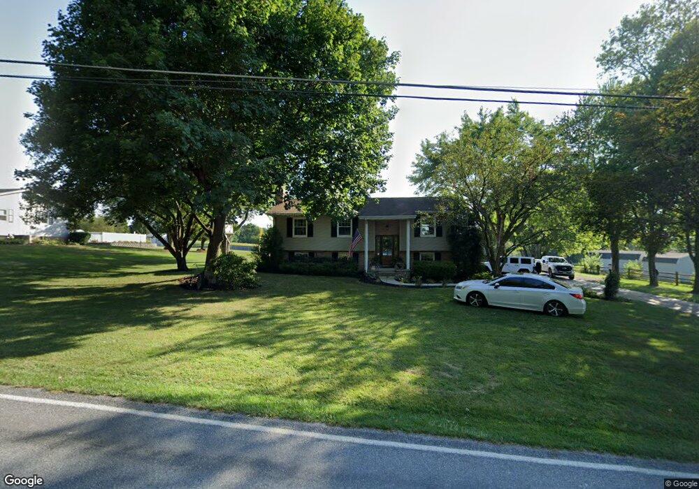
679 Mehring Rd Unit 3 Littlestown, PA 17340
Estimated Value: $349,578 - $423,000
3
Beds
2
Baths
1,220
Sq Ft
$319/Sq Ft
Est. Value
About This Home
This home is located at 679 Mehring Rd Unit 3, Littlestown, PA 17340 and is currently estimated at $388,895, approximately $318 per square foot. 679 Mehring Rd Unit 3 is a home located in Adams County with nearby schools including Rolling Acres El School, Maple Avenue Middle School, and Littlestown Senior High School.
Ownership History
Date
Name
Owned For
Owner Type
Purchase Details
Closed on
May 22, 2008
Sold by
Lawrence David L and Lawrence Carolyn M
Bought by
Barthel Brandon K and Barthel Brandi M
Current Estimated Value
Home Financials for this Owner
Home Financials are based on the most recent Mortgage that was taken out on this home.
Original Mortgage
$272,744
Interest Rate
6.13%
Mortgage Type
FHA
Create a Home Valuation Report for This Property
The Home Valuation Report is an in-depth analysis detailing your home's value as well as a comparison with similar homes in the area
Home Values in the Area
Average Home Value in this Area
Purchase History
| Date | Buyer | Sale Price | Title Company |
|---|---|---|---|
| Barthel Brandon K | $274,900 | -- |
Source: Public Records
Mortgage History
| Date | Status | Borrower | Loan Amount |
|---|---|---|---|
| Previous Owner | Barthel Brandon K | $272,744 |
Source: Public Records
Tax History
| Year | Tax Paid | Tax Assessment Tax Assessment Total Assessment is a certain percentage of the fair market value that is determined by local assessors to be the total taxable value of land and additions on the property. | Land | Improvement |
|---|---|---|---|---|
| 2025 | $4,743 | $250,600 | $61,800 | $188,800 |
| 2024 | $4,534 | $250,600 | $61,800 | $188,800 |
| 2023 | $4,444 | $250,600 | $61,800 | $188,800 |
| 2022 | $4,442 | $250,600 | $61,800 | $188,800 |
| 2021 | $4,285 | $250,600 | $61,800 | $188,800 |
| 2020 | $4,224 | $250,600 | $61,800 | $188,800 |
| 2019 | $4,134 | $250,600 | $61,800 | $188,800 |
| 2018 | $3,768 | $233,500 | $61,800 | $171,700 |
| 2017 | $3,638 | $233,500 | $61,800 | $171,700 |
| 2016 | -- | $233,500 | $61,800 | $171,700 |
| 2015 | -- | $233,500 | $61,800 | $171,700 |
| 2014 | -- | $233,500 | $61,800 | $171,700 |
Source: Public Records
Map
Nearby Homes
- LOT 9 Mehring Rd
- 6120 Baltimore Pike
- 1120 Hanover Pike
- 567 Lumber St
- 559 Lumber St
- 535 Lumber St
- 43 Ashfield Dr Unit 14
- 13 Fieldcrest Dr Unit 154
- 2100 Blacks School House Rd
- 149 Lumber St
- 230 M St
- 1 Hickory Ln
- 22 Cemetery St
- 41 Smith Cir
- 115 Charles St
- 117 Charles St
- 161 Cemetery St
- 68 Maple Ave
- 1555 Humbert Schoolhouse Rd
- 15 Yorktowne Ct Unit 97
- 693 Mehring Rd Unit 2
- 690 Mehring Rd Unit 8
- 709 Mehring Rd
- 670 Mehring Rd
- 651 Mehring Rd
- 660 Mehring Rd
- 710 Mehring Rd
- 498 Bollinger Rd
- 648 Mehring Rd Unit 5
- 635 Mehring Rd
- 472 Bollinger Rd
- 530 Bollinger Rd
- 35 Woodcrest Cir Unit 24
- 509 Bollinger Rd
- 542 Bollinger Rd Unit 2
- 25 Woodcrest Cir
- 454 Bollinger Rd Unit 1
- 497 Bollinger Rd Unit 8
- 489 Bollinger Rd Unit 7
Your Personal Tour Guide
Ask me questions while you tour the home.