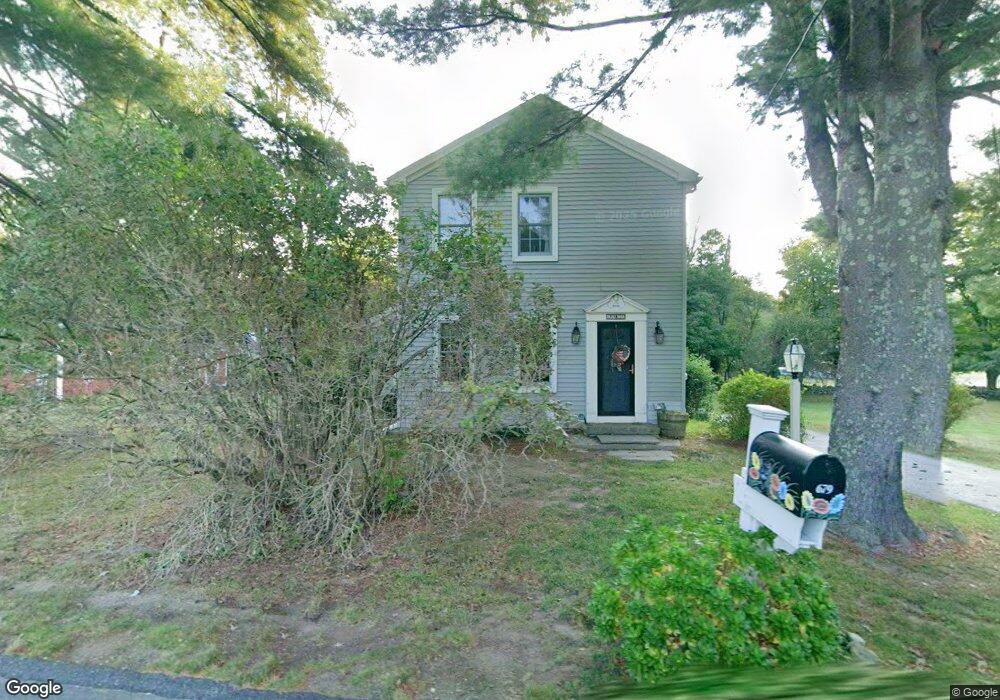
679 Montgomery Rd Westfield, MA 01085
Estimated Value: $339,000 - $427,000
3
Beds
1
Bath
1,806
Sq Ft
$210/Sq Ft
Est. Value
About This Home
This home is located at 679 Montgomery Rd, Westfield, MA 01085 and is currently estimated at $380,047, approximately $210 per square foot. 679 Montgomery Rd is a home located in Hampden County with nearby schools including Westfield High School, White Oak School, and Westfield Christian Academy.
Ownership History
Date
Name
Owned For
Owner Type
Purchase Details
Closed on
May 1, 2003
Sold by
Arps Jeffrey L and Arps Nancy L
Bought by
Patterson Paula A and Patterson Richard W
Current Estimated Value
Purchase Details
Closed on
May 31, 1996
Sold by
Martin John O
Bought by
Arps Jeffrey L and Arps Nancy L
Home Financials for this Owner
Home Financials are based on the most recent Mortgage that was taken out on this home.
Original Mortgage
$113,900
Interest Rate
7.91%
Mortgage Type
Purchase Money Mortgage
Create a Home Valuation Report for This Property
The Home Valuation Report is an in-depth analysis detailing your home's value as well as a comparison with similar homes in the area
Home Values in the Area
Average Home Value in this Area
Purchase History
| Date | Buyer | Sale Price | Title Company |
|---|---|---|---|
| Patterson Paula A | $187,500 | -- | |
| Arps Jeffrey L | $119,900 | -- |
Source: Public Records
Mortgage History
| Date | Status | Borrower | Loan Amount |
|---|---|---|---|
| Previous Owner | Arps Jeffrey L | $10,000 | |
| Previous Owner | Arps Jeffrey L | $122,200 | |
| Previous Owner | Arps Jeffrey L | $113,900 | |
| Previous Owner | Arps Jeffrey L | $48,000 | |
| Closed | Arps Jeffrey L | $11,500 |
Source: Public Records
Tax History Compared to Growth
Tax History
| Year | Tax Paid | Tax Assessment Tax Assessment Total Assessment is a certain percentage of the fair market value that is determined by local assessors to be the total taxable value of land and additions on the property. | Land | Improvement |
|---|---|---|---|---|
| 2025 | $4,539 | $299,000 | $122,300 | $176,700 |
| 2024 | $4,377 | $274,100 | $111,300 | $162,800 |
| 2023 | $4,071 | $249,600 | $106,000 | $143,600 |
| 2022 | $4,071 | $220,200 | $94,700 | $125,500 |
| 2021 | $3,921 | $207,700 | $89,100 | $118,600 |
| 2020 | $3,831 | $199,000 | $89,100 | $109,900 |
| 2019 | $3,724 | $189,300 | $84,700 | $104,600 |
| 2018 | $3,665 | $189,300 | $84,700 | $104,600 |
| 2017 | $3,633 | $187,100 | $85,900 | $101,200 |
| 2016 | $3,637 | $187,100 | $85,900 | $101,200 |
| 2015 | $3,469 | $187,100 | $85,900 | $101,200 |
| 2014 | $2,593 | $187,100 | $85,900 | $101,200 |
Source: Public Records
Map
Nearby Homes
- 132 North Rd
- 336 Russellville Rd
- 50 Russellville Rd
- 19 3rd Ave
- 117 Russellville Rd
- 6 Johns Dr
- 83 Main Rd
- 745 West Rd
- 10 Day Lily Ln
- Lot 5 Brickyard Rd
- 119 Brickyard Rd
- 868 Southampton Rd Unit 18
- 194 Lockhouse Rd
- 1430 Russell Rd Unit 19
- 1430 Russell Rd Unit 9
- 1430 Russell Rd Unit 35
- 369 College Hwy
- 45 Jaeger Dr
- 163 Barbara St
- 47 Jaeger Dr
- 675 Montgomery Rd
- 669 Montgomery Rd
- 687 Montgomery Rd
- 666 Montgomery Rd
- 9 North Rd
- 665 Montgomery Rd
- 662 Montgomery Rd
- 661 Montgomery Rd
- 14 North Rd
- 658 Montgomery Rd
- 699 Montgomery Rd
- 27 North Rd
- 27 North Rd
- 649 Montgomery Rd
- 649 Montgomery Rd Unit 1
- 45 North Rd
- 668 Montgomery Rd
- 643 Montgomery Rd
- 690 Montgomery Rd
- 646 Montgomery Rd