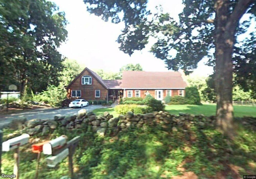
679 Raymond Hill Rd Uncasville, CT 06382
Estimated Value: $468,000 - $638,000
3
Beds
4
Baths
3,508
Sq Ft
$162/Sq Ft
Est. Value
About This Home
This home is located at 679 Raymond Hill Rd, Uncasville, CT 06382 and is currently estimated at $568,179, approximately $161 per square foot. 679 Raymond Hill Rd is a home located in New London County with nearby schools including Leonard J. Tyl Middle School, Montville High School, and Bradley School-New London Regional.
Ownership History
Date
Name
Owned For
Owner Type
Purchase Details
Closed on
May 30, 2024
Sold by
Paddon Robert
Bought by
Patterson Bruce A
Current Estimated Value
Purchase Details
Closed on
Apr 25, 2019
Sold by
Nelson Wayne S and Nelson Lynn C
Bought by
N Silver Brook Holdings
Create a Home Valuation Report for This Property
The Home Valuation Report is an in-depth analysis detailing your home's value as well as a comparison with similar homes in the area
Home Values in the Area
Average Home Value in this Area
Purchase History
| Date | Buyer | Sale Price | Title Company |
|---|---|---|---|
| Patterson Bruce A | -- | None Available | |
| Patterson Bruce A | -- | None Available | |
| N Silver Brook Holdings | $1,000,000 | -- | |
| N Silver Brook Holdings | $1,000,000 | -- | |
| N Silver Brook Holdings | $1,000,000 | -- |
Source: Public Records
Tax History Compared to Growth
Tax History
| Year | Tax Paid | Tax Assessment Tax Assessment Total Assessment is a certain percentage of the fair market value that is determined by local assessors to be the total taxable value of land and additions on the property. | Land | Improvement |
|---|---|---|---|---|
| 2025 | $8,965 | $310,520 | $33,250 | $277,270 |
| 2024 | $8,623 | $310,520 | $33,250 | $277,270 |
| 2023 | $8,623 | $310,520 | $33,250 | $277,270 |
| 2022 | $8,294 | $310,520 | $33,250 | $277,270 |
| 2021 | $7,936 | $249,940 | $37,200 | $212,740 |
| 2020 | $8,093 | $249,940 | $37,200 | $212,740 |
| 2019 | $8,126 | $249,940 | $37,200 | $212,740 |
| 2018 | $7,931 | $249,940 | $37,200 | $212,740 |
| 2017 | $7,923 | $249,940 | $37,200 | $212,740 |
| 2016 | $7,488 | $244,610 | $43,600 | $201,010 |
| 2015 | $7,488 | $244,610 | $43,600 | $201,010 |
| 2014 | $7,184 | $244,610 | $43,600 | $201,010 |
Source: Public Records
Map
Nearby Homes
- 82C Pires Dr
- 63 Velgouse Rd
- 2 Chesterfield Rd
- 45 Lynch Hill Rd
- 104 Woodland Dr Unit A
- 79 Cottonwood Ln
- 636 Connecticut 163
- 49 Cottonwood Ln
- 727 Old Colchester Rd
- 9 Morgan St
- 320 Maple Ave
- 170 Raymond Hill Rd
- 271 Leffingwell Rd Unit LOT 12
- 135 Noble Hill Rd
- 1465 Norwich-New London Turnpike
- 9 Trading Cove Cir
- 7 Trading Cove Cir
- 32 Cedar Ln
- 0 Monahan Dr
- 19 Desjardins Dr
- 688 Raymond Hill Rd
- 681 Raymond Hill Rd
- 670 Raymond Hill Rd
- 680 Raymond Hill Rd
- 662 Raymond Hill Rd
- 685 Raymond Hill Rd
- 518 Fitch Hill Rd
- 13 Randy Ln
- 656 Raymond Hill Rd
- 693 Raymond Hill Rd
- 699 Raymond Hill Rd
- 16 Randy Ln
- 526 Fitch Hill Rd
- 522 Fitch Hill Rd
- 19 Randy Ln
- 650 Raymond Hill Rd
- 696 Raymond Hill Rd
- 644 Raymond Hill Rd
- 514 Fitch Hill Rd
- 702 Raymond Hill Rd