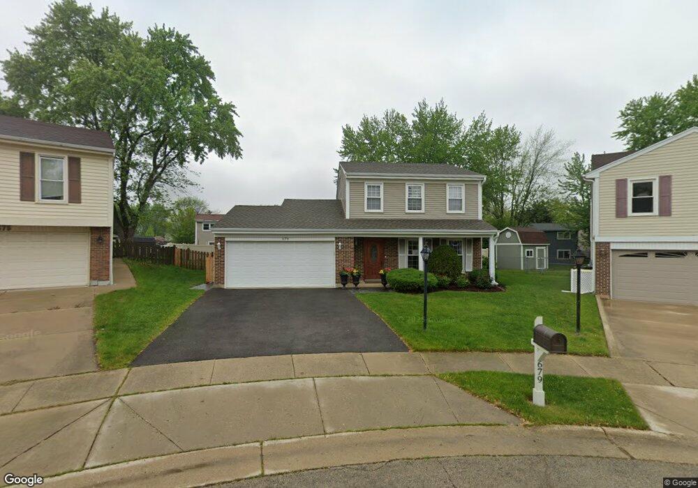
679 Rodenburg Rd Roselle, IL 60172
Estimated Value: $329,000 - $397,000
3
Beds
2
Baths
1,600
Sq Ft
$230/Sq Ft
Est. Value
About This Home
This home is located at 679 Rodenburg Rd, Roselle, IL 60172 and is currently estimated at $368,614, approximately $230 per square foot. 679 Rodenburg Rd is a home located in DuPage County with nearby schools including Waterbury Elementary School, Spring Wood Middle School, and Lake Park High School.
Ownership History
Date
Name
Owned For
Owner Type
Purchase Details
Closed on
May 3, 2024
Sold by
Mogielnicki Andrzej and Mogielnicki Agnieszka
Bought by
Fiedorczuk Robert and Rutkowska Beata
Current Estimated Value
Purchase Details
Closed on
Mar 13, 1997
Sold by
Lebeau Keith and Lebeau Carol A
Bought by
Mogielnicki Andrzej and Mogielnicki Agnieszka
Home Financials for this Owner
Home Financials are based on the most recent Mortgage that was taken out on this home.
Original Mortgage
$116,800
Interest Rate
7.15%
Create a Home Valuation Report for This Property
The Home Valuation Report is an in-depth analysis detailing your home's value as well as a comparison with similar homes in the area
Home Values in the Area
Average Home Value in this Area
Purchase History
| Date | Buyer | Sale Price | Title Company |
|---|---|---|---|
| Fiedorczuk Robert | $280,000 | Saturn Title | |
| Mogielnicki Andrzej | $146,000 | Collar Counties Title Plant |
Source: Public Records
Mortgage History
| Date | Status | Borrower | Loan Amount |
|---|---|---|---|
| Previous Owner | Mogielnicki Andrzej | $116,800 |
Source: Public Records
Tax History Compared to Growth
Tax History
| Year | Tax Paid | Tax Assessment Tax Assessment Total Assessment is a certain percentage of the fair market value that is determined by local assessors to be the total taxable value of land and additions on the property. | Land | Improvement |
|---|---|---|---|---|
| 2024 | $7,543 | $108,224 | $35,397 | $72,827 |
| 2023 | $6,977 | $98,970 | $32,370 | $66,600 |
| 2022 | $6,932 | $96,210 | $32,160 | $64,050 |
| 2021 | $6,623 | $91,410 | $30,560 | $60,850 |
| 2020 | $6,655 | $89,180 | $29,810 | $59,370 |
| 2019 | $6,448 | $85,700 | $28,650 | $57,050 |
| 2018 | $6,295 | $81,680 | $27,900 | $53,780 |
| 2017 | $6,008 | $75,710 | $25,860 | $49,850 |
| 2016 | $5,770 | $70,070 | $23,930 | $46,140 |
| 2015 | $5,691 | $65,390 | $22,330 | $43,060 |
| 2014 | $5,330 | $61,200 | $22,330 | $38,870 |
| 2013 | $5,286 | $63,290 | $23,090 | $40,200 |
Source: Public Records
Map
Nearby Homes
- 640 Stafford Dr
- 640 Rodenburg Rd
- 515 Dover Ct
- 565 Kensington Ct
- 662 Daisy Ln Unit 110
- 815 Woodside Dr
- 871 Rosebud Ct
- 6N331 Keeney Rd
- 445 Fordham Place
- 6N447 Virginia Rd
- 1125 Darby Ln
- 6N505 Gary Ave
- 6N632 Gary Ave
- 1190 Singleton Dr
- 6N041 Keeney Rd
- Lot Foster Ave
- 6N160 Garden Ave
- 660 Newport St S
- 550 Lake St
- 613 Autumn Dr
- 675 Rodenburg Rd
- 683 Rodenburg Rd
- 641 Stafford Dr
- 665 Rodenburg Rd
- 687 Rodenburg Rd
- 645 Stafford Dr
- 649 Stafford Dr
- 637 Stafford Dr
- 633 Stafford Dr
- 691 Rodenburg Rd
- 655 Rodenburg Rd
- 675 Foxdale Ct
- 629 Stafford Dr
- 670 Foxdale Ct
- 685 Foxdale Ct
- 695 Rodenburg Rd
- 715 Berwick Place
- 660 Briarwood Ln
- 625 Stafford Dr
- 680 Briarwood Ln