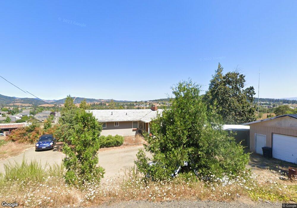
679 Schudeiske Rd Sutherlin, OR 97479
Estimated Value: $435,000 - $504,000
3
Beds
2
Baths
1,496
Sq Ft
$314/Sq Ft
Est. Value
About This Home
This home is located at 679 Schudeiske Rd, Sutherlin, OR 97479 and is currently estimated at $469,586, approximately $313 per square foot. 679 Schudeiske Rd is a home located in Douglas County with nearby schools including East Sutherlin Primary School, West Sutherlin Intermediate School, and Sutherlin Middle School.
Ownership History
Date
Name
Owned For
Owner Type
Purchase Details
Closed on
Apr 10, 2013
Sold by
Dunbar Aaron R and Dunbar Kathleen R
Bought by
Higgs Glenn and Higgs Patricia
Current Estimated Value
Home Financials for this Owner
Home Financials are based on the most recent Mortgage that was taken out on this home.
Original Mortgage
$219,387
Outstanding Balance
$154,857
Interest Rate
3.47%
Mortgage Type
New Conventional
Estimated Equity
$314,729
Create a Home Valuation Report for This Property
The Home Valuation Report is an in-depth analysis detailing your home's value as well as a comparison with similar homes in the area
Home Values in the Area
Average Home Value in this Area
Purchase History
| Date | Buyer | Sale Price | Title Company |
|---|---|---|---|
| Higgs Glenn | $215,000 | First American |
Source: Public Records
Mortgage History
| Date | Status | Borrower | Loan Amount |
|---|---|---|---|
| Open | Higgs Glenn | $219,387 |
Source: Public Records
Tax History Compared to Growth
Tax History
| Year | Tax Paid | Tax Assessment Tax Assessment Total Assessment is a certain percentage of the fair market value that is determined by local assessors to be the total taxable value of land and additions on the property. | Land | Improvement |
|---|---|---|---|---|
| 2024 | $2,031 | $261,648 | -- | -- |
| 2023 | $1,974 | $254,028 | $0 | $0 |
| 2022 | $1,918 | $246,630 | $0 | $0 |
| 2021 | $1,864 | $239,447 | $0 | $0 |
| 2020 | $1,812 | $232,473 | $0 | $0 |
| 2019 | $1,761 | $225,702 | $0 | $0 |
| 2018 | $1,712 | $219,129 | $0 | $0 |
| 2017 | $1,863 | $212,747 | $0 | $0 |
| 2016 | $1,812 | $206,551 | $0 | $0 |
| 2015 | $1,761 | $200,535 | $0 | $0 |
| 2014 | $1,710 | $194,695 | $0 | $0 |
| 2013 | -- | $189,025 | $0 | $0 |
Source: Public Records
Map
Nearby Homes
- 2730 Golfview Ave
- 307 Cambridge Dr
- 149 Coles Valley St
- 154 Coles Valley St
- 126 Coles Valley St
- 135 Elkton St
- 336 Schudeiske Rd
- 122 Lilly Ct
- 101 Frontier Ct
- 910 Swallow Ave
- 178 Dovetail Ln
- 892 Fir Grove Ln
- 908 Fir Grove Ln
- 1688 W Central Ave
- 181 SW Hutchins St
- 1878 Trails End Ln
- 420 Backwater Loop
- 702 Divot Loop
- 0 Dakota St Unit B 500248401
- 832 Sand Pines Ave
- 820 Fort McKay Rd
- 553 Schudeiske Rd
- 770 Schudeiske Rd
- 500 Schudeiske Rd
- 770 Schudieske
- 333 Cambridge Dr
- 674 Fort McKay Rd
- 771 Fort McKay Rd
- 331 Cambridge Dr
- 2580 Peachwood Ct
- 861 Fort McKay Rd
- 329 Cambridge Dr
- 2576 Peachwood Ct
- 328 Cambridge Dr
- 320 Ridgeway St
- 2584 Peachwood Ct
- 351 Ashwood St
- 889 Fort McKay Rd
- 319 Ridgeway St
- 323 Cambridge Dr