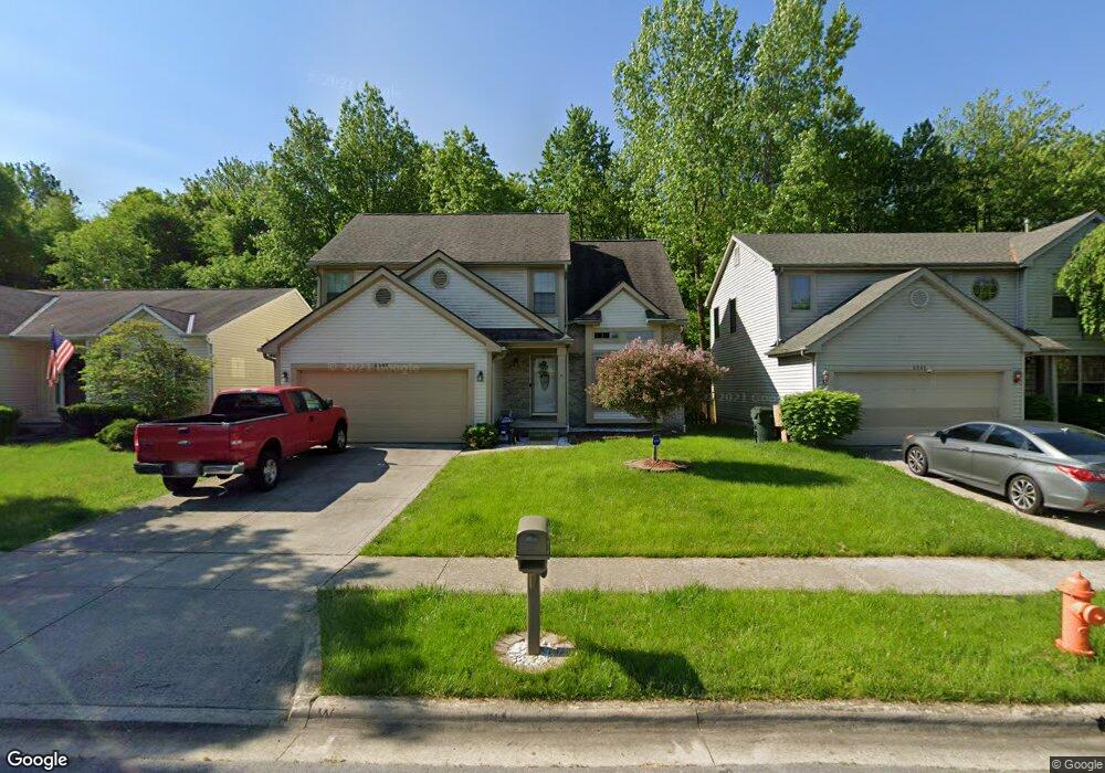
6790 Lehman Rd Canal Winchester, OH 43110
East Columbus-White Ash NeighborhoodEstimated Value: $471,000 - $502,258
4
Beds
3
Baths
2,501
Sq Ft
$196/Sq Ft
Est. Value
About This Home
This home is located at 6790 Lehman Rd, Canal Winchester, OH 43110 and is currently estimated at $490,315, approximately $196 per square foot. 6790 Lehman Rd is a home located in Franklin County with nearby schools including Winchester Trail Elementary School, Indian Trail Elementary School, and Canal Winchester Middle School.
Ownership History
Date
Name
Owned For
Owner Type
Purchase Details
Closed on
Jul 5, 2013
Sold by
Martin Gary L and Martin Karen M
Bought by
Hollis Christopher S and Hollis Sharon A
Current Estimated Value
Home Financials for this Owner
Home Financials are based on the most recent Mortgage that was taken out on this home.
Original Mortgage
$155,000
Outstanding Balance
$112,660
Interest Rate
3.91%
Mortgage Type
New Conventional
Estimated Equity
$377,655
Purchase Details
Closed on
Feb 23, 1988
Bought by
Martin Gary L
Create a Home Valuation Report for This Property
The Home Valuation Report is an in-depth analysis detailing your home's value as well as a comparison with similar homes in the area
Home Values in the Area
Average Home Value in this Area
Purchase History
| Date | Buyer | Sale Price | Title Company |
|---|---|---|---|
| Hollis Christopher S | $205,000 | None Available | |
| Martin Gary L | $25,000 | -- |
Source: Public Records
Mortgage History
| Date | Status | Borrower | Loan Amount |
|---|---|---|---|
| Open | Hollis Christopher S | $155,000 |
Source: Public Records
Tax History Compared to Growth
Tax History
| Year | Tax Paid | Tax Assessment Tax Assessment Total Assessment is a certain percentage of the fair market value that is determined by local assessors to be the total taxable value of land and additions on the property. | Land | Improvement |
|---|---|---|---|---|
| 2024 | $6,592 | $135,700 | $48,130 | $87,570 |
| 2023 | $6,553 | $135,695 | $48,125 | $87,570 |
| 2022 | $6,628 | $120,760 | $48,130 | $72,630 |
| 2021 | $6,703 | $120,760 | $48,130 | $72,630 |
| 2020 | $6,678 | $120,760 | $48,130 | $72,630 |
| 2019 | $6,227 | $96,600 | $38,500 | $58,100 |
| 2018 | $6,036 | $96,600 | $38,500 | $58,100 |
| 2017 | $6,035 | $96,600 | $38,500 | $58,100 |
| 2016 | $5,980 | $88,770 | $26,150 | $62,620 |
| 2015 | $6,000 | $88,770 | $26,150 | $62,620 |
| 2014 | $5,999 | $88,770 | $26,150 | $62,620 |
| 2013 | $3,203 | $93,415 | $27,510 | $65,905 |
Source: Public Records
Map
Nearby Homes
- 7026 Weurful Dr
- 6977 Remsen Dr Unit 77D
- 5206 Novelty Ave Unit 73C
- 5200 Mantua Dr Unit 63C
- 5176 Mantua Dr Unit 65D
- 5195 Mantua Dr Unit 62D
- 5222 Algean Dr
- 5106 Novelty Ave Unit 68F
- 6757 Lagrange Dr Unit 57A
- 5012 Gore St
- 0 Lehman Rd Unit 225027581
- 0 Lehman Rd Unit 225021076
- 5493 Meadow Passage Dr
- 6755 Axtel Dr Unit 14C
- 5332 Wadley Ct
- 6790 Laburnum Dr
- 6773 Laburnum Dr
- 6786 Warriner Way
- Fairton Plan at Brookview
- Henley Plan at Brookview
- 6995 Weurful Dr
- 7003 Weurful Dr
- 6987 Weurful Dr
- 6979 Weurful Dr
- 7011 Weurful Dr
- 7019 Weurful Dr
- 6971 Weurful Dr
- 7027 Weurful Dr
- 6955 Weurful Dr
- 6947 Weurful Dr
- 7043 Weurful Dr
- 6994 Weurful Dr
- 7002 Weurful Dr
- 6986 Weurful Dr
- 6978 Weurful Dr
- 7010 Weurful Dr
- 6939 Weurful Dr
- 7051 Weurful Dr
- 6970 Weurful Dr
- 7018 Weurful Dr