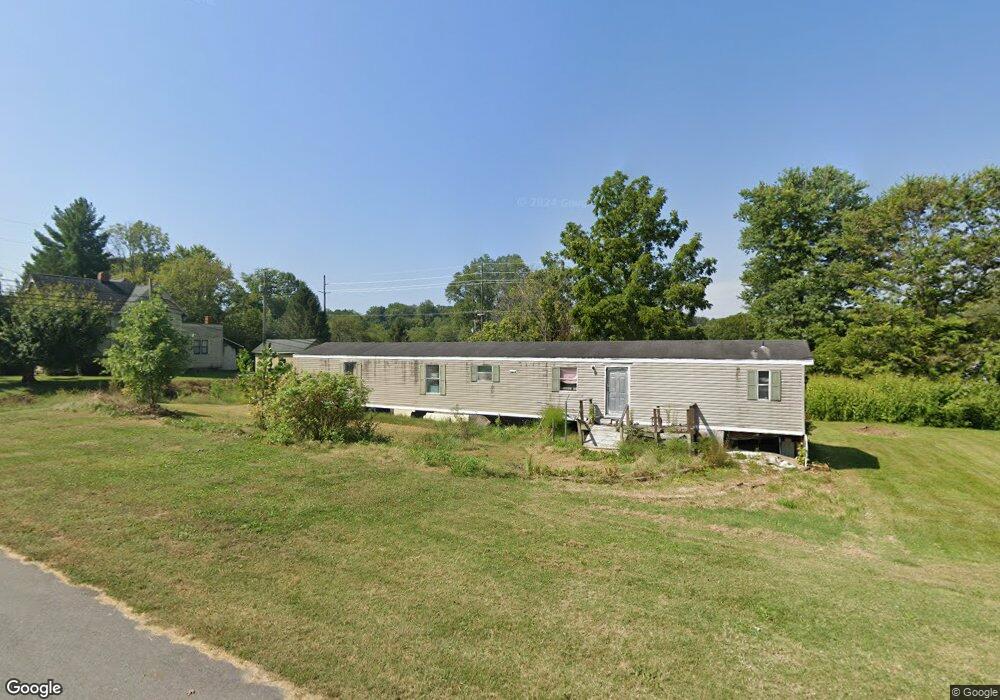
6794 N Main St Freetown, IN 47235
Estimated Value: $33,000 - $199,000
--
Bed
1
Bath
1,280
Sq Ft
$77/Sq Ft
Est. Value
About This Home
This home is located at 6794 N Main St, Freetown, IN 47235 and is currently estimated at $98,075, approximately $76 per square foot. 6794 N Main St is a home with nearby schools including Brownstown Elementary School, Brownstown Central Middle School, and Brownstown Central High School.
Create a Home Valuation Report for This Property
The Home Valuation Report is an in-depth analysis detailing your home's value as well as a comparison with similar homes in the area
Home Values in the Area
Average Home Value in this Area
Tax History Compared to Growth
Tax History
| Year | Tax Paid | Tax Assessment Tax Assessment Total Assessment is a certain percentage of the fair market value that is determined by local assessors to be the total taxable value of land and additions on the property. | Land | Improvement |
|---|---|---|---|---|
| 2024 | $570 | $14,600 | $11,400 | $3,200 |
| 2023 | $1,390 | $14,100 | $11,400 | $2,700 |
| 2022 | $168 | $14,200 | $11,400 | $2,800 |
| 2021 | $136 | $28,100 | $11,900 | $16,200 |
| 2020 | $134 | $28,200 | $11,900 | $16,300 |
| 2019 | $128 | $28,200 | $11,900 | $16,300 |
| 2018 | $128 | $28,600 | $11,900 | $16,700 |
| 2017 | $99 | $25,800 | $11,900 | $13,900 |
| 2016 | $80 | $27,400 | $10,800 | $16,600 |
| 2014 | $101 | $24,100 | $7,700 | $16,400 |
| 2013 | $101 | $23,800 | $7,700 | $16,100 |
Source: Public Records
Map
Nearby Homes
- 5000 W County Road 680 N
- 6100 W County Road 700 N
- 5000 W County Road 700 N
- 6000 W County Road 700 N
- 6725 W County Road 700 N
- 3000 W Block Co Rd 900 N
- 2221 Indiana 258
- 9649 N County Road 450 W
- 4325 N County Road 650 W
- 8000 W County Road 625 Tract 4 N
- 8000 W County Road 625 N Unit LotWP004
- 7594 W County Road 925 N
- 3780 W County Road 300 N
- 3264 N County Road 250 W
- 8515 N County Road 100 W
- 11000 N County Road 650 W
- 2000 Block W 1125 N
- 1109 N County Road 600 W Unit Medora
- 9601 Buffalo Pike
- 8650 Mount Nebo Rd
- 6820 N Main St
- 6819 N State Road 135
- 6768 N Main St
- 6801 N Main St
- 6761 N Main St
- 4916 W 2nd St
- 4966 W 1st St
- 6735 N Main St
- 4904 W Columbus Pike
- 4915 W 2nd St
- 0 S State Road 135 Unit 21487047
- 135 S
- 4969 W 1st St
- 4969 W 1st St
- 6785 N Main St
- 6893 Indiana 135
- 4876 W 2nd St
- 4842 W Columbus Pike
- 6730 N State Road 135