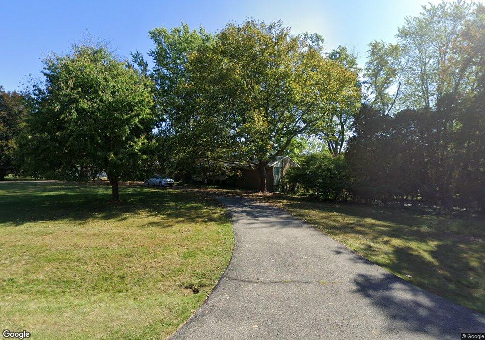
6795 Orinoco Cir Bloomfield Hills, MI 48301
Estimated Value: $623,000 - $708,000
4
Beds
3
Baths
2,270
Sq Ft
$290/Sq Ft
Est. Value
About This Home
This home is located at 6795 Orinoco Cir, Bloomfield Hills, MI 48301 and is currently estimated at $658,379, approximately $290 per square foot. 6795 Orinoco Cir is a home located in Oakland County with nearby schools including Conant Elementary School, South Hills Middle School, and Bloomfield Hills High School.
Ownership History
Date
Name
Owned For
Owner Type
Purchase Details
Closed on
Sep 2, 2016
Sold by
Rothman Andrew and David Lebenbom Trust
Bought by
Lebenbom Michael
Current Estimated Value
Home Financials for this Owner
Home Financials are based on the most recent Mortgage that was taken out on this home.
Original Mortgage
$260,000
Interest Rate
3.43%
Mortgage Type
Purchase Money Mortgage
Purchase Details
Closed on
Feb 18, 2003
Sold by
Lebenbom David
Bought by
Lebenbom David and David Lebenbom Revocable Trust
Purchase Details
Closed on
Nov 15, 2002
Sold by
Lebenbom Elaine F
Bought by
Lebenbom David
Create a Home Valuation Report for This Property
The Home Valuation Report is an in-depth analysis detailing your home's value as well as a comparison with similar homes in the area
Home Values in the Area
Average Home Value in this Area
Purchase History
| Date | Buyer | Sale Price | Title Company |
|---|---|---|---|
| Lebenbom Michael | $320,000 | First American Title | |
| Lebenbom David | -- | -- | |
| Lebenbom David | -- | -- |
Source: Public Records
Mortgage History
| Date | Status | Borrower | Loan Amount |
|---|---|---|---|
| Closed | Lebenbom Michael | $260,000 |
Source: Public Records
Tax History Compared to Growth
Tax History
| Year | Tax Paid | Tax Assessment Tax Assessment Total Assessment is a certain percentage of the fair market value that is determined by local assessors to be the total taxable value of land and additions on the property. | Land | Improvement |
|---|---|---|---|---|
| 2024 | $3,801 | $241,270 | $0 | $0 |
| 2023 | $3,678 | $232,410 | $0 | $0 |
| 2022 | $6,913 | $233,620 | $0 | $0 |
| 2021 | $6,863 | $216,520 | $0 | $0 |
| 2020 | $3,364 | $193,480 | $0 | $0 |
| 2019 | $6,458 | $180,650 | $0 | $0 |
| 2018 | $6,420 | $173,880 | $0 | $0 |
| 2017 | $6,374 | $164,290 | $0 | $0 |
| 2016 | $5,999 | $187,130 | $0 | $0 |
| 2015 | -- | $176,040 | $0 | $0 |
| 2014 | -- | $132,780 | $0 | $0 |
| 2011 | -- | $145,430 | $0 | $0 |
Source: Public Records
Map
Nearby Homes
- 6720 Castle Dr
- 6940 Castle Dr
- 6800 Crestway Dr
- 6701 Franklin Rd
- 4665 W Maple Rd
- 4647 Private Lake Dr
- 6940 Wing Lake Rd
- 4428 Old Trinity Ct
- 7100 Wing Lake Rd
- 25690 W 14 Mile Rd
- 6041 Eastmoor Rd
- 6572 Spruce Dr
- 6730 Halyard Rd
- 6420 Apple Grove Ln Unit 10
- 7005 Cathedral Dr
- 32890 Whatley Rd
- 32696 Ravine Dr
- 6660 Woodbank Dr
- 2014 Waldons Ct
- 7371 Lindenmere Dr
- 6757 Orinoco Cir
- 6765 Orinoco Cir
- 6790 Orinoco Cir
- 6815 Orinoco Cir
- 6755 Orinoco Cir
- 6861 Orinoco Cir
- 6810 Orinoco Cir
- 6770 Orinoco Cir
- 6750 Orinoco Cir
- 6791 Castle Dr
- 6735 Orinoco Cir
- 6830 Orinoco Cir
- 6815 Castle Dr
- 6850 Orinoco Cir
- 6855 Orinoco Cir
- 6885 Castle Ct
- 6775 Castle Dr
- 6848 Orinoco Cir
- 6895 Castle Ct
- 6800 Franklin Rd