Estimated Value: $129,000 - $208,000
3
Beds
2
Baths
1,388
Sq Ft
$116/Sq Ft
Est. Value
About This Home
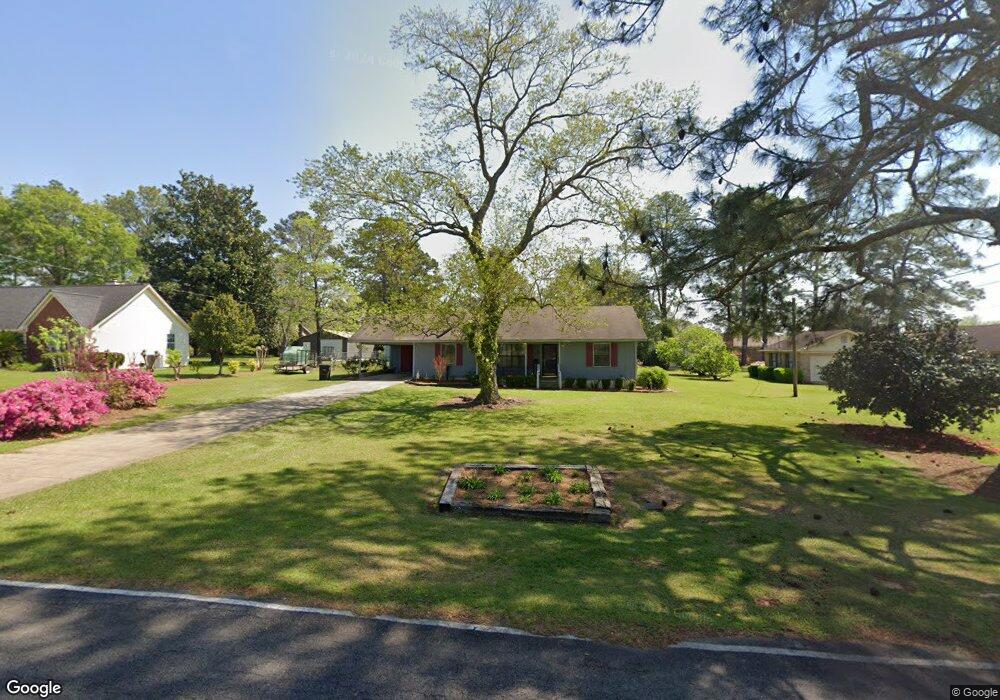
This home is located at 68 25th St NE, Cairo, GA 39828 and is currently estimated at $161,065, approximately $116 per square foot. 68 25th St NE is a home located in Grady County with nearby schools including Cairo High School.
Ownership History
Date
Name
Owned For
Owner Type
Purchase Details
Closed on
Aug 17, 2022
Sold by
Tuggle John B
Bought by
Allen Christopher B and Allen Sandra Michelle
Current Estimated Value
Home Financials for this Owner
Home Financials are based on the most recent Mortgage that was taken out on this home.
Original Mortgage
$92,380
Interest Rate
5.54%
Mortgage Type
New Conventional
Purchase Details
Closed on
Jun 25, 2022
Sold by
Allen Alunda R
Bought by
Tuggle John B and Renaud Charles
Home Financials for this Owner
Home Financials are based on the most recent Mortgage that was taken out on this home.
Original Mortgage
$92,380
Interest Rate
5.54%
Mortgage Type
New Conventional
Purchase Details
Closed on
Mar 19, 2005
Sold by
Allen Alundra R
Bought by
Allen Alundra R and Allen Gerald D
Purchase Details
Closed on
Dec 19, 2001
Sold by
Willis Geneva W
Bought by
Allen Alundra R
Purchase Details
Closed on
Oct 26, 1982
Bought by
Willis Geneva W
Create a Home Valuation Report for This Property
The Home Valuation Report is an in-depth analysis detailing your home's value as well as a comparison with similar homes in the area
Home Values in the Area
Average Home Value in this Area
Purchase History
| Date | Buyer | Sale Price | Title Company |
|---|---|---|---|
| Allen Christopher B | $91,000 | -- | |
| Tuggle John B | $80,664 | -- | |
| Allen Alundra R | -- | -- | |
| Allen Alundra R | $66,500 | -- | |
| Willis Geneva W | $4,500 | -- |
Source: Public Records
Mortgage History
| Date | Status | Borrower | Loan Amount |
|---|---|---|---|
| Closed | Allen Christopher B | $92,380 |
Source: Public Records
Tax History Compared to Growth
Tax History
| Year | Tax Paid | Tax Assessment Tax Assessment Total Assessment is a certain percentage of the fair market value that is determined by local assessors to be the total taxable value of land and additions on the property. | Land | Improvement |
|---|---|---|---|---|
| 2024 | $1,869 | $47,362 | $4,422 | $42,940 |
| 2023 | $1,347 | $37,403 | $4,800 | $32,603 |
| 2022 | $1,379 | $37,403 | $4,800 | $32,603 |
| 2021 | $1,382 | $37,403 | $4,800 | $32,603 |
| 2020 | $1,386 | $37,403 | $4,800 | $32,603 |
| 2019 | $1,386 | $37,403 | $4,800 | $32,603 |
| 2018 | $1,318 | $37,403 | $4,800 | $32,603 |
| 2017 | $1,268 | $37,403 | $4,800 | $32,603 |
| 2016 | $1,095 | $31,794 | $4,800 | $26,994 |
| 2015 | $1,084 | $31,794 | $4,800 | $26,994 |
| 2014 | $1,084 | $31,794 | $4,800 | $26,994 |
| 2013 | -- | $28,785 | $4,800 | $23,985 |
Source: Public Records
Map
Nearby Homes
- 2600 U S 84
- 21 24th St NE
- 78.6 Ac Strickland Rd
- 66 22nd St NE
- 0 20th St NE
- 00 20th St NE
- 0 NE Airport Rd Unit 145784
- 3109 U S 84
- 3109 U S 84
- 236 Helton Ln
- 225 Helton Ln
- 00 NW 9th Ave
- 711 2nd Ave NE
- 530 6th St
- 530 6th Ave SE
- 471 4th St SE
- 481 4th St SE
- 00 State Route 188
- 0 State Route 188
- 602 4th St SE
- 74 25th St NE
- 62 25th St NE
- 63 25th St NE
- 69 26th St NE
- 80 25th St NE
- 63 26th St NE
- 57 25th St NE
- 2460 Pineacre Dr NE
- 2570 Pineacre Dr NE
- 51 25th St NE
- 2580 MacIvor Dr NE
- 62 24th St NE
- 66 26th St NE
- 58 24th St NE
- 74 26th St NE
- 2506 MacIvor Dr NE
- 2506 MacIvor Dr NE Unit 1
- 64 24th St NE
- 58 26th St NE
- 78 26th St NE