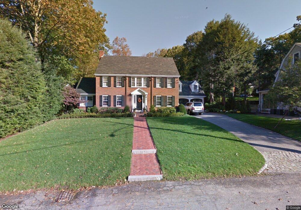
68 Colbert Rd E West Newton, MA 02465
West Newton NeighborhoodEstimated Value: $2,342,372 - $3,549,000
About This Home
This home is located at 68 Colbert Rd E, West Newton, MA 02465 and is currently estimated at $2,806,843, approximately $816 per square foot. 68 Colbert Rd E is a home located in Middlesex County with nearby schools including Peirce Elementary School, F.A. Day Middle School, and Newton North High School.
Ownership History
We collect this data history from publicly available records. To have your information removed, we recommend requesting removal directly through your county’s website.
Purchase Details
Home Financials for this Owner
Home Financials are based on the most recent Mortgage that was taken out on this home.Home Values in the Area
Average Home Value in this Area
Purchase History
We collect this data history from publicly available records. To have your information removed, we recommend requesting removal directly through your county’s website.
| Date | Buyer | Sale Price | Title Company |
|---|---|---|---|
| $510,000 | -- |
Mortgage History
We collect this data history from publicly available records. To have your information removed, we recommend requesting removal directly through your county’s website.
| Date | Status | Borrower | Loan Amount |
|---|---|---|---|
| Closed | $340,000 | ||
| Closed | $340,000 | ||
| Closed | $68,000 |
Tax History
We collect this data history from publicly available records. To have your information removed, we recommend requesting removal directly through your county’s website.
| Year | Tax Paid | Tax Assessment Tax Assessment Total Assessment is a certain percentage of the fair market value that is determined by local assessors to be the total taxable value of land and additions on the property. | Land | Improvement |
|---|---|---|---|---|
| 2025 | $20,879 | $2,130,500 | $1,227,800 | $902,700 |
| 2024 | $20,188 | $2,068,400 | $1,192,000 | $876,400 |
| 2023 | $19,253 | $1,891,300 | $923,200 | $968,100 |
| 2022 | $18,423 | $1,751,200 | $854,800 | $896,400 |
| 2021 | $17,777 | $1,652,100 | $806,400 | $845,700 |
| 2020 | $17,248 | $1,652,100 | $806,400 | $845,700 |
| 2019 | $16,762 | $1,604,000 | $782,900 | $821,100 |
| 2018 | $16,245 | $1,501,400 | $704,700 | $796,700 |
| 2017 | $15,750 | $1,416,400 | $664,800 | $751,600 |
| 2016 | $15,064 | $1,323,700 | $621,300 | $702,400 |
| 2015 | $14,363 | $1,237,100 | $580,700 | $656,400 |
Map
- 308 Prince St
- 91 Mary Ellen Rd
- 210 Evelyn Rd
- 514 Lowell Ave Unit 514
- 10 Burnham Rd
- 22 Regent St
- 136 Beaumont Ave
- 444 Lowell Ave
- 444 Lowell Ave Unit 444
- 442 Lowell Ave Unit 444
- 61 Lakeview Ave
- 19 Bonnybrook Rd
- 50 Grove Hill Park
- 90 Hull St
- 443 Chestnut St
- 176 Paulson Rd
- 29 Gammons Rd
- 36 Dexter Rd
- 1242 Beacon St
- 1242 Beacon St Unit 1242
- 17 Wauwinet Rd
- 74 Colbert Rd E
- 9 Wauwinet Rd
- 25 Wauwinet Rd
- 18 Wauwinet Rd
- 24 Wauwinet Rd
- 3 Wauwinet Rd
- 151 Valentine St
- 83 Bonad Rd
- 79 Colbert Rd E
- 155 Valentine St
- 32 Wauwinet Rd
- 67 Colbert Rd E
- 60 Colbert Rd E
- 73 Bonad Rd
- 167 Valentine St
- 38 Wauwinet Rd
- 177 Valentine St
- 129 Valentine St
- 23 Risley Rd
Ask me questions while you tour the home.