
Seller's Agent in 2025
Manuel Dominguez
RE/MAX
(732) 795-9500
7 in this area
19 Total Sales
Please email you offer to mannydsellshomes@gmail.com
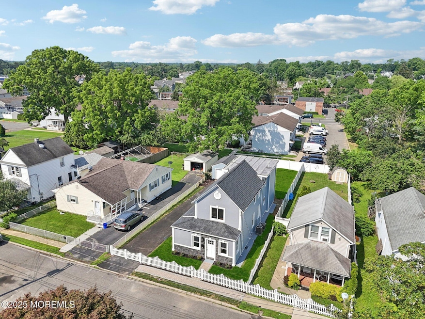
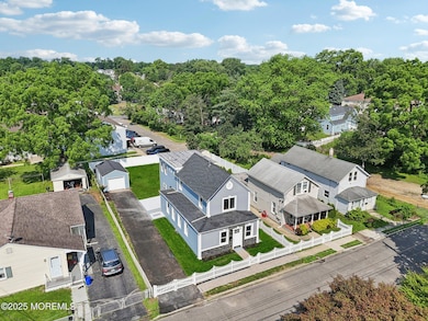
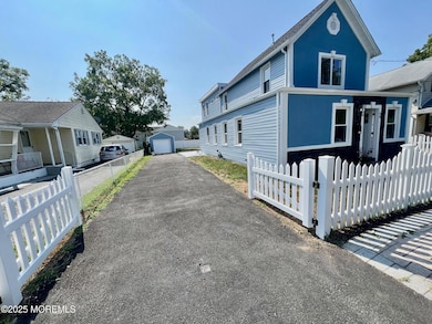
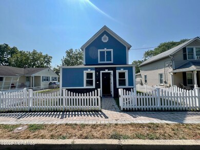
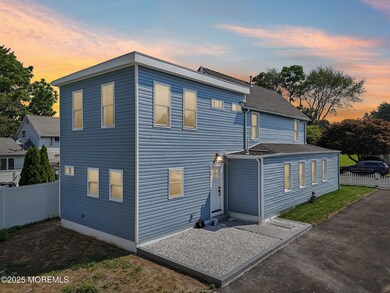
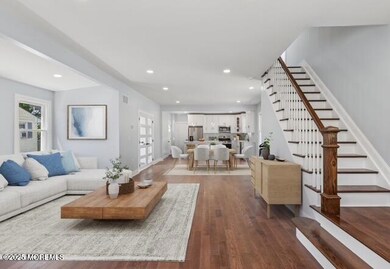
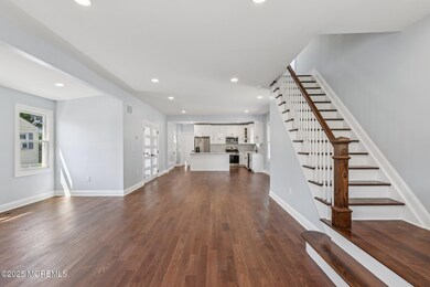
Experience elevated coastal living in this fully reimagined Long Branch home, rebuilt from the studs up with every modern upgrade. Just minutes from the beach, Pier Village, and NJ Transit, this 4-bedroom, 3.5-bath residence (plus home office/bonus room) combines luxury design with everyday comfort. Inside, wide-plank hardwood floors flow throughout the sun-filled, open layout. The brand-new chef's kitchen features quartz countertops, custom cabinetry, and premium appliances, opening seamlessly to living and dining areas designed for gathering. A rare highlight: two primary suites—one on the first floor and one on the second—ideal for multi-generational living, hosting guests.
Last Agent to Sell the Property
RE/MAX Synergy Brokerage Phone: (212) 639-9292 License #2076047 Listed on: 08/15/2025
| Date | Type | Sale Price | Title Company |
|---|---|---|---|
| Deed | $275,000 | Nu World Title | |
| Deed | $275,000 | Nu World Title | |
| Deed | $102,000 | -- |
| Date | Status | Loan Amount | Loan Type |
|---|---|---|---|
| Open | $506,659 | Construction | |
| Closed | $506,659 | Construction |
| Date | Event | Price | List to Sale | Price per Sq Ft |
|---|---|---|---|---|
| 11/14/2025 11/14/25 | Sold | $710,000 | +1.4% | $394 / Sq Ft |
| 10/03/2025 10/03/25 | Pending | -- | -- | -- |
| 08/28/2025 08/28/25 | Price Changed | $699,888 | -6.7% | $389 / Sq Ft |
| 08/15/2025 08/15/25 | For Sale | $749,888 | 0.0% | $417 / Sq Ft |
| 08/08/2025 08/08/25 | Pending | -- | -- | -- |
| 07/11/2025 07/11/25 | For Sale | $749,888 | 0.0% | $417 / Sq Ft |
| 07/09/2025 07/09/25 | Price Changed | $749,888 | -- | $417 / Sq Ft |
| Year | Tax Paid | Tax Assessment Tax Assessment Total Assessment is a certain percentage of the fair market value that is determined by local assessors to be the total taxable value of land and additions on the property. | Land | Improvement |
|---|---|---|---|---|
| 2025 | $5,890 | $401,200 | $208,500 | $192,700 |
| 2024 | $5,344 | $383,200 | $183,500 | $199,700 |
| 2023 | $5,344 | $344,100 | $153,500 | $190,600 |
| 2022 | $5,515 | $311,400 | $143,500 | $167,900 |
| 2021 | $5,515 | $275,600 | $118,500 | $157,100 |
| 2020 | $5,447 | $260,600 | $104,500 | $156,100 |
| 2019 | $5,158 | $245,400 | $96,500 | $148,900 |
| 2018 | $4,924 | $232,900 | $89,500 | $143,400 |
| 2017 | $4,724 | $229,200 | $88,500 | $140,700 |
| 2016 | $4,660 | $230,600 | $93,500 | $137,100 |
| 2015 | $4,721 | $212,000 | $90,500 | $121,500 |
| 2014 | $4,423 | $209,300 | $101,500 | $107,800 |
Seller's Agent in 2025
Manuel Dominguez
RE/MAX
(732) 795-9500
7 in this area
19 Total Sales
L
Buyer's Agent in 2025
Luciana Dias Lourenco
EXIT Realty East Coast Shirvanian
(732) 229-8700
6 in this area
22 Total Sales
Source: MOREMLS (Monmouth Ocean Regional REALTORS®)
MLS Number: 22520145
APN: 27-00243-0000-00069
Disclaimer: Certain information contained herein is derived from information provided by parties other than Homes.com. All information provided is deemed reliable, but is not guaranteed to be accurate and should be independently verified.
![]() IDX information is provided exclusively for personal, non-commercial use, and may not be used for any purpose other than to identify prospective properties consumers may be interested in purchasing.
IDX information is provided exclusively for personal, non-commercial use, and may not be used for any purpose other than to identify prospective properties consumers may be interested in purchasing.
Information is deemed reliable but not guaranteed.