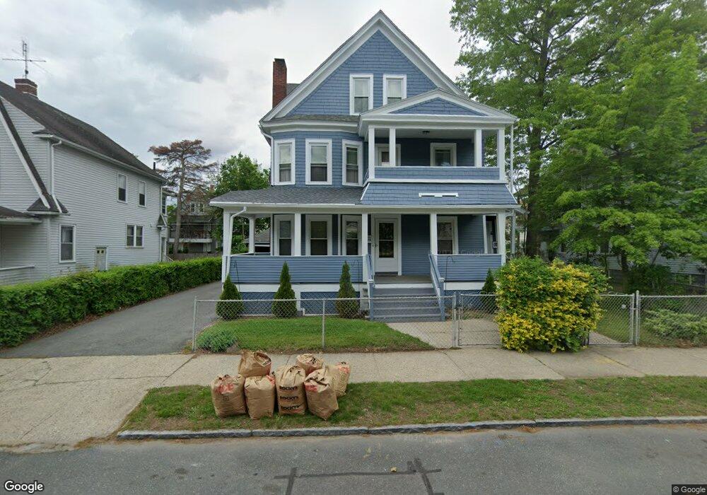
68 Dunmoreland St Unit 70 Springfield, MA 01109
Upper Hill NeighborhoodEstimated Value: $314,816 - $383,000
10
Beds
3
Baths
3,202
Sq Ft
$107/Sq Ft
Est. Value
About This Home
This home is located at 68 Dunmoreland St Unit 70, Springfield, MA 01109 and is currently estimated at $343,454, approximately $107 per square foot. 68 Dunmoreland St Unit 70 is a home located in Hampden County with nearby schools including Mary M. Walsh Elementary School, M Marcus Kiley Middle, and Springfield High School of Science and Technology.
Ownership History
Date
Name
Owned For
Owner Type
Purchase Details
Closed on
Dec 19, 2019
Sold by
Adamson Ida L
Bought by
Ida L Adamson Ft
Current Estimated Value
Create a Home Valuation Report for This Property
The Home Valuation Report is an in-depth analysis detailing your home's value as well as a comparison with similar homes in the area
Home Values in the Area
Average Home Value in this Area
Purchase History
| Date | Buyer | Sale Price | Title Company |
|---|---|---|---|
| Ida L Adamson Ft | -- | None Available |
Source: Public Records
Tax History Compared to Growth
Tax History
| Year | Tax Paid | Tax Assessment Tax Assessment Total Assessment is a certain percentage of the fair market value that is determined by local assessors to be the total taxable value of land and additions on the property. | Land | Improvement |
|---|---|---|---|---|
| 2025 | $3,556 | $226,800 | $31,100 | $195,700 |
| 2024 | $3,225 | $200,800 | $31,100 | $169,700 |
| 2023 | $3,188 | $187,000 | $28,300 | $158,700 |
| 2022 | $3,790 | $201,400 | $26,400 | $175,000 |
| 2021 | $3,113 | $164,700 | $18,700 | $146,000 |
| 2020 | $3,037 | $155,500 | $18,700 | $136,800 |
| 2019 | $2,706 | $137,500 | $16,000 | $121,500 |
| 2018 | $2,503 | $130,500 | $16,000 | $114,500 |
| 2017 | $2,503 | $127,300 | $15,000 | $112,300 |
| 2016 | $2,184 | $111,100 | $15,000 | $96,100 |
| 2015 | $2,150 | $109,300 | $15,000 | $94,300 |
Source: Public Records
Map
Nearby Homes
- 88 Dunmoreland St
- 19 Westford Ave
- 21 Westford Cir
- 124-126 Westford Cir
- 179 Albemarle St
- 140 Northampton Ave
- 162 Northampton Ave
- 135-137 Suffolk St
- 62-64 Bristol St
- 290 Quincy St
- 129 Eastern Ave
- 158 Norfolk St
- 43 Colonial Ave
- 111 Marlborough St
- 65 Montrose St
- 52-56 Andrew St
- 58 Willard Ave
- 0 NS (24) Alden St
- 67 Carlisle St
- 81 Hayden Ave
- 76 Dunmoreland St
- 62 Dunmoreland St Unit 64
- 67 Massachusetts Ave Unit 69
- 67-69 Massachusetts Ave
- 63-65 Massachusetts Ave
- 65 Massachusetts Ave
- 82 Dunmoreland St
- 56 Dunmoreland St Unit 58
- 73-75 Massachusetts Ave
- 75 Dunmoreland St
- 69 Dunmoreland St
- 55 Massachusetts Ave
- 77 Dunmoreland St
- 63 Dunmoreland St
- 75 Massachusetts Ave
- 79 Massachusetts Ave Unit 81
- 50 Dunmoreland St Unit 52
- 81 Dunmoreland St
- 57 Dunmoreland St
- 51 Massachusetts Ave