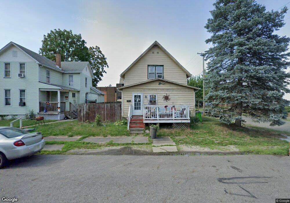
68 E High St Alliance, OH 44601
Estimated Value: $75,059 - $102,000
3
Beds
2
Baths
1,238
Sq Ft
$71/Sq Ft
Est. Value
About This Home
This home is located at 68 E High St, Alliance, OH 44601 and is currently estimated at $88,015, approximately $71 per square foot. 68 E High St is a home located in Stark County with nearby schools including Alliance Intermediate School at Northside, Alliance Elementary School at Rockhill, and Alliance Middle School.
Ownership History
Date
Name
Owned For
Owner Type
Purchase Details
Closed on
Apr 23, 2019
Sold by
Estate Of William Ferguson
Bought by
Ferguson Smith Kainan M
Current Estimated Value
Purchase Details
Closed on
Apr 18, 2019
Sold by
Smith Kainan M Ferguson
Bought by
Ferguson Karla K
Purchase Details
Closed on
May 24, 1999
Sold by
Walker David W and Walker Karen M
Bought by
Ferguson William R and Ferguson Dolores A
Create a Home Valuation Report for This Property
The Home Valuation Report is an in-depth analysis detailing your home's value as well as a comparison with similar homes in the area
Home Values in the Area
Average Home Value in this Area
Purchase History
| Date | Buyer | Sale Price | Title Company |
|---|---|---|---|
| Ferguson Smith Kainan M | -- | None Available | |
| Ferguson Karla K | -- | None Available | |
| Ferguson William R | $37,000 | -- |
Source: Public Records
Tax History
| Year | Tax Paid | Tax Assessment Tax Assessment Total Assessment is a certain percentage of the fair market value that is determined by local assessors to be the total taxable value of land and additions on the property. | Land | Improvement |
|---|---|---|---|---|
| 2025 | $363 | $18,270 | $2,450 | $15,820 |
| 2024 | -- | $18,270 | $2,450 | $15,820 |
| 2023 | $473 | $11,200 | $1,330 | $9,870 |
| 2022 | $453 | $11,200 | $1,330 | $9,870 |
| 2021 | $454 | $11,200 | $1,330 | $9,870 |
| 2020 | $427 | $9,840 | $1,160 | $8,680 |
| 2019 | $432 | $9,850 | $1,160 | $8,690 |
Source: Public Records
Map
Nearby Homes
- 62 E High St
- 427 S Union Ave
- 0 E Oxford St
- 62 E Market St
- 361 E Main St
- 163 W Market St
- 726 S Arch Ave
- V/L S Freedom Ave
- 228 W Oxford St
- 807 S Union Ave
- 621 S Haines Ave
- 452 E Summit St
- 264 W Market St
- 46 Rosenberry St
- 234 Rosenberry St
- 231 Rosenberry St
- 442 S Liberty Ave
- 226 Milner St
- 118 S Mckinley Ave
- 203 Glamorgan St
- 331 S Park Ave
- 329 S Park Ave
- 50 E High St
- 405 S Park Ave
- 405 South Park
- 40 E High St
- 63 E High St
- 350 S Park Ave
- 342 S Park Ave
- 330 S Park Ave
- 410 S Park Ave
- 53 E High St
- 419 S Park Ave
- 410-412 S Park Ave Unit 412 S. Park
- 410-412 S Park Ave
- 400 S Park Ave
- 32 E High St
- 421 S Park Ave
- 103 E Broadway St
- 43 E High St
Your Personal Tour Guide
Ask me questions while you tour the home.