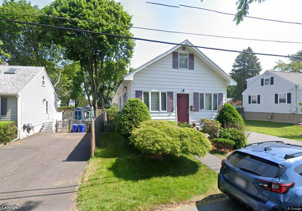
68 Emerson Ave Peabody, MA 01960
South Peabody NeighborhoodEstimated Value: $586,998 - $614,000
3
Beds
1
Bath
1,216
Sq Ft
$494/Sq Ft
Est. Value
About This Home
This home is located at 68 Emerson Ave, Peabody, MA 01960 and is currently estimated at $600,250, approximately $493 per square foot. 68 Emerson Ave is a home located in Essex County with nearby schools including Peabody Veterans Memorial High School and St John The Baptist School.
Ownership History
Date
Name
Owned For
Owner Type
Purchase Details
Closed on
May 13, 2009
Sold by
Connaughton Clair
Bought by
Perrin Keith and Perrin Ligia P
Current Estimated Value
Home Financials for this Owner
Home Financials are based on the most recent Mortgage that was taken out on this home.
Original Mortgage
$240,560
Outstanding Balance
$151,991
Interest Rate
4.85%
Mortgage Type
Purchase Money Mortgage
Estimated Equity
$448,259
Purchase Details
Closed on
Aug 4, 2004
Sold by
Nelson Donald James and Nelson Susanne Irene
Bought by
Connaughton Clair
Create a Home Valuation Report for This Property
The Home Valuation Report is an in-depth analysis detailing your home's value as well as a comparison with similar homes in the area
Home Values in the Area
Average Home Value in this Area
Purchase History
| Date | Buyer | Sale Price | Title Company |
|---|---|---|---|
| Perrin Keith | $248,000 | -- | |
| Connaughton Clair | $285,000 | -- |
Source: Public Records
Mortgage History
| Date | Status | Borrower | Loan Amount |
|---|---|---|---|
| Open | Connaughton Clair | $240,560 | |
| Previous Owner | Connaughton Clair | $56,400 |
Source: Public Records
Tax History Compared to Growth
Tax History
| Year | Tax Paid | Tax Assessment Tax Assessment Total Assessment is a certain percentage of the fair market value that is determined by local assessors to be the total taxable value of land and additions on the property. | Land | Improvement |
|---|---|---|---|---|
| 2025 | $4,260 | $460,000 | $220,800 | $239,200 |
| 2024 | $4,046 | $443,600 | $220,800 | $222,800 |
| 2023 | $4,109 | $431,600 | $197,100 | $234,500 |
| 2022 | $3,494 | $345,900 | $176,100 | $169,800 |
| 2021 | $3,496 | $333,300 | $160,100 | $173,200 |
| 2020 | $3,541 | $329,700 | $160,100 | $169,600 |
| 2019 | $3,261 | $296,200 | $160,100 | $136,100 |
| 2018 | $3,048 | $266,000 | $145,500 | $120,500 |
| 2017 | $3,053 | $259,600 | $145,500 | $114,100 |
| 2016 | $2,867 | $240,500 | $145,500 | $95,000 |
| 2015 | $2,893 | $235,200 | $141,900 | $93,300 |
Source: Public Records
Map
Nearby Homes
- 30 Saint Ann's Ave
- 60 Lynn St
- 41 Dexter St
- 3 Veterans Memorial Dr
- 6 Christopher Terrace
- 5 Quarry Terrace
- 232 Lynn St
- 29 Rockway Rd
- 34 Glendale Ave
- 5 Louis Rd
- 21 Chanelle Cir
- 17 Lions Ln
- 11 Osborne Hill Dr
- 6 Countryside Ln Unit 1303
- 17 Janet Ln
- 159 Marlborough Rd
- 12 Tanglewood Ln Unit 12
- 39 Graves Rd
- 25 Outlook Ave
- 176 Marlborough Rd
- 66 Emerson Ave
- 70 Emerson Ave
- 33 Martinack Ave
- 35 Martinack Ave
- 64 Emerson Ave
- 67 Emerson Ave
- 37 Martinack Ave
- 71 Emerson Ave
- 63 Emerson Ave
- 62 Emerson Ave
- 29 Martinack Ave
- 32 Rockdale Ave
- 61 Emerson Ave
- 36 Martinack Ave
- 38 Martinack Ave
- 34 Rockdale Ave
- 58 Emerson Ave
- 28 Rockdale Ave
- 40 Martinack Ave
- 27 Martinack Ave