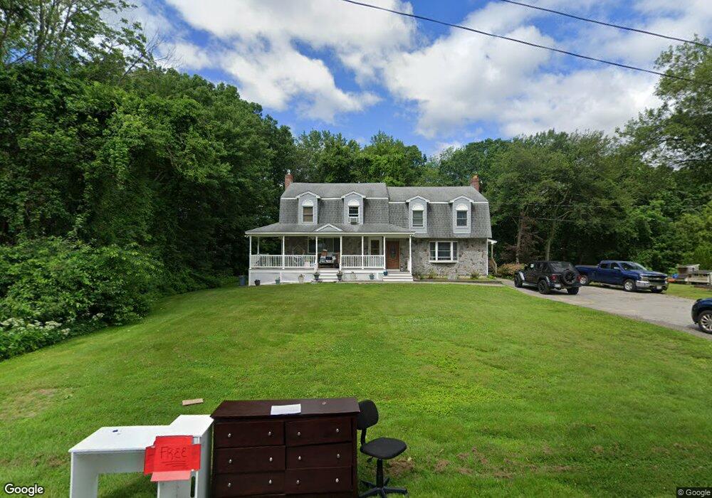
68 Genest St Dracut, MA 01826
Estimated Value: $430,796
Studio
3
Baths
--
Sq Ft
31,320
Sq Ft Lot
About This Home
This home is located at 68 Genest St, Dracut, MA 01826 and is currently priced at $430,796. 68 Genest St is a home located in Middlesex County with nearby schools including Greenmont Avenue School, Richardson Middle School, and Dracut Senior High School.
Ownership History
Date
Name
Owned For
Owner Type
Purchase Details
Closed on
Jan 10, 2018
Sold by
Driscoll Brian and Driscoll Louise
Bought by
Murphy Danielle
Current Estimated Value
Home Financials for this Owner
Home Financials are based on the most recent Mortgage that was taken out on this home.
Original Mortgage
$261,250
Outstanding Balance
$220,238
Interest Rate
3.9%
Mortgage Type
New Conventional
Purchase Details
Closed on
May 31, 1990
Sold by
6-8 Benest Street T
Bought by
Driscoll Brian W
Home Financials for this Owner
Home Financials are based on the most recent Mortgage that was taken out on this home.
Original Mortgage
$168,000
Interest Rate
10.25%
Mortgage Type
Purchase Money Mortgage
Create a Home Valuation Report for This Property
The Home Valuation Report is an in-depth analysis detailing your home's value as well as a comparison with similar homes in the area
Home Values in the Area
Average Home Value in this Area
Purchase History
| Date | Buyer | Sale Price | Title Company |
|---|---|---|---|
| Murphy Danielle | $275,000 | -- | |
| Driscoll Brian W | $210,000 | -- |
Source: Public Records
Mortgage History
| Date | Status | Borrower | Loan Amount |
|---|---|---|---|
| Open | Murphy Danielle | $261,250 | |
| Previous Owner | Driscoll Brian W | $168,000 |
Source: Public Records
Tax History
| Year | Tax Paid | Tax Assessment Tax Assessment Total Assessment is a certain percentage of the fair market value that is determined by local assessors to be the total taxable value of land and additions on the property. | Land | Improvement |
|---|---|---|---|---|
| 2023 | -- | $0 | $0 | $0 |
| 2022 | $0 | $0 | $0 | $0 |
| 2021 | $0 | $0 | $0 | $0 |
| 2020 | $0 | $0 | $0 | $0 |
| 2017 | $5,094 | $351,300 | $139,100 | $212,200 |
| 2016 | $5,022 | $338,400 | $133,700 | $204,700 |
| 2015 | $5,166 | $346,000 | $133,700 | $212,300 |
| 2014 | $4,673 | $322,500 | $133,700 | $188,800 |
Source: Public Records
Map
Nearby Homes
- 551 Hildreth St Unit 10
- 25 Tobey Rd Unit 57
- 51 Tobey Rd Unit 47
- 417 Hildreth St Unit 2
- 417 Hildreth St Unit 30
- 306 Aiken Ave Unit 16
- 367 Hildreth St Unit 14
- 345 Hildreth St Unit 14
- 16 Peabody Ave
- 1391 Bridge St
- 75 Sladen St
- 26 Farmland Rd Unit C
- 15 Dana St
- 40 Arlington Ave
- 69 Arlington St
- 175 Willard St Unit 9
- 23 18th St
- 1563 Bridge St
- 35 Whitney Ave Unit 33
- 1573 Bridge St
- 6 Genest St Unit A
- 10 Genest St
- 20 Genest St
- 45 Pillsbury Ave
- 32 Pillsbury Ave
- 19 Genest St
- 30 Genest St
- 29 Genest St
- 35 Pillsbury Ave
- 66 Thissell St
- 32 Genest St Unit 34
- 36 Dorothy Ave
- 58 Thissell St
- 27 Pillsbury Ave
- 16 Dorothy Ave
- 42 Genest St
- 42 Genest St Unit 2
- 44 Thissell St
- 529 Hildreth St
- 65 Thissell St
Your Personal Tour Guide
Ask me questions while you tour the home.