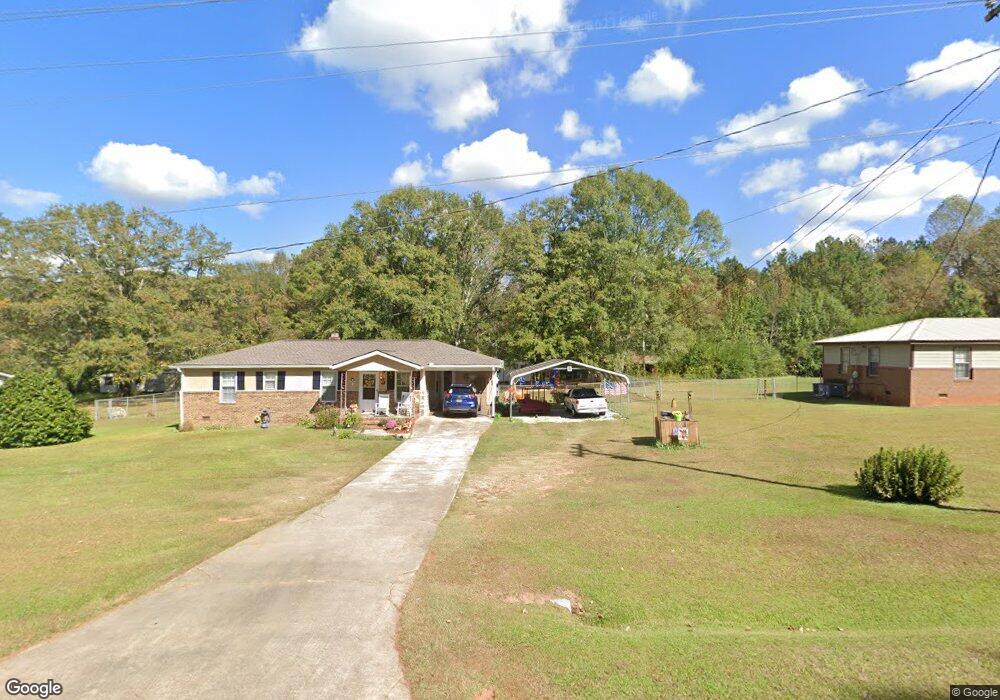
68 Hudson Rd Lagrange, GA 30240
Estimated Value: $170,000 - $220,000
3
Beds
2
Baths
1,080
Sq Ft
$181/Sq Ft
Est. Value
About This Home
This home is located at 68 Hudson Rd, Lagrange, GA 30240 and is currently estimated at $194,955, approximately $180 per square foot. 68 Hudson Rd is a home located in Troup County with nearby schools including Long Cane Elementary School, Berta Weathersbee Elementary School, and Whitesville Road Elementary School.
Ownership History
Date
Name
Owned For
Owner Type
Purchase Details
Closed on
Nov 9, 2015
Sold by
Bassett Barbara Erlene
Bought by
Bassett Barbara Erlene and Bassett Roger
Current Estimated Value
Purchase Details
Closed on
Oct 15, 1977
Bought by
Bassett Roger Donald
Purchase Details
Closed on
Apr 25, 1976
Purchase Details
Closed on
Apr 24, 1976
Purchase Details
Closed on
May 30, 1975
Create a Home Valuation Report for This Property
The Home Valuation Report is an in-depth analysis detailing your home's value as well as a comparison with similar homes in the area
Purchase History
| Date | Buyer | Sale Price | Title Company |
|---|---|---|---|
| Bassett Barbara Erlene | -- | -- | |
| Bassett Roger Donald | -- | -- | |
| -- | $27,000 | -- | |
| -- | $2,600 | -- | |
| -- | -- | -- |
Source: Public Records
Tax History
| Year | Tax Paid | Tax Assessment Tax Assessment Total Assessment is a certain percentage of the fair market value that is determined by local assessors to be the total taxable value of land and additions on the property. | Land | Improvement |
|---|---|---|---|---|
| 2025 | $872 | $63,148 | $14,000 | $49,148 |
| 2024 | $661 | $51,148 | $14,000 | $37,148 |
| 2023 | $697 | $52,468 | $14,000 | $38,468 |
| 2022 | $523 | $45,108 | $10,000 | $35,108 |
| 2021 | $1,099 | $38,428 | $10,000 | $28,428 |
| 2020 | $978 | $34,428 | $6,000 | $28,428 |
| 2019 | $1,034 | $36,280 | $6,000 | $30,280 |
| 2018 | $931 | $32,864 | $4,000 | $28,864 |
| 2017 | $931 | $32,864 | $4,000 | $28,864 |
| 2016 | $914 | $32,295 | $4,000 | $28,295 |
| 2015 | $947 | $33,332 | $4,000 | $29,332 |
| 2014 | $949 | $33,332 | $4,000 | $29,332 |
| 2013 | -- | $33,332 | $4,000 | $29,332 |
Source: Public Records
Map
Nearby Homes
- 105 Redwood Dr
- 640 Hudson Rd
- 0 Glass Bridge Rd Unit 10679358
- 266 Glass Bridge Rd
- 22 Freeman Rd
- 288 Bradfield Dr
- 808 S Fling Rd
- 2239 Pegasus Pkwy
- 119 Plymouth Dr
- 112 Foxdale Dr
- 102 Bridgewater Dr
- 0 Bradfield Dr Unit 10568803
- 509 Connie Dr
- 8 Horace Carter Rd
- 427 Fling Rd
- 113 Colonial Ct Unit 100
- 124 Lincoln Ln
- 311 Cumberland Dr
- 107 Waters Edge Dr
- 107 Sweetwater Ct
- 56 Hudson Rd
- 78 Hudson Rd
- 44 Hudson Rd
- 30 Hudson Rd
- 5898 Old West Point Rd
- 121 Hudson Rd
- 16 Hudson Rd
- 6010 Old West Point Rd
- 6006 Old West Point Rd
- 1941 Cannonville Rd
- 6004 Old West Point Rd
- 6085 Old West Point Rd
- 55 Maefield Dr
- 35 Maefield Dr
- 49 Maefield Dr
- 1925 Cannonville Rd
- 6002 Old West Point Rd
- 6035 Old West Point Rd
- 6000 Old West Point Rd
- 1911 Cannonville Rd
Your Personal Tour Guide
Ask me questions while you tour the home.